¤ SILVER SPRINGS PARKS
Our Silver Springs Community Parks


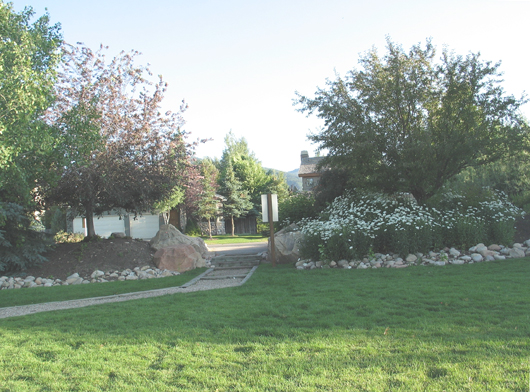
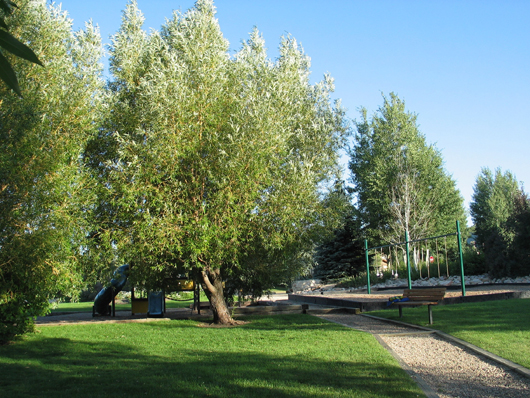
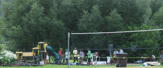
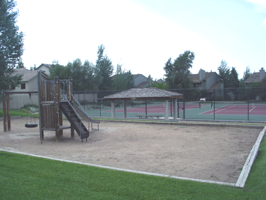
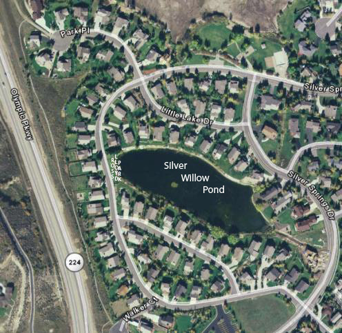
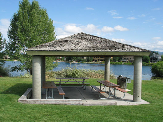
There are two developed Park areas within the Silver Springs Community. The 2.01 acre Park (a.k.a. Parcel H) situated on the south edge of Silver Willow Lake has a small beach area, a pavilion with three picnic tables and a stationary grill. There is a volleyball court, a cement basketball court, a large children’s jungle gym, a public latrine, and plenty of grass area for Frisbee and hitting plastic baseballs. If you bring your dogs please remember to pick up after them, tie a plastic bag to the dog leash or carry newspaper ready for the next use. Dog pick up stations have been installed. Nothing ruins a nice outing faster than fouled shoes.
Second is the Tennis Court Park off Meadow Loop Road in the midst of Ptarmigan, Quail Meadows Townhomes, Silver Meadows, and Meadow Spring homes. The northeast section of this Park belongs to the Meadow Springs subdivision as indicated on the Section Map: SW quarter SE quarter Section 30- T1S R4E (Close up at : https://www.silverspringscommunity.com/wp-content/uploads/tenniscourts-swquartersequartersection-30-t1s-r-4e.bmp . Code for the tennis court gate lock as of July 2016 is 241. Please do not share this code with non-residents.
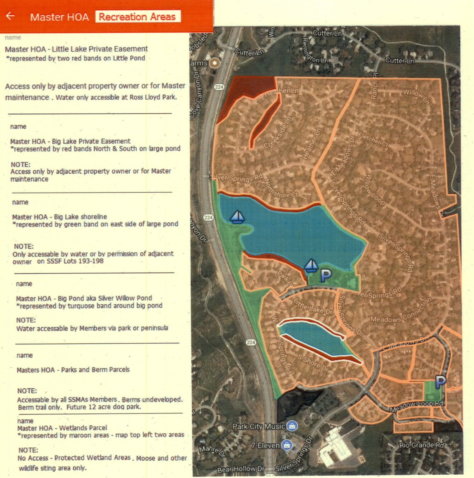
Common area Parcel R , in conjunction with Parcel J, contains approximately 12 acres, located from Silver Springs NorthShore entry, runs south along Hwy 224 to the south Silver Springs entry. This long, narrow parcel could be developed as a dog park or running track.
The Master Association also owns Parcel J and the area around the west pump station on Silver Willow Lake. This parcel could be developed as a picnic area and a boat launch area. The General Membership could vote on whether the MA should buy canoes or small boats that would be stored and locked on the premises for use by our members. Liability insurance estimates need to be considered.
![]()
SILVER MINNOW POND AND OPEN SPACE
Silver Meadows HOA holds title to the Silver Minnow Pond (”detention water pond”)
and the surrounding area. Silver Meadows HOA maintains the flower beds
and walking paths around its perimeter. Homeowners maintain the vegetable gardens.
This is not a Master Association property.
Silver Minnow Pond is accessible from Silver Springs Drive on the left (north),
and from W. Meadow Loop Road, a.k.a. Scythe Place, on the right (south),
there is also a trail from the top (east) from Silver Meadows.
![]()
SILVER SPRINGS COMMUNITY LAKE PARK- Parcel H
1992 History of the Parks by Fred L. Stayrook
Center Entry/Exit -Spring 2008
Park Center
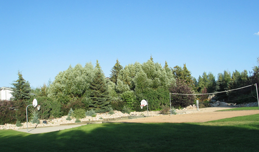
Basketball and Volleyball
Our Park trees provided shade, ambiance, and privacy – also environmental benefits. This beautiful copse of native trees was a result of over twenty years of planning and care.
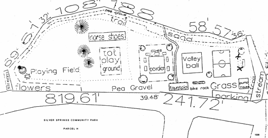
(Parcel “P” inlet stream on the left) 1990 Design (Parcel “Q” inlet stream on right)
![]()
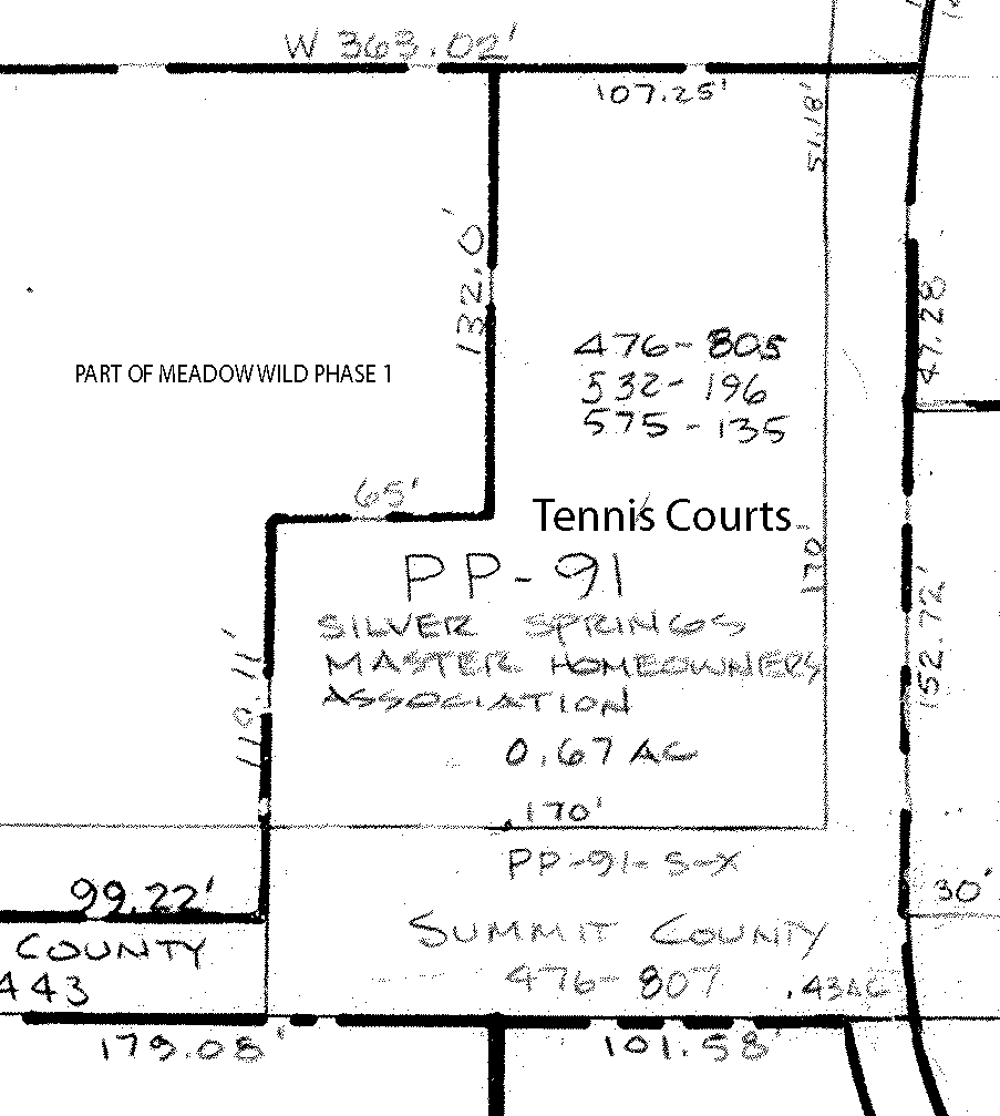
TENNIS COURT PARK AND PLAYGROUND – PP-91
Meadow Spring HOA holds title to the NE tennis court. The other court belongs to the MHOA.
This park is on the elbow of Meadow Loop Road.
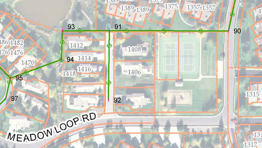
The two tennis courts and playground area are nestled amidst Meadow Spring on the left (north),
Silver Meadows on top (east), Ptarmigan on the right (south), and Quail Meadows Townhomes
on the bottom (west).
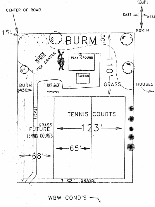
1990 Design
![]()
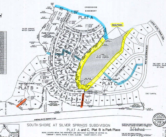
ROSS LLOYD POCKET PARK
…can be found on the Southshore plat map recorded as a part of Southshore.
This sliver of land belongs to the Southshore Homeowners not to the Master Association.
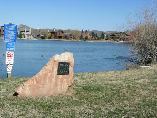
The Ross Lloyd Park is a narrow strip of land on the west end of Silver Willow Pond
– This Park was named in honor of Ross Lloyd, the man who lost his life in 1977 during a construction accident. The Lloyd Brothers Construction Company had been hired to install the culinary water, sewer lines, and the beginning of an underdrain system. Ross and his crew were working in the SouthShore area when his backhoe broke down. Ross hopped down to work on the backhoe, while he was inspecting the machine Ross’s head was crushed, he died on the scene. (Alan Sulser)
This 69.62′ X 9.99′ “Park” is located outside of the 1989 “Exclusive Private Enjoyment Easement.” The Easement is represented as a private trail around this 5.24 acre pond for water-front property owners only. Ross Lloyd Park is located along Silver Springs Road, recorded on the SouthShore 1991 Plat map as a SouthShore subdivision property not a Master Association common area parcel. In either case this Park does not provide legal access to the trail easement or the Silver Willow Pond for the majority of MA property owners who pay for its maintenance, repairs (aerators), insurance, taxes and management, etc.
Ross Lloyd Pocket Park – left (west) side of Silver Willow Pond/lake
May 3, 2011- SSSFHOA Minutes. According to the notes on the recorded plat map the small portion is indicated as being the Park, the remaining larger area
is part of the 1989 Exclusive Private Enjoyment Easement.
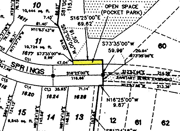
Ross Lloyd Pocket Park highlighted in yellow (9.99′ X 69.62′) on section of 1991 SouthShore recorded plat map. This Park does not provide legal access to the Silver Willow Pond by the majority of MA property owners who pay for its maintenance, repairs, insurance, taxes and management.
2009 October 2: Small Pond-Lake Survey showing Private Easement. Click to enlarge.
https://www.silverspringscommunity.com/wp-content/uploads/lakes-plats-survey-7087-ros.pdf
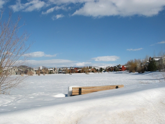
Ross Lloyd Park – Winter 2007-2008
The Pocket Park is a small stripe of land 9.99′ X 69.62′. The bench, monument and signs were placed within the “Private Enjoyment Easement” along the perimeter of this Pond. The plat map shows the Pocket Park as a SouthShore subdivision property not as a Master Association parcel. This Park does not provide legal access to the Silver Willow Pond by the majority of the 513 SSMA property owners who pay for its maintenance, repairs, insurance, taxes and management.
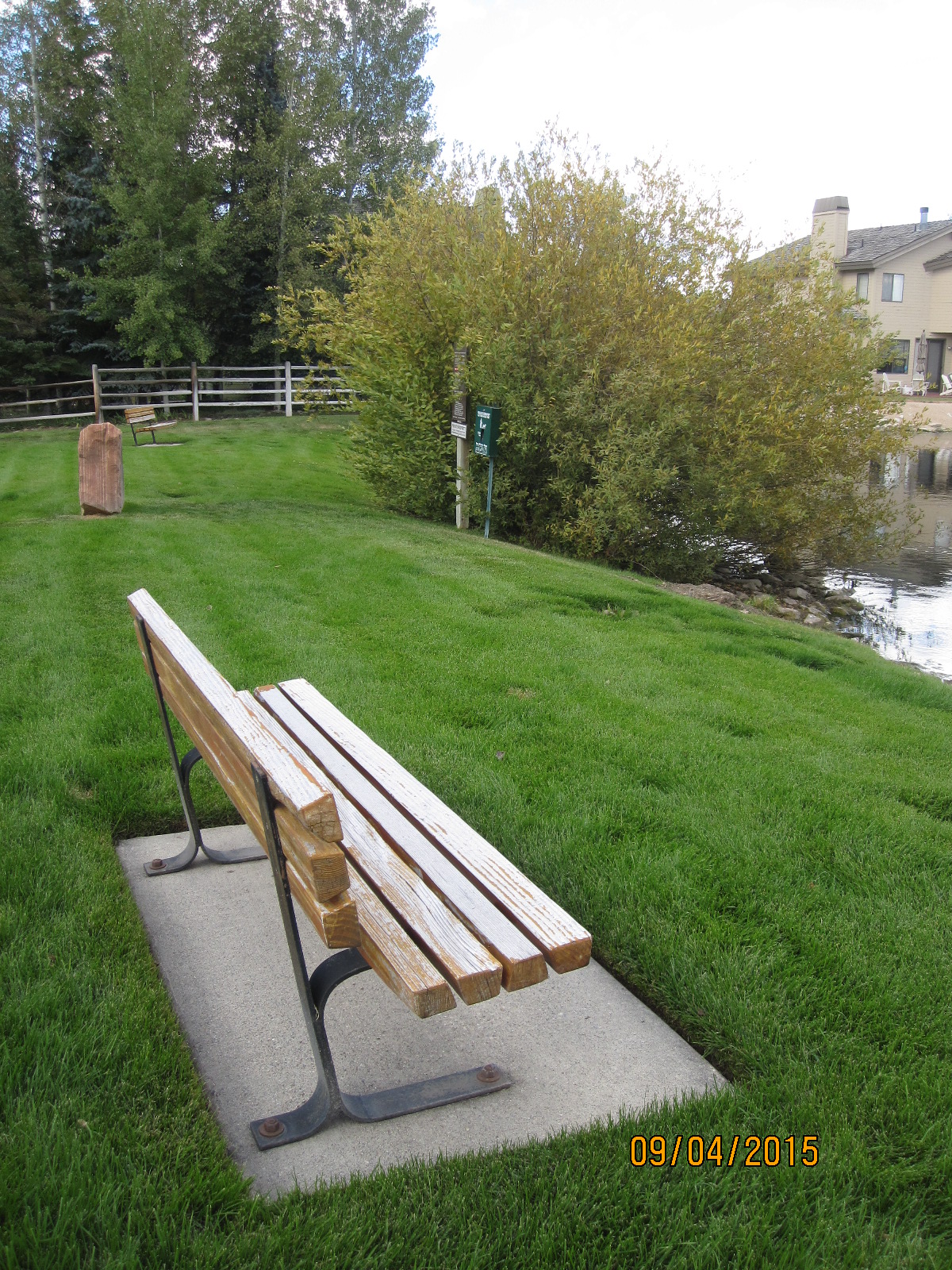
Two benches on the Private Enjoyment Easement, Ross Lloyd pocket park, on the west end of the private Silver Willow Pond. This pond and park belong to Southshore subdivision not to the Master Association.
![]()
THE DICK MITCHELL MEMORIAL PARK
This water channel and the adjoining parcel does not belong to any HOA.
It is known as “The Black Hole Parcel” because no chain of title exists.
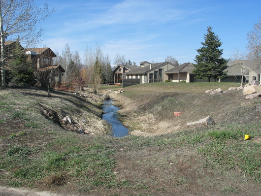
Parcel “V” was to become Dick Mitchell Memorial Park on corner of Silver Springs Drive and Meadows Connection – 4/2008
A connection channel and Parcel “V” (highlighted together in yellow) are parts of the outlet channel for the storm drains. This channel runs from Silver Willow Pond (aka Little Lake or Parcel G) north under two streets, through Parcel Q to Silver Willow Lake. This in turn maintains the lakes water level and aerates it. The channel, once known as a “fish ladder” for spawning trout, runs past the Dick Mitchell Memorial Park on Parcel V, then under Silver Springs Road and into the Big Silver Willow Pond (aka Big Lake or Parcel F).
This once overgrown area has been maintained since 1984 by Dick Mitchell and his family.
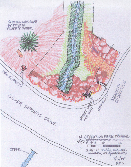
The Silver Springs Single Family HOA does not hold title to the Dick Mitchell Memorial Park located on the northeast corner of Silver Springs Drive and Meadows Connection, between Lots 172 and 17. At one point the Master Association thought this parcel was one of their parcels. Ralph Stanislaw drew up a landscape plan but the uncertainty of ownership precluded the MA from going forward with the work. More title work and searches by High Country Title has determined it is a “black hole” that was never recorded. Bids for the work have been solicited and obtained, development pending contiguous owner and board discussion and approval.
![]()
UNDEVELOPED PARCELS R AND J
POSSIBLY FOR COMMUNITY GARDEN OR DOG PARK
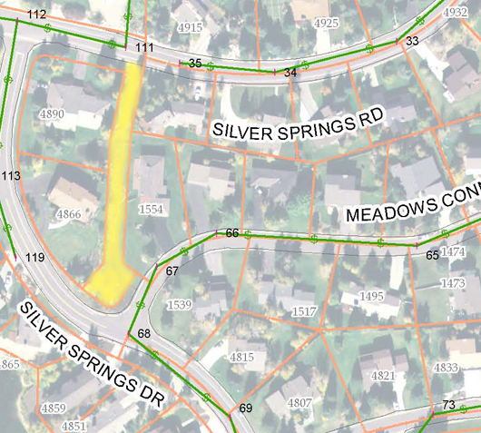
Common area Parcel R , in conjunction with Parcel J, included the area around the pump station on the west side of Silver Willow Lake. These parcels total approximately 12 acres. Parcel R, situated from top to bottom begins at the Silver Springs NorthShore entry, runs south along Hwy 224 to the south Silver Springs entry. This long, narrow parcel could be developed as a dog park, community garden or running track accessed via Park Place or Blue Roof area. The peninsula belongs to Mtn. Regional Water Company.
What rights does UDOT hold on these areas, future road widening, utility easements, stream/water rights?
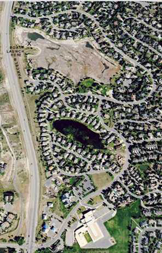
“X” marks the areas where boat launch areas could be developed by the M.A. for the members.
The remainder of the 12+ acre area could be fenced as a dog park or used as a jogging trail.
The General Membership could vote on whether the MA should develop these parcels, and whether to buy canoes or small boats that would be stored and code locked on the premises for use by our members. Liability insurance estimates need to be considered.
Parcel J – Berm Parcel open space, could be a community garden, watered from the lakes.
There are established access rights. Walking between Park Place Lots 37 and 38.
There is another access between SouthShore lots 12 and 13 to Parcel R and J from Silver Springs Road.
This is another example of access to shared common areas where walking past homes at these points is very much like walking on the streets or near homes in the proximity of the other Community parks and amenities..
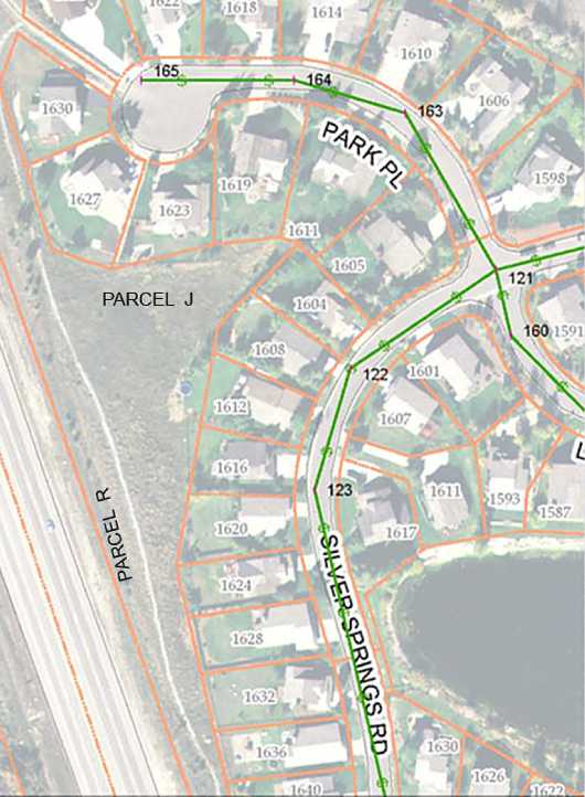
Another view (at bottom) of Parcel R and J.
Orange lines are access parcels marked on the recorded plats..
Blue lines are stream beds and common area access banks.
Yellow lines are the Enjoyment Easement recorded on this plat.
![]()
PARKS TIME-LINE NOTES
1986 – American Savings and Loan Association acquired Parcel “H” through foreclosure due to a default on the loan by InSource, Inc. and Hazelwood, Inc. This parcel was then offered in 1988 to the Silver Springs Homeowners.
1988 – American Savings and Loan Association sold Parcel “H” to the Homeowners Association for $10. for the purpose of developing a park/recreational area.
1989 – Silver Springs Development: Mike Barnes, Warren Spieker Jr, and Richard Widdows , purchased all the real property within the Silver Springs Subdivision that was held by American Savings and Loan. (See American Savings 1986 Parcel map – includes Silver Springs Phase 1-D, 1-G)
SSD then produced a Developer- Association Agreement which required that a Master Homeowners Association, comprised of all (twelve) separate Homeowners Associations, be established within Silver Springs Communities. With this Agreement they conveyed Parcel “H” and the Tennis Park area to the Master Homeowners Association. Part of that Tennis Park had been acquired from Don Stringham.
SSD then were instrumental in forming the Master Homeowners Association through the 1989 Developer-Homeowner Agreement that was formalized in 1990:
“1. Conveyance of Park Parcel. Developer shall execute a Special Warranty Deed conveying that certain common area parcel, hereinafter described and known as the “Park Parcel”, to each of the [twelve] homeowner associations named herein, as grantees. Said deed shall be placed in escrow with Coalition Title (the “Escrow Agent”), a title company located at Park City, Utah, with escrow to commence and eventual delivery of deed to the Park Parcel to occur as follows:
(a) Developer shall deposit the Park Parcel deed into escrow immediately at such time as the governing boards of at least two-thirds of the duly constituted associations representing property owners in the Subdivision have executed this Agreement in accordance with the regulations of each respective organization…..
(e) The Park Parcel is an area of approximately 2.1 acres (SOS-A-Park), located along the southeast shore of the large pond within the Subdivision,”
The Dev-HOA Agreement continues: “2. Conveyance of Tennis Court Parcel. Developer shall execute a Special Warranty Deed conveying that certain common area parcel, hereinafter described and known as the “Tennis Court Parcel” to each of the homeowner associations named herein, as grantees. The terms and conditions of escrow, including commencement thereof and eventual delivery of deed, shall be identical to the provisions set forth in paragraph 1 concerning conveyance of the Park Parcel.
“The Tennis Court Parcel is an area of approximately 0.6 acre (PP-91) and includes one of two tennis courts installed thereon, along with a small open area immediately adjacent thereon. (The exact dimensions are unknown; survey needed to confirm exact acreage.) The other tennis court at the site is not owned by the Developer, who is under no obligation to acquire the same for the benefit of the Homeowners; however, if acquired by Developer, the other tennis court will be conveyed to the Homeowners. The Tennis Court Parcel is located in the southeastern portion of the Subdivision,….”—Dev-HOA Agreement
At the Annual General Membership meeting of the Silver Springs Single Family Homeowners Association, President Dale Boschetto informed the members of the imminent formation of the Silver Springs Master Homeowners Association. Dale also informed the members that there would be equal assessments per Living Unit. It was announced that a Park Development Committee would begin planning during the Spring of 1990.
![]()
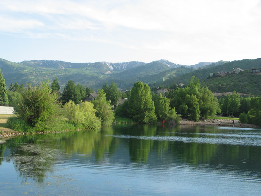
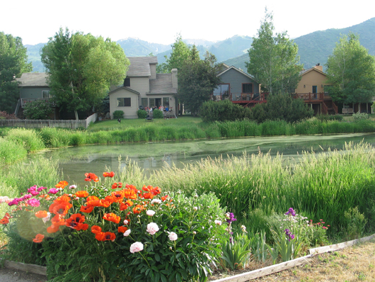
Beautiful south beach of Silver Willow Lake – trees muffled noise and provided privacy and shade.
1990 – The Master HOA was incorporated. The Park Development Committee began planning to break ground for a community Park beginning in the Spring of 1990. The Parks Development Committee Chairman, Randy Arnold, presented the Parks Plan and Budget. Linda Karz, a Silver Springs resident designed the Park and its landscaping. The Capital Improvements Assessment for that year were announced as $160 per Living Unit. The SSSFHOA announced that this money would be paid from an Equity Fund they had set up for the SSFHOA Homeowners Association members.
1990- October 4 – Park Report
1991 – At the Annual Silver Springs Single Family Homeowners Association Meeting – the Parks Development Committee Chairman, Randy Arnold, gave an update on the Parks:
$40,000 of the proposed $64,000 budget had been collected from the homeowners.
$32,000 of the anticipated $50,000 had been spent .
The Parks are under budget and the Committee will have the money to complete the Park.
1991- September 9 – “The Rock Pit Report”
1992 – The Master Association recommended that an additional $115 Special Assessment be collected from each Living Unit to allow completion of the Parks. The Silver Springs Single Family Homeowners Association Board of Trustees calls a Special Meeting to vote on this Special Assessment, as provided in our CC&Rs.
1992- June 10 – MA/SSSFHOA Special Assessment Meeting for a Vote
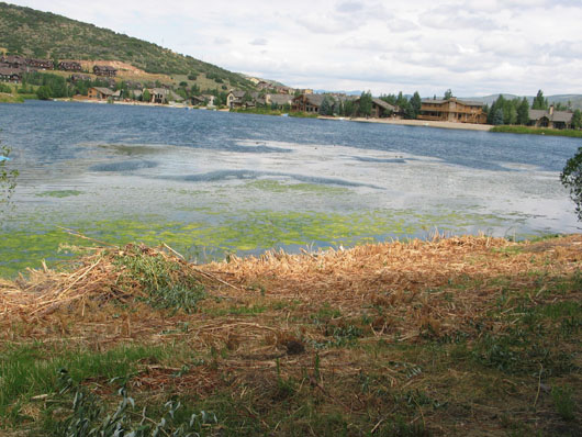
Pond/Lake Cleanup and Proper Plantings
2008 – Keith B. Clapier, owner of Park City Arborist, was hired by the HOA at Deer Lake Village on Queen Esther Drive to clean up their 1.5 acre pond. Besides removing 1,000 pounds of goldfish from the water the pond is being cleaned by big mouth bass and plantings around the perimeter of the pond. Clapier is an expert on surveying wetlands and riparian habitats (areas bordering waterways). Clapier will be planting riparian zone trees like cottonwood and birch as well as introducing native grasses and aquatic plants to the Deer Valley pond. “Ideally, 100 percent of the shoreline will be covered in plants,” he said, Clapier is a 20-year native of the U.S. Forest Service. “Trees placed in the right places will not obstruct views, but will provide the water with cooling shade and over-hanging branches from which insects fall in, nourishing the fish and amphibians (frogs, salamanders)….Properly placed aquatic plants in ponds and streams have dense, fibrous root systems that filter out sediment and contaminants, and remove fertilizer nitrogen that causes algae to bloom and thrive.” Properly planned and planted waterways attract water fowl, deer and moose, and are visually more attractive and beautiful to look at and enjoy. Clapier can be contacted at 435-513-2188.
![]()
BOARD SUPPORTED DESTRUCTION OF PARK TREES AND SHRUBS

July 25, 2009 – Trees add ambiance, shade, privacy, and beauty.
Pavilion sheltered by trees (aspens, willows, cottonwoods) and vegetation.
This beautiful copse of native trees was a result of over twenty years of planning and care.
2009 – August 2 , Silver Springs Master HOA had the park trees and vegetation pruned and cut down leaving a bare shoreline. Park trees and bush willows were unceremoniously cut down, duck habitat destroyed, while Park maintenance is the worst it has been in years. Recommended Park Maintenance
August 3, 2009 What took over twenty years to grow was destroyed in a day by Green Leaf Maintenance.
Our pavilion is now a stark patio without privacy, ample shade, ambiance.
Note piles of pruned and destroyed trees and vegetation in the background.
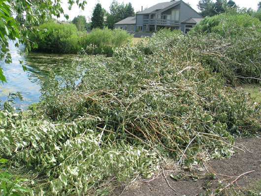
Destruction of trees during the hottest part of the summer. Homeowners were not given notice.
Duck nesting area ruined by removal of lake edge vegetation. All this destruction was committed at the request of one property owner across the lake who wanted a view of the park lawn, the trees were hampering his view of park activities. Another example of abuse of authority.
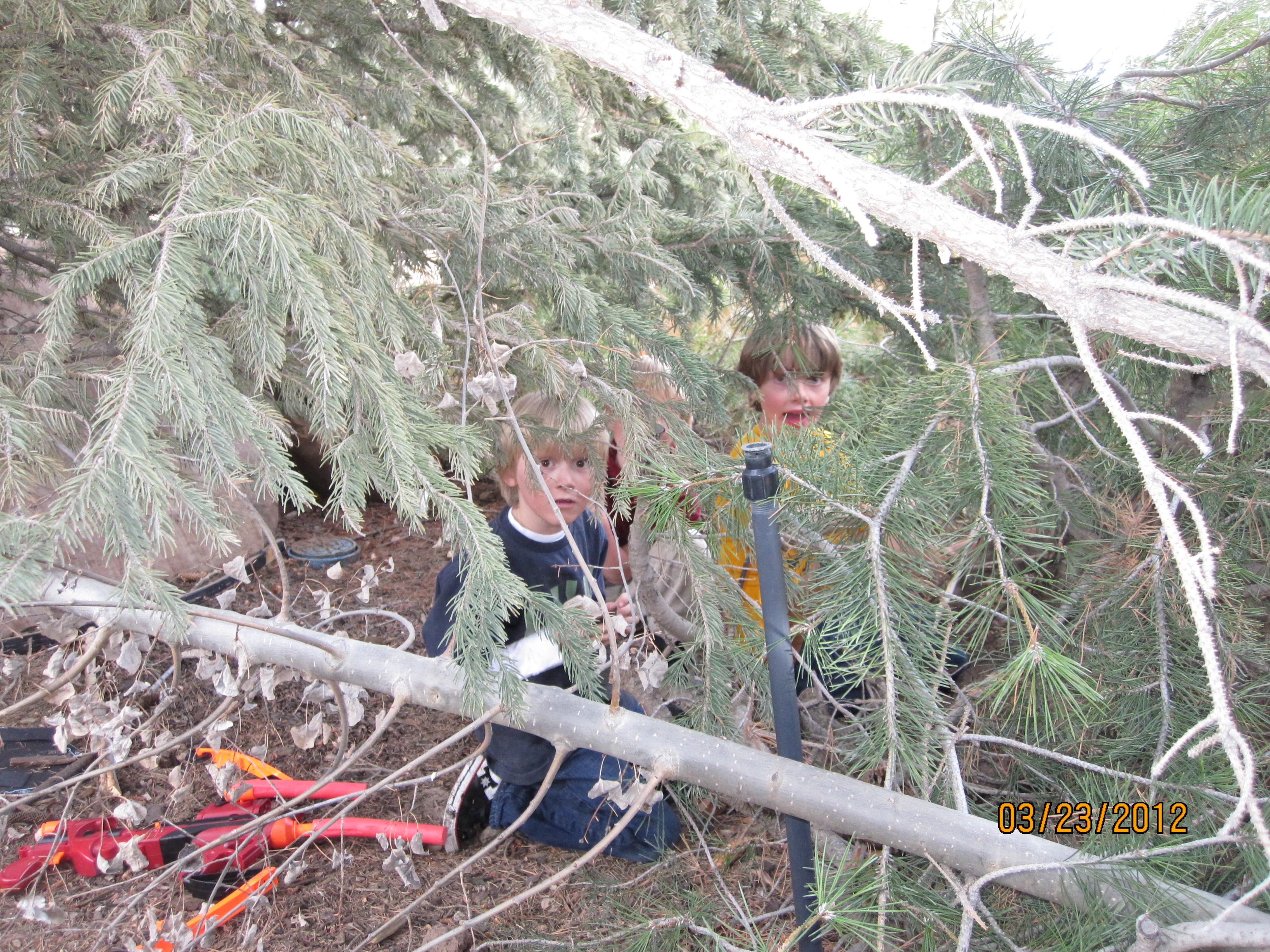
Neighborhood boys complain that the Park was ruined when all their ‘fort’ branches were chopped off so now they play in the neighbor’s yard and trees.
2010 – March 26 , Don’t Weep for These Willows” – Swaner Nature Preserve and dozens of volunteers harvest and plant natural willows to help water quality, prevent erosion, provide leaf litter for insects and fish, to supply bird nesting habitat and to cool the stream water. This is the opposite action taken by the MA Board and Greenleaf Maintenance on August 3rd [see calendar at https://www.silverspringscommunity.com/?m=20090803&cat=1]. Our park trees were cut down or heavily pruned and the lake shore was cleared of nearly all the natural willows and other vegetation, partly after a request for an across the lake lawn view by one of the board members who is also a lake front property owner.
![]()
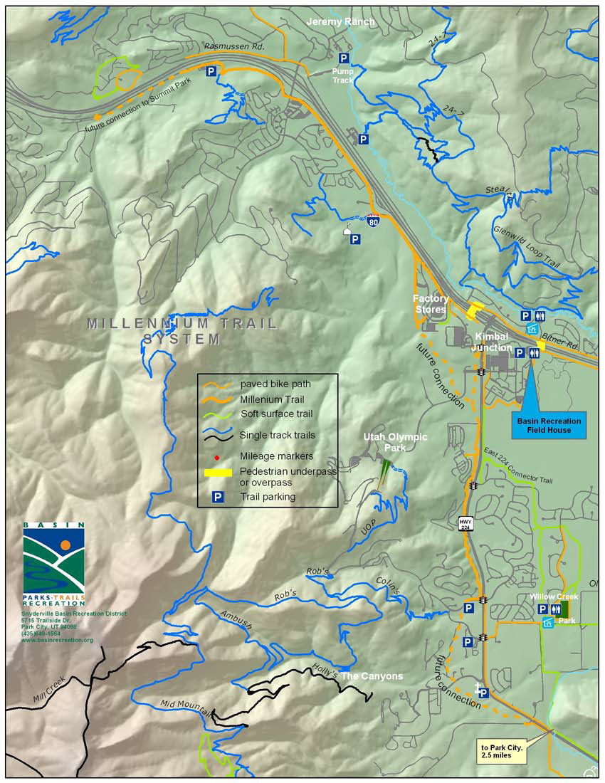
SUMMIT COUNTY’S MILLENNIUM TRAIL SYSTEM

This system is on the east side of Silver Springs.
![]()
HOW WE FINANCE THE MAINTENANCE ON OUR SILVER SPRINGS PARKS
1988 – May – American Savings and Loan Association sold Parcel “H” to the Homeowners Association for $10.00 for the purpose of developing a park/recreational area. [search for this deed]
1989 – Silver Springs Development (SSD): Mike Barnes, Warren Spieker Jr., and Richard Widdows, purchased all real property within Silver Springs Subdivision from American Savings and Loan Association
1990 – At the Annual Silver Springs Single Family Homeowners Association Meeting, President Dale Boschetto informed the membership of the newly formed Master Homeowners Association. Dale also informed the members that there would be equal assessments for each Living Unit per Section 5(a),
1991– At the Annual Silver Springs Single Family Homeowners Association Meeting, the Parks Development Committee representative, Randy Arnold, gave an update on the Parks:
“$40,000 of the proposed $64,000 Budget had been collected.
$32,000 of the anticipated $50,000 had been spent
The Parks are under budget and the Committee will have the money to complete the work.”
2005– The discrepancy of interpretation of the two pertinent documents that govern the Silver Springs HOAs, namely the MA and the individual subdivision CCRs, was resolved by this 1995 Amendment to the Silver Springs Single Family CC&Rs showing a differentiation between Membership and Voting rights, and between SSSFHOA fee assessments from those by the Master Homeowners Association. as stated below :“ARTICLE III
MEMBERSHIP
Section 1. Membership. Every person or entity who is record owner of a fee or undivided fee interest in any lot which is subject by covenants of record to assessment by the Association, shall be a member of the Association.
Section 3 . Voting Rights The Association shall have one class of voting membership which Members shall be all those Owners as defined in Section I above and each Owner shall be entitled to one (1) vote appurtenant to each Lot in which an Owner holds the interest required for membership by Section l.”Assessments for the maintenance of the Lakes and common areas should be assessed according to ascribed and realized benefits, use, and access of these amenities, not by the three property ownership categories, but amended to two categories: Living Units with a lake view frontage; Living Units without a lake view frontage..To further illustrate the need for amending and implementing a fair maintenance assessment we need to acknowledge that since the recordation of the Dev-HOA Agreement the Lake view owners removed the Lake Enjoyment Easement circa 1989 from access and use by the general membership. This was accomplished by the capitulation of Lynn Stevens, manager of the Silver Springs Water Company, pressured by the attorney for the lake view residents and a number of lake view owners themselves. Stevens deeded the Enjoyment Easement property to the lake view owners group. New Silver Springs President Fred Stayrook was informed after the deed was transferred of the seized rights without a vote or consideration of the general membership. Our Lake Enjoyment Easement was parceled and absorbed by these lake view lots. Therefore, the assessment for maintenance should reflect this change and who is almost exclusively benefiting from these marvelous amenities and therefore the lake view lots should be assessed the majority of the cost to maintain them. (An example is that there are approximately 25 little lake and 29 large lake view owners and 508 +4 residential unit owners in the Silver Springs Community. The 458 non-lake view owners would be assessed a base fee , while the lake view owners would pay 5 times the base fee. The base fee would vary by what the budgeted maintenance items were required and approved for the year.) The lake Park is watered by use of the original irrigation system. The original pump house is located on the east side of the park. Using this system saves on water costs but there is a Pacificorp electric meter for running the pump. This metered electricity is part of the MHOA Budget. The MA Board pays Green Leaf (residents of SSSF) for the Park lawn and flower beds care, irrigation service, weed control, monitoring the latrine company, and other work.. Robyn Bailey is the paid manager for the MA while her husband is the owner of Green Leaf. No Service Contract for property maintenance and work liability has been negotiated nor employed by the MA board. Robyn creates the invoices from Green Leaf to the MA, then she writes the checks from the MA account to pay for these invoices.
2009 – Bill Noland announced in 2009 that the MA now had negotiated a contract with Green Leaf to the end of the year after which bids were suppose to be gathered annually. This bid process was not done in 2010. The bids I gathered from Wasatch, Aspen, and other lawn maintenance companies were for less money than Green Leaf. A Service Contract protects the MA and its members. Value for work performed should be established. A Service Contract should look at the following items: establish extent of work expected to be done, cost of additional work, timetable/schedule of work completed, is company on-call for emergencies at what length of response time, bottom-line expenditures no open-ended accounts, cost per hour/per man, what work is expected on undeveloped common area parcels specifically weed control, degree of accountability to Board of Trustees, itemized monthly statements (separate from Budget list), is service bonded and insured, assignment of liability, equipment availability, etc. Every four or five years bids should be obtained to maintain fair market contract pricing. This protects the Association Members (Homeowners), the service provider and the Master Association. Green Leaf has been the sole vendor for lawn maintenance since 1990 when the MA was created.
![]()
TAXES ON OUR PARKS
I talked to Steve Martin the head assessor at the Summit County Courthouse regarding how taxes are assessed and billed on our Parks and other common areas. What I understand is that the common areas do not have tax parcel numbers nor tax serial numbers and do not show up as an item on the list of assessments on our tax bills each November.. If set up correctly, the common areas, like the Park, are undivided interests distributed among all of the Master HOA property owners. So individually these parcels are valueless as such to each member. However, having common areas can enhance the value of properties. He said he knows that the homes on the lake receive quite a bit of enhanced value, in some cases twice as much, as evidenced by the Multiple Listing Service. Properties radiating away from the lake receive less enhanced value, and after a block or so receive almost no enhanced value. Another factor is that the majority of the properties around the lake perimeter are larger and have added higher cost items which contributes to the enhanced values seen on the MLS.
Common area parcels like the Parks or tennis courts or other common space usually do not add value because of the mixed perception that either the areas are an extension of space and view or they are a source of noise, traffic, and interference. However, if the common area has a spectacular view, is on a ski slope, or is expansive like the Swaner Nature Park, then these areas can add enhanced value to a property.
If a common area does have a tax serial number and it is owned by the MA then the MA pays for the taxes from our annual dues. So indirectly each member pays property taxes as an even share. (I have not been able to get information from the MA regarding how much each MA subdivision pays so I do not know if indeed our MA has made the share even or tiered).
There are benefits to having the MA own the undivided common areas for member joint ownership. The MA is an entity that lies between the common area and the individual homeowners should liability issues arise. I am fairly sure that the MA has liability on the Board of Trustees and on the two lakes but I do not know if they have insurance on the Park or the other common areas. If I learn about this I will add it here.
—If anyone has more information or input please send to [email protected]