Parcel I -Beach-LOST
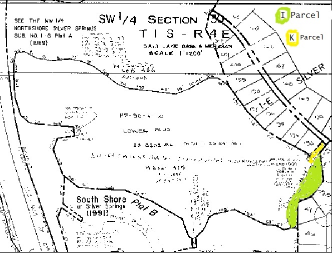
1988 Summit County Section 30 plat map shows Parcel K lake access and Parcel I beach area.
1988 – August 8 – Letter from American Savings Attorney Ryan Richards regarding Silver Springs Parcels.
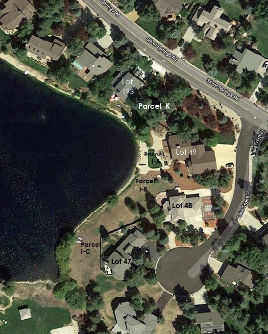
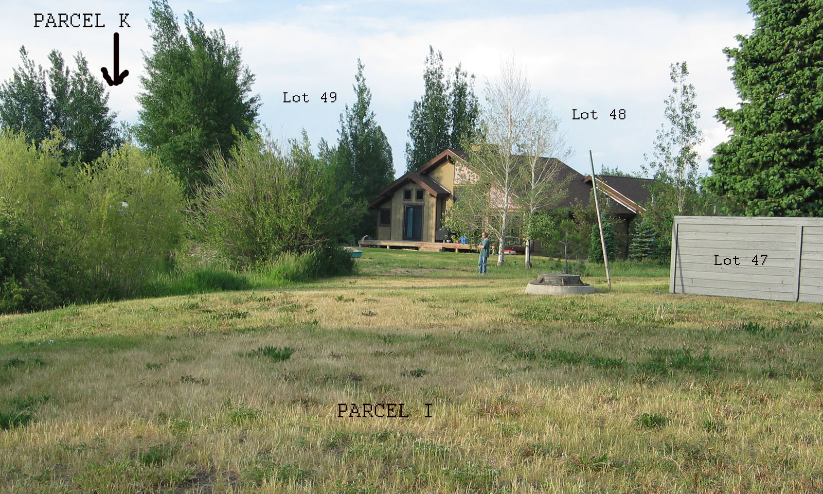
Parcel “I” – Silver Springs Common Area contiguous with Silver Springs Lot 47 (+ PP-98-A-4-A,), Lot 48 (+ PP-98-A-4-B) , and Lot 49 (+PP-98-A-4-C).
Parcel I on the 1978 Master Plan was to contain a the pump house for the SS Plat 1-A irrigation system. Also to contain part of the sewer system infrastructure, and to be used as a Common Area beach and lake access to the southeast portion of Silver Willow Lake for the homeowners of the Master Association of SS East.
[In 1988 American Savings & Loan Bank was solicited by SSSF lake front lot 193-E owners Bill Ligety (a board trustee) & wife Cindy Sharp for their private perquisite purchase of the 25′ wide access Parcel K. Parcel K adjoins Parcel I, both were in use by the SS Homeowners to access the Silver Willow Lake and pedestrian trail around the perimeter of the lake. These parcels were sold by American Savings to Ligety & Sharp under great protest of the SSSF Board and Homeowner Members. ] The SSSF Board President Dale Boschetto resigned as an outcome of the hotly disputed sale of Parcels I and K to the contiguous owners of Lots 193, 47, 48, and 49, and the forfeiture of Homeowners Association access and use rights.
Parcel I: Letter from American Savings on August 8, 1988: “We were able to discover no official reason for the existence of this Parcel, however, from our interviews with the developer and present residents, it appears that Parcel I is the result of a lake excavation discrepancy. That is, the surveys of the adjacent lots were done before the lake was excavated and while the lot lines should touch the 15-foot buffer outside the rap rap like at other lakefront areas, here there was left a strip of land between the eventual waterline and the lots. Our decision was to conform this area to other lakefront areas by conveying Parcel I to the adjacent lot owners.”
Parcel I: Minutes of the Planning Commission for Meeting held August 23, 1988.
Parcel I : Minutes of the Planning Commission for Meeting held September 13, 1988.
Other Lake Access Parcel descriptions are Parcel K which includes the pathway access from Silver Springs Road to Parcel I Beach and the lake perimeter trail. Parcel W includes information on the Exclusive Private Enjoyment Easement.
 Parcel I – Common Area beach area – Access via Parcel K now amended to SLS-E-193
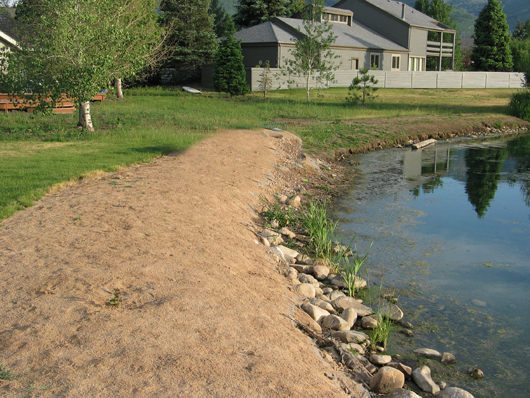
Parcel I is the Enjoyment Easement Beach area on the east side of Silver Willow Lake –
located next to Common Area Access Parcel K
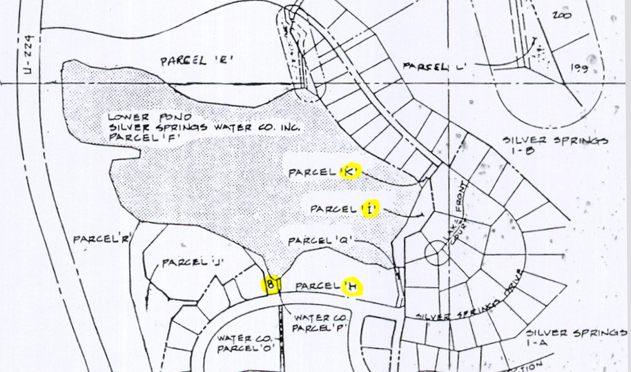
Parcel I on the east bank of Lower Pond contained 0.54 acres
Parcel I was deed to three lot owners:
- Carl W. Caughran Lot 47 received 0.20 acres, PP-98-A-4-A, on November 7, 1988 from American Savings which he transferred to Don Zinn as Instrument 393193 Bk 771, Pgs 652-657, et. al.
Original .34 acres plus .20 acres = .54 acre. (QCD Entry 299737 transfers 8,508 sf or .1953 acre.) - Richard A. Groth Lot 48 “Parcel 98-A-4-B” received on November 28, 1988, which was recorded as part of Lot 48, from American Savings. Entry 302655 on Dec. 29, 1988.
(ALSO: (THE FOLLOWING DESC PARCEL IN NOT PART OF THE SUBDIVISION)
BEG AT NW COR LOT 48 SILVER SPRINGS NO1-A SUBDIVISION ACCORDING TO TH OFFICIAL PLAT THEREOF; SD PT ALSO BEING N2064.38 FT & E 2566.96 FT; FR SW COR OF EC 30 T1SR4E,SLBM; RUN TH S 38*30’W107.35 FT ALG W LINE OF SD LOT 48′ TH N 6*01’56” W 66.42 FT; TH N 24*00′ E96.73 FT; TH S 77*30′ E 94.17 FT TO BEG. Original .45 acres plus .17 acre. = .62 acre in SLS-48 7,706 SF or 0.1769 acre.
CONT 0.17 ACRES (REM DESC) BAL 0.62 ACRES. M178-272 M215-292-3 M232-423 09-152 382-203 443-34 571-27 503-394506-584) - Dan Schofield Lot 49 received 0.17 acres, PP-98-A-4-C, on August 23, 1989 from American Savings & Loan which he transferred to Robert J. Petrarca; then transferred to Rand Howard. Original .48 acres plus .17 acres = .65 acre. (QCD Entry 308500 on May 30, 1989.)
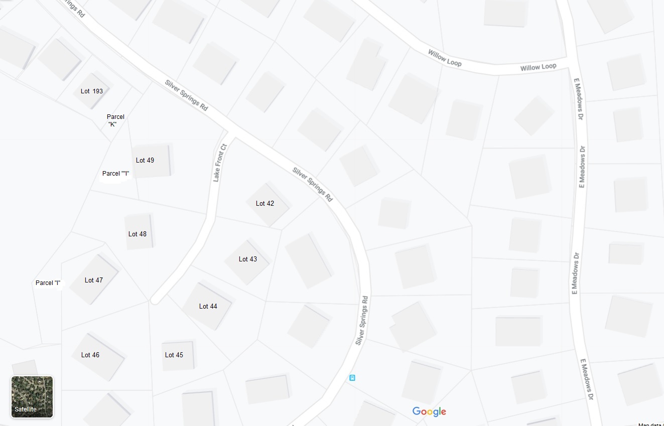
Parcel I shown on the shoreline side between addresses 5077 Silver Springs Road (Lot 193), and continuing along the shoreline to 1518 Lake Front Court (Lot 47).
See Minutes: In September 2015 ownership of the Silver Willow (aka North Pond, Big Lake, Parcel F) perimeter trail along Lots 47, 48, 49, 193, 194, 195, 196, 197, 198, was transferred either from the SS Master Association or from Summit County Mountain Regional Special District 16 to the owners of these lots. This portion of the lake perimeter trail is shown on the MA Interactive Map as owned by the lot owners but with the individual permission of the lot owners SSMA Homeowners can gain access to this portion of the lake trail.