¤ WATERWAYS : above ground and underground
“collective water tributaries”
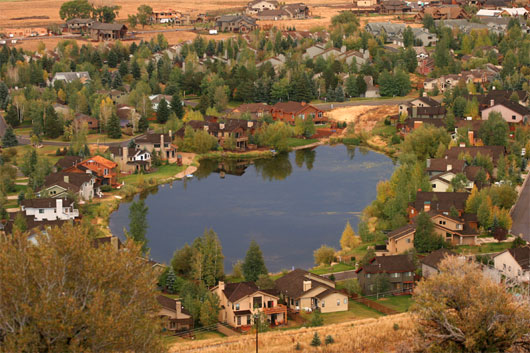
Silver Springs Community Waterways
The waterways in Silver Springs are currently owned by two entities. The spillways, outlet and inlet waters, the waters in the ponds/lakes, drainage channels and all the Water Rights belong to Mountain Regional Water Special Service District and to the State. The banks and land beneath these waterways belong to the General Membership through the Master HOA. The waterways water quality is not suitable for swimming, wading, or water sports.
Not all waterways easements belong to the SSMA, some are drainage channel easements belonging to individual property owners or Mountain Regional Water (via 2004 Lake Conveyance Agreement) and some are controlled by the SSMA. Mid-2010 the 1990 water attorney, Craig Smith, who was involved with the Lake Conveyance Agreement, stated his opinion that the drainages the Association is responsible for are for the ones used by Spring Creek Spring past the Blue Roof, down through the west side of SouthShore. The drainage that comes into the little lake from the Willow Creek diversion on the east side of SouthShore is not the Association’s responsibility. Should we count on his opinion or should the State Water Division be petitioned for a written statement.]
See https://www.silverspringscommunity.com/master-association/ma-common-area-parcels/ for a list and descriptions of the community waterways parcels.
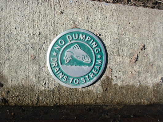
Robert L. Morgan, State Engineer has written a letter explaining to the HOA that it is illegal to divert or store any water from any stream. The direct flows into and out of the lakes are considered to be Spring Creek, and modification of these streams requires a Stream Alteration Permit from the Utah Department of Natural Resources Division of Water Rights. Some of the diversions throughout Silver Springs are considered canals, channels or ditches that do not require permits. The Division of Wildlife Resources has had a moratorium on any additional ponds, no matter how small, on the East Canyon Creek drainage because of water quality, temperature problems in this drainage, and construction on activities that have introduced silt and debris into the water, as well as chemicals such as phosphorous. Additionally, the growth of cattails and other fauna has choked the waterways and inhibited the migration of fish. The SSSF, NS, and SS CCRs require that the drainage channel easement area of each lot be maintained continuously by the owner of the lot. The Autumn flows in the ladder are minimal. The stream channels need to be rehabilitated in order to regain the fish population. (Also see Administrative Rules of the Division of Water Rights.) We are looking for photos of all water features, ponds, lakes, streams, etc. that anyone might have to share with us. Please send or contact [email protected]
Do not play on or around the aerators, baffles, or any drain structure, they are dangerous.
Do not tie your boat to them.
1982 SSSF Recorded CC&R Article IX Section 3: Easements
Recorded Entry 190498 has remained the same to this day (2014):
Section 3. Easements for installation and maintenance of utilities and drainage facilities are reserved as shown on the recorded Plat and over the rear and side five feet of each lot. Within these easements, no structure, planting or other materials shall be placed or permitted to remain which may damage or interfere with the installation and maintenance of utilities, or which may change the direction of flow of drainage channels in the easements, or which may obstruct or retard the flow of water through drainage channels in the easements. The easement area of each lot and all improvements in it shall be maintained continuously BY THE OWNER OF THE LOT, except for which a public authority or utility company is responsible.
 Parcel “O” drainage channel in west Silver Springs….
 Parcel Q north section.
1988 August 8 – American Savings Letter regarding Parcels: “Waterways: Silver Willow Lake, its inlet and outlet streams and the surrounding rip rap together with a 15-foot buffer strip outside the rip rap are owned by the Silver Springs Water Company. Use of these by the Homeowners and others will be regulated by the Water Company.”
Minutes of the Planning Commission for Meeting held August 23, 1988.
Minutes of the Planning Commission for Meeting held September 13, 1988.
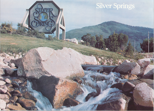
Silver Springs south entry sign erected c. 1981 at the south entry into Silver Springs. Spring Creek is the point of water delivery. This parcel was suppose to be deeded to the Silver Springs HOA. – Photo courtesy of Vern C. Hardman
This original sign logo was removed from the frame when the gas station was sold to Sinclair Oil Co. The sign logo was stored across Hwy 224 in Franklin D. Richard III’s red barn. A fluke tornado tore the barn roof off and dumped it on the newly refurbished Snyder Cemetery wrought iron fence. When the remainder of the barn was torn down our original logo sign was hauled away with the debris.
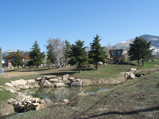
Silver Springs South Entry sign – April 2008 – Photo courtesy of Clay Archer
“We all live downstream”
It is against the law to introduce any species of plant or animal into these ponds.
1981- Silver Springs Water Distribution System
1981-Note the landscaped enjoyment easement along the waterways intended for all residents.
The possible Inundation Zone will likely be the homes directly surrounding the ponds.
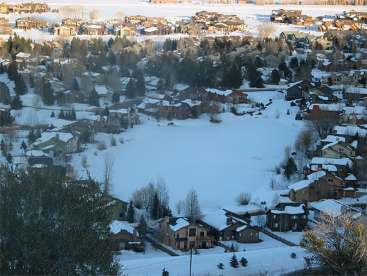
WINTER WATERWAYS IN SILVER SPRINGS
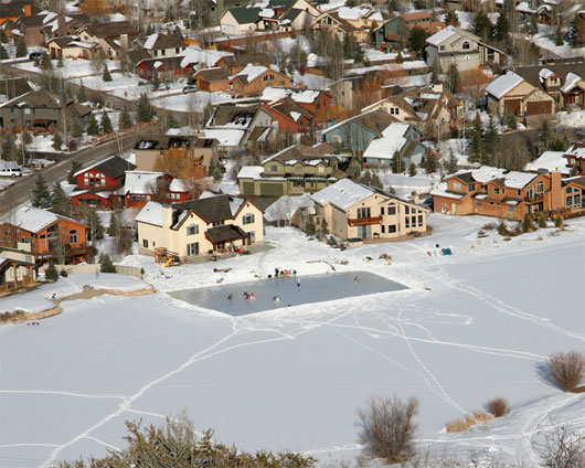
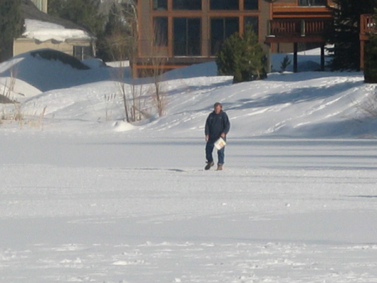
Silver Willow Lake in Winter – with Mooney’s “Ice Rink” – Photo courtesy of Rob Follett
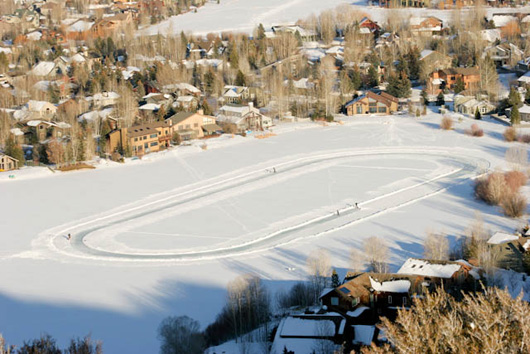
Quarter mile “ice skating oval” on Silver Willow Lake January 2009 – Photo courtesy of Rob Follett
Silver Willow Duck Pond in Winter – March 2008 – Photo courtesy of L. Archer
Feeding the ducks
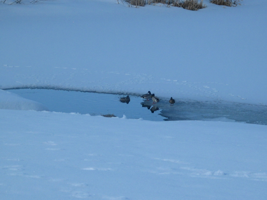
Ducks on the Pond – March 2008 – Photo courtesy of L. Archer
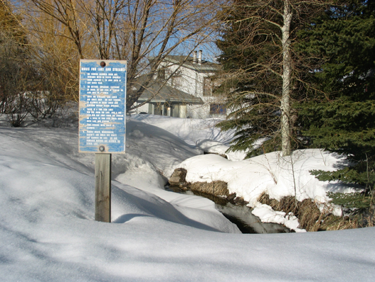
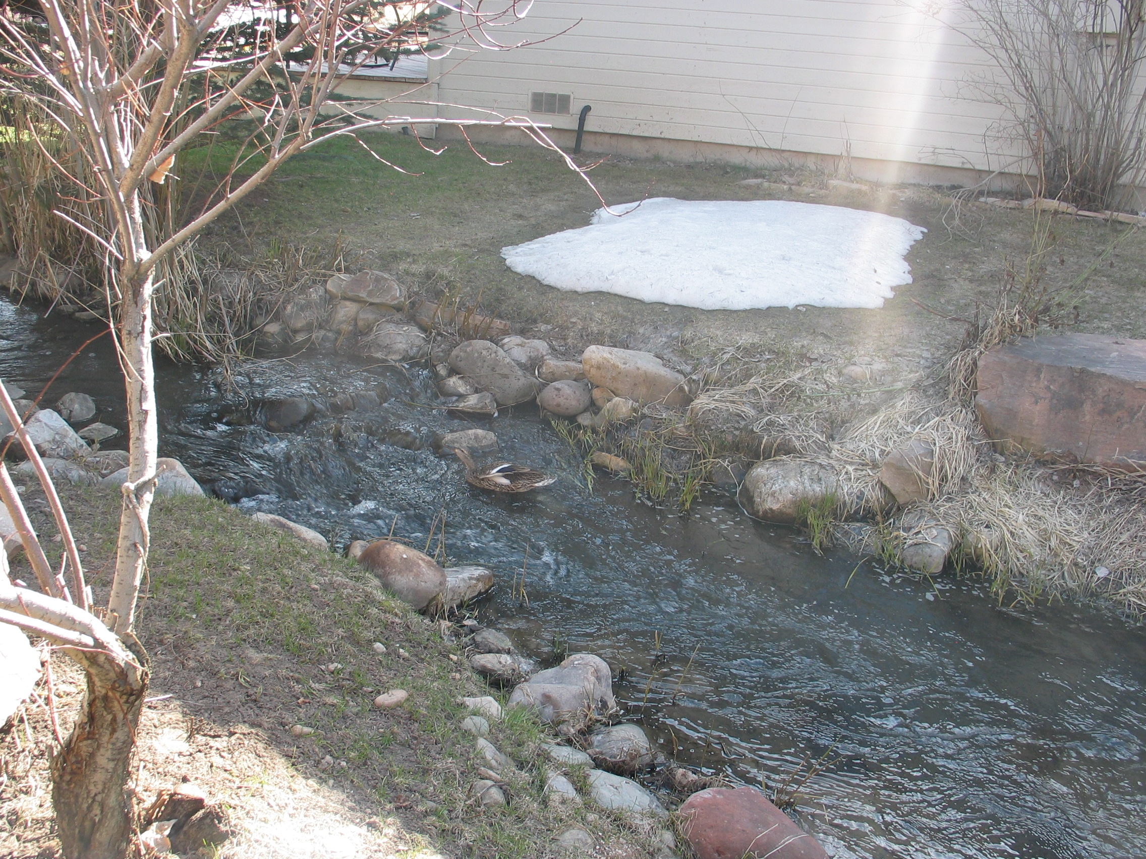
Parcel Q (branch of Red Pine Creek?) runs into Silver Springs Lake – March 2008 – Photo courtesy of L.Archer
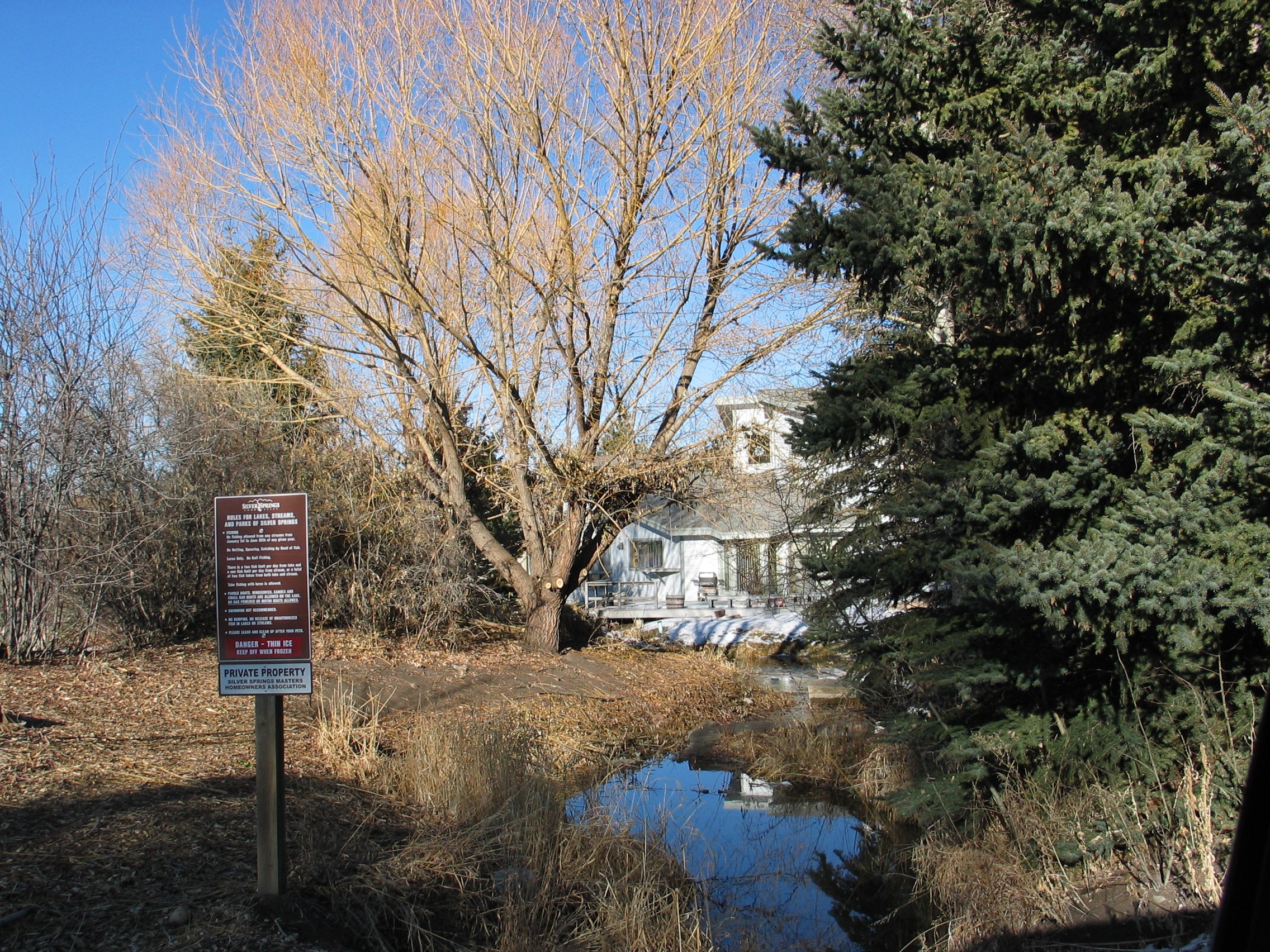
WILL WE LOSE ACCESS AND USE OF THIS “PRIVATIZED” STREAM
SILVER SPRINGS WEST AND SILVER SPRINGS EAST STREAMS 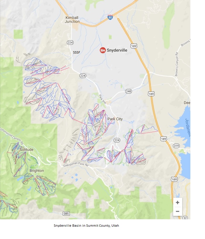 Highway 224 separates Silver Springs East from Sunpeak (originally known as Silver Springs West)
SPRING, SUMMER AND FALL SILVER SPRINGS WATERWAYS
Silver Willow Pond “Duck Lake” in the Fall – Photo courtesy of Rob Follett
Parcel Q fish ladder on the east end of Duck Lake was built by the SouthShore developers for the U.S. Army Corps of Engineers as mitigation for other culvert work done on Spring Creek (Application number 91-35-18SA). The ladder allows fish to migrate, each spring, from the large lake up to the small lake and up Spring Creek to spawn.
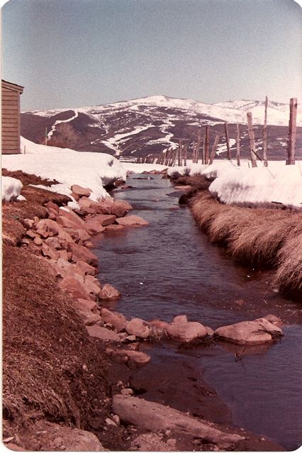
” Spring 1984-Willow Creek in our backyard before all the willows.” –Photo courtesy of Kirsten Kobler
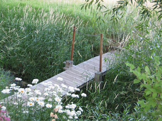
Summer 2008 Ptarmigan named this crossing “Pete’s Bridge” across Willow Creek in memory of the resident who built it and protected it from the “bridge troll”. Pete has since passed away.
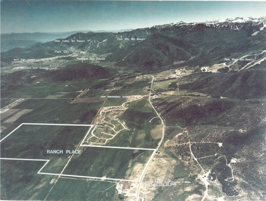
Silver Springs circa 1980 – First Homes before lakes were dredged
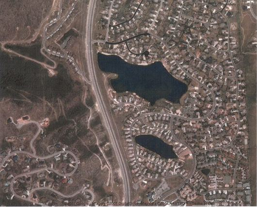
[North is at top] Waterways in Silver Springs – Silver Willow Lake on top, Silver Willow Pond in middle, Silver Meadow Minnow Pond bottom right.
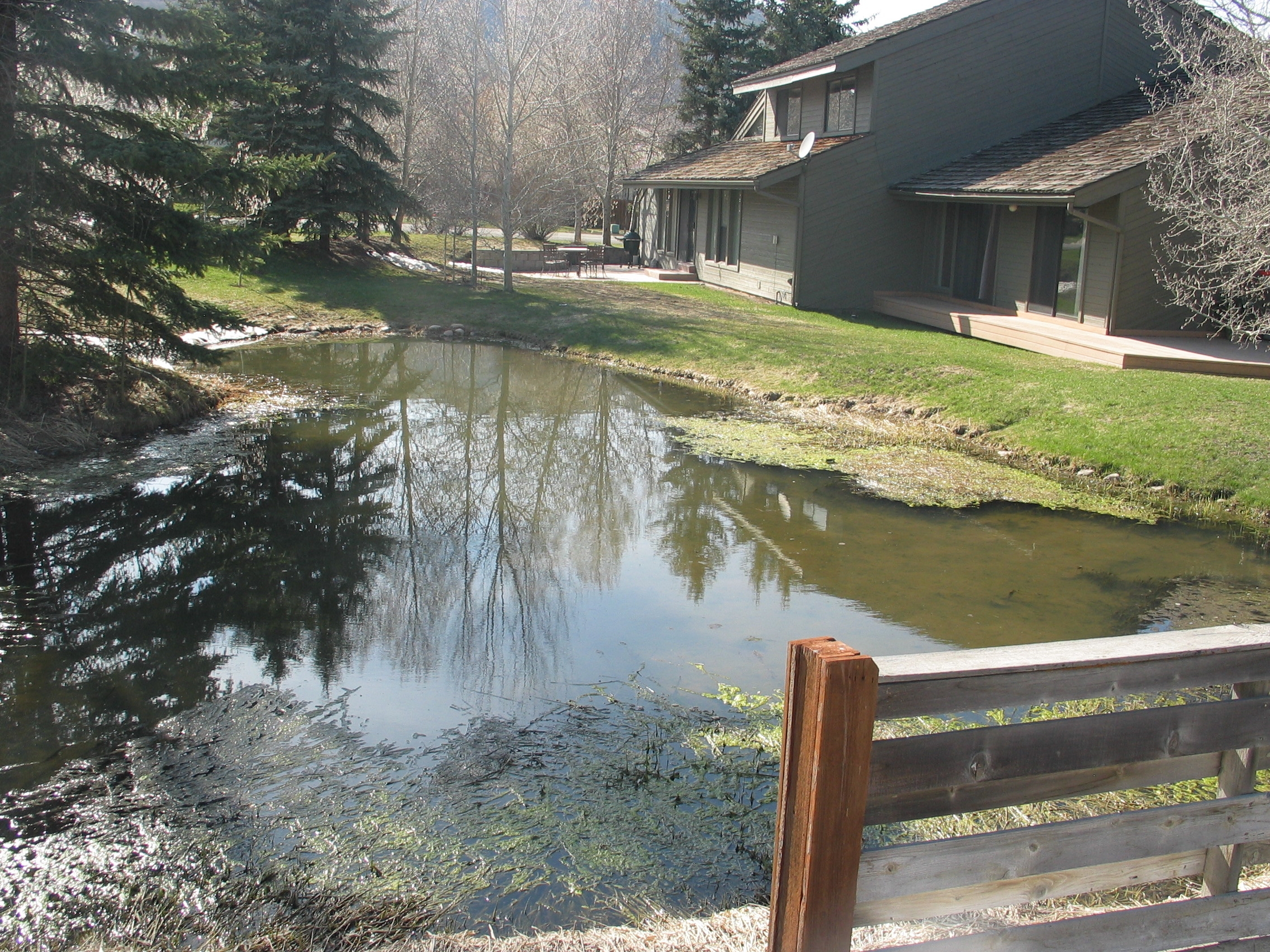
Retention pond on Lot SLS-173, visible on above aerial map photo.
1995, April 21 – Division of Water Rights Letter to Brian Geotz of the SS Water Co. – [incomplete]
1995, May 5 – Silver Springs Water Co. presentation to the SSMA [Incomplete]
1995, May 9, 1995 – Summit County Planning Commission Minutes [Incomplete]
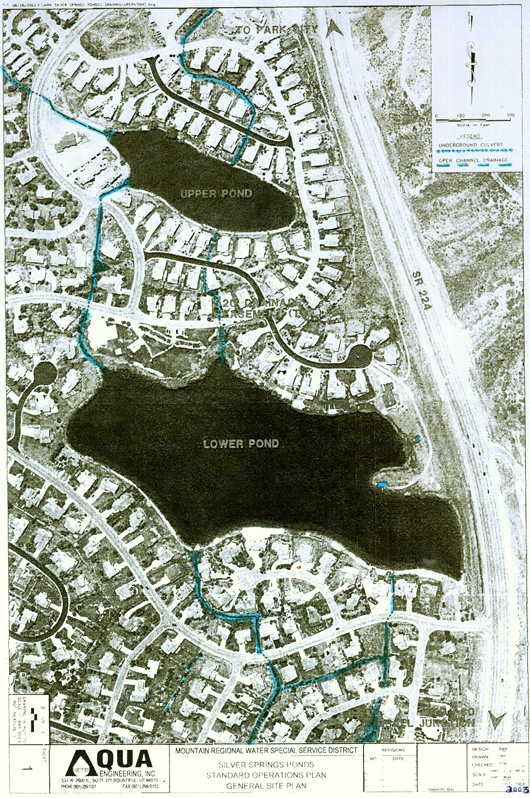
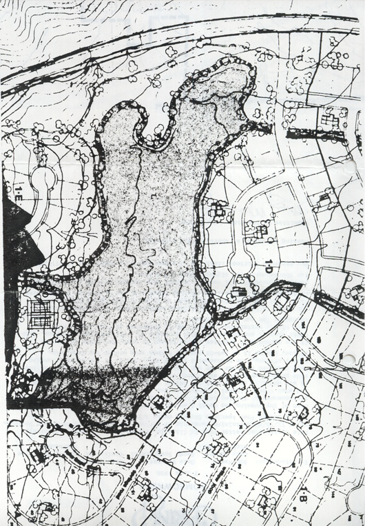
[North is at bottom] View of most of Silver Springs Community Waterways. Supposedly, the drainages the SSMA is responsible for are for the water coming from Spring Creek Springs past the Blue Roof, down through the west side of SouthShore (left side of map). The drainage that comes into the little lake from the Willow Creek diversion on the east side of SouthShore (right side of the map) is not the Association’s responsibility. Can we count on Craig Smith’s opinion or should the State Water Division be petitioned for a written statement.]
Lower Pond (big Silver Willow Lake) History – Lower refers to the lower elevation of the big lake (6480′ above sea level), though it is north of the smaller lake it is “downhill” from the smaller lake. Stream flow is from the Upper Pond (6510′ above sea level) (small lake) to the Lower Pond (large lake). Note inlet and outlet streams/ drainage channels.
December 2000 Water Committee:
Ralph Stanislaw – Park Place
Ron Duyker – South Shore
Matt Lindon – Silver Springs
Brodie Pollard – Silver Springs
Mike Washington – North Shore
Jaylene Chandler – Sun Peak
Chuck Hollingshead -Sun Peak
Ron Lockhart – Sun Peak
Craig Smith & Brett Rich – Attorneys from Neilson & Senior
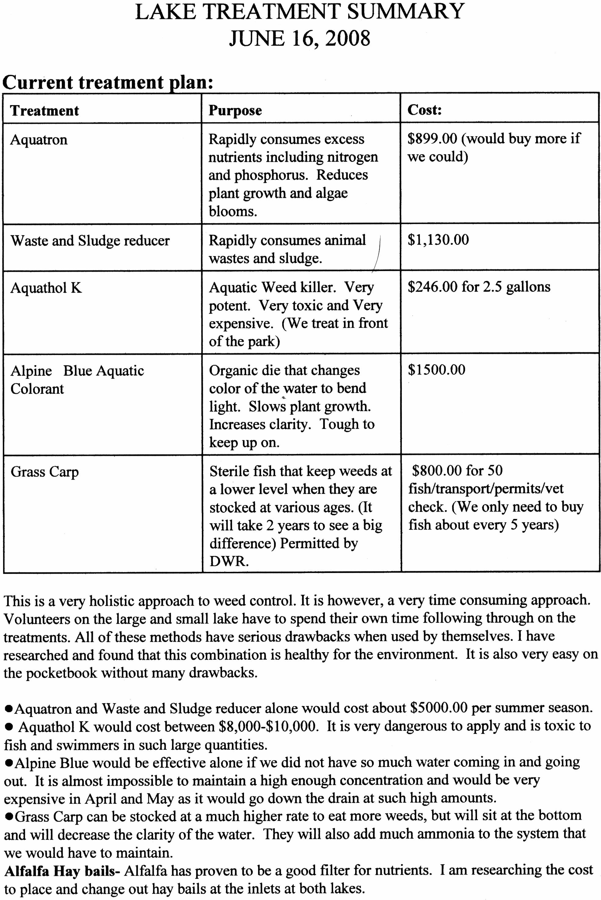
Lake Treatment Summary – By Gaylynn Mooney
The Lake requires several different chemicals to be added once or several times a year in order to maintain a degree of clarity, decrease the foul smell each spring, keep the weeds from growing, etc.
What the MA Board budgeted and spent for Lake maintenance and clean-up
2005: $34,597.17;
2006: $115,658 plus a Special Assessment of $69,525, plus Summit County paid $32,000 ;
2007: $24, 405;
2008: Proposed $90,000. for the Small Lake.
Pond/Lake Cleanup and Proper Plantings
Keith B. Clapier, owner of Park City Arborist, was hired by the HOA at Deer Lake Village on Queen Esther Drive to clean up their 1.5 acre pond. Besides removing 1,000 pounds of goldfish from the water the pond is being cleaned by big mouth bass and plantings around the perimeter of the pond. Clapier is an expert on surveying wetlands and riparian habitats (areas bordering waterways). Clapier will be planting riparian zone trees like cottonwood and birch as well as introducing native grasses and aquatic plants to the Deer Valley pond. “Ideally, 100 percent of the shoreline will be covered in plants,” he said, Clapier is a 20-year native of the U.S. Forest Service. “Trees placed in the right places will not obstruct views, but will provide the water with cooling shade and over-hanging branches from which insects fall in, nourishing the fish and amphibians (frogs, salamanders)….Properly placed aquatic plants in ponds and streams have dense, fibrous root systems that filter out sediment and contaminants, and remove fertilizer nitrogen that causes algae to bloom and thrive.” Properly planned and planted waterways attract water fowl, deer and moose, and are visually more attractive and beautiful to look at and enjoy. Clapier can be contacted at 435-513-2188

Cattail Control
Cattails are colonial plants rising from creeping stems called rhizomes like a branching shrub on its side. The creeping rootstock of underground rhizomes is one means of reproduction to rapidly spread cattails locally while the seeds are another way cattails establish new colonies. The common cattail can grow up to nine feet in height.
Cattails can quickly ruin a pond’s visual and recreational benefits. Control is best achieved through disruption of the root system. Cutting cattails 2 or 3 inches under the waterline 2 or 3 times to drown them can actually stimulate them if done in May. Pulling them out by the roots can be impractical and costly to dispose.
Cattails are perennial wetland plants found growing above the surface of the water in marshes, ditches, shoreline shallow areas of lakes, ponds, slow streams, quiet water up to 4 feet deep, and seasonal flood areas.
Although widespread throughout most of North America, Europe, Asia, and Africa, cattails are not likely to grow in depths exceeding 18? to 24? or areas not wet most of the growing season.
Cattail seeds germinate in April and plants mature from July through August.
We recommend Avocet with Cide Kick II for easy control without digging up the landscape or concern over maintaining water level. Using our treatment method, herbicide travels throughout the plant killing both the roots and vegetative portions. Simply spray on the portions of the cattail that can be reached. There is no need to spray from multiple directions.
Restore the visual and recreational value of your property through optimum treatment results.
Contact Lake Restoration at 1-877-428-8898 for application tips regarding timing, affects of weather, results, and more.
[2008 – NorthShore waterways are in desperate need of this type of maintenance.]
2015- The greatest assault on private property was during the Barack Hussein Obama administration with an arbitrary rule set by the Environmental Protection Agency that made it possible for federal and state bureaucrats, with a flick of a pen, to place land, pretty much anywhere, under the jurisdiction of federal regulators.
Called the Waters of the United States (WOTUS), the 2015 land grab determined that the EPA had control over any backyard ditch, drainage area or ravine where water gathered during rains. This includes the Silver Springs Community retention ponds (lakes), water channels (“collective water tributaries”), streams and creeks. It took control of that property away from landowners and farmers to give it to federal regulators and open the access to local municipalities such as our HOA.
Never in modern times has the federal government–by fiat (a binding edict issued by a person in command) -attempted a more brazen or widespread invasion of private property rights.
The EPA ruling got hung up in court, which is of little solace to innocent landowners. Once the case got diverted to the federal courts, President Trump’s EPA dropped the whole matter by reversing the kleptocratic regulations.
On October 22, 2019, EPA and the Department of the Army published a final rule to repeal the 2015 rule that impermissibly expanded the definition of “waters of the United States” (WOTUS) under the Clean Water Act. This action also recodifies the longstanding and familiar regulatory text that existed prior to the 2015 rule—providing regulatory consistency across states. The final rule will become effective on December 23, 2019. Read the final rule.
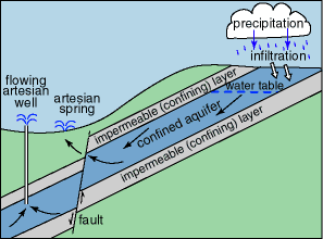
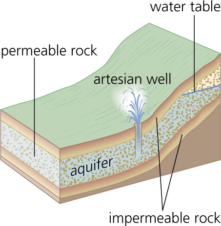
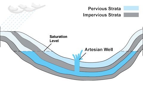
EXAMPLES OF HOW NATURAL UNDERGROUND WATER UNDER PRESSURE DEVELOPS INTO ARTESIAN WELLS AND ARTESIAN SPRINGS
The central area of our neighborhood includes artesian well/artesian spring activity. The large retention pond/lake reportedly has six or more active artesians, that is partly the reason it was located where it is. But this water source is never explained by the board neither has anyone attempted to locate where in our neighborhood natural pressure water exists and how it particularly affects a few individual properties.
The July 1979 Special Notice recorded by the developers warns builders and owners to avoid possible structural damages from abnormal water fluctuations, they are advised to use wider footings or by extending the foundation down to the gravel base. Any basements constructed will be at owner’s risk. etc.
If you are lucky to live in the mountains you prepare for their characteristics and features.