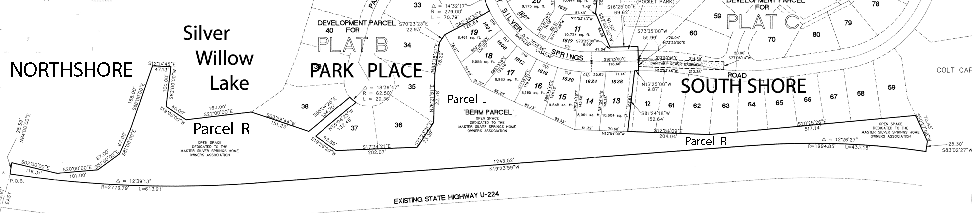
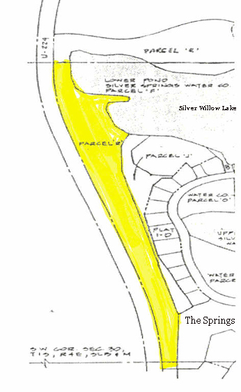
Parcel R – Berm/Trail
PARCEL R aka Tax I.D. # SOS-A-BERM – 5.21 acres (Account number 0279194 Entry 00347494),
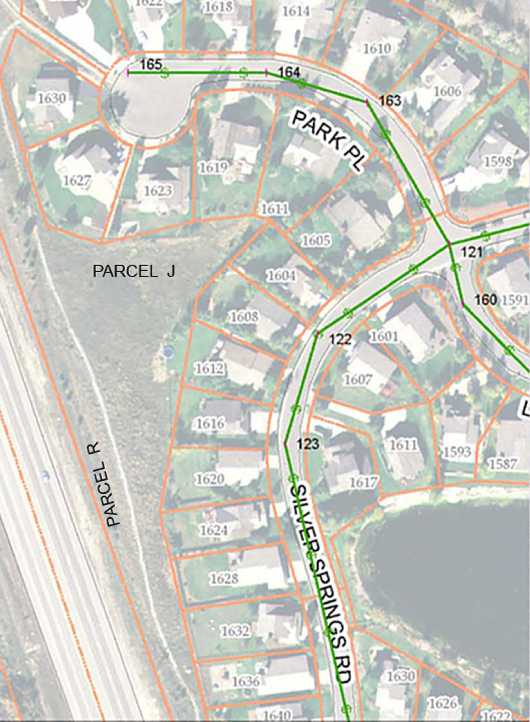
includes the area around the peninsula well pump station on the west side of Silver Willow Lake, in conjunction with Parcel J (wraps around the northwest, west, and southwest sides of Park Place) a part of the SOUTH BERM 6.80 acres (Entry 347491 Book 625 Pages 724-725). These parcels together contain approximately 12 acres, and are commonly called the “Berm”.
The very east tip of the peninsula is deeded to Mountain Regional, 100 feet around the whole well (must also include land under water).
1988 Letter to SSWater Co. Lynn Stevens – increase berm height.
Silver Springs MHOA Parcels R and J Plat – 1991
September 23, 1991 Deed for NSS Bern at Entry 347491 Book 625 Pages 724-725
Signed by Ruth Wagner
May 18, 2001 Quit Claim Deed for SOS-A-Berm at Entry 589411, Book 1371, Page 1389
Signed by Michael S. Barnes
1981 – November 10 – Summit County Planning Commission Meeting Minutes. Silver Springs Development Project Master Plan Amendment – Request for approval of sidewalk/pedestrian plan and increased density and 26 acre open space for public park. ” The park could contain various recreational facilities along with the use of the lake where water activities (other than swimming) could take place. The long narrow strip (six miles includes Parcel R) along the highway could be utilized as a bicycle and jogging area. The pathway connects the elementary school with the more active area of the park.”Parcel R : Minutes of the Planning Commission for Meeting held August 23, 1988.
Parcel R : Minutes of the Planning Commission for Meeting held September 13, 1988.From the 1989 Developer-Homeowner Agreement – The Developer conveyed the 6.8 acre Southern end of Parcel R Berm with a Special Warranty Deed to all of the HOAs named in the Agreement. The Developer agreed, but was under no obligation, to complete an addition of earthen material to this berm to increase the height along Highway 224 for noise reduction and privacy for the homes he was to build east of the berm.
The Developer represented that a 15 foot access easement which is located approximately between SouthShore Lots A-13 and C-12 (designated at that time as SLS-F-183-184) would provide access to and from the interior road, Silver Springs Road, and to and from the berm and walking trail, for the use and benefit of all Silver Springs Homeowners. The southern end of this parcel commences in the vicinity of the main Silver Springs Drive entrance from Highway 224, then proceeds in a northerly direction ending north of the northwest portion of the large pond at the Silver Springs Road (north entrance) to the Subdivision.
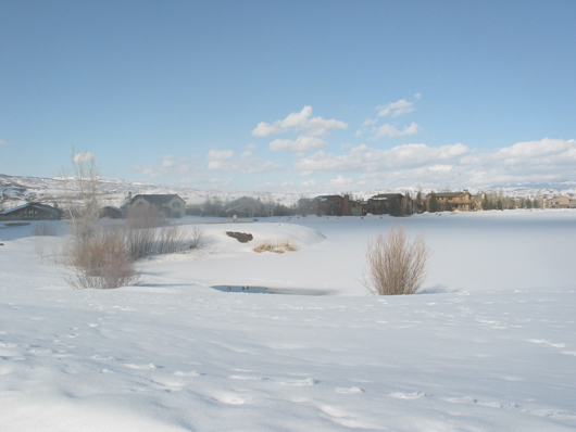
West crescent of lake, south of the peninsula – Winter 2007 View
Parcel R, situated from top to bottom begins at the Silver Springs Northshore entry where the Silver Springs/NorthShore monument entry sign is situated, then runs south along Hwy 224 south to The Springs at Walker Court subdivision (located just north of the Blue Roof parcel). This long, narrow parcel could possibly be developed as a dog park or running track.
The south Parcel varies in width. Aka SOUTH BERM has 6.80 acres, a portion could be converted to a community garden (any other ideas?)
The north half of Parcel R is aka SOS-A-Berm has 5.21 acres, begins at the NorthShore entry monument piece. The area around the peninsula could become a boat launch area..
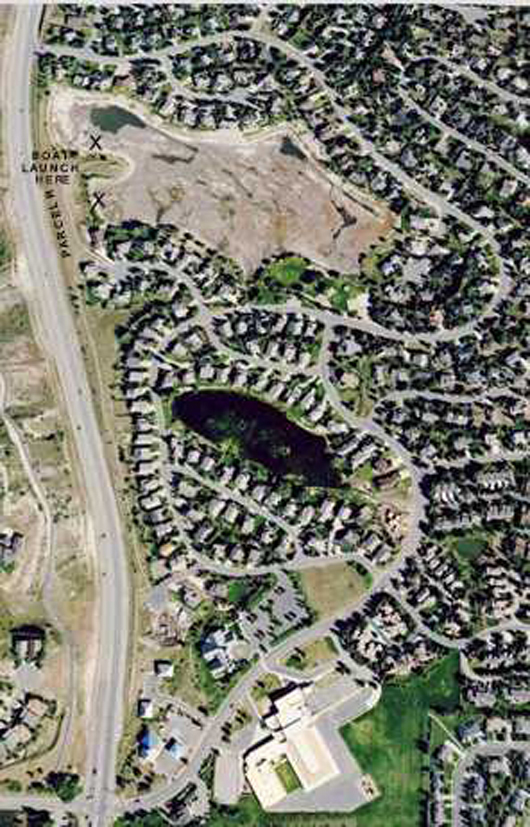
“X” marks the areas where boat launch areas could be developed by the M.A. for the members.
The remainder of the 12+ acre area could be fenced as a dog park or used as a jogging trail.
The General Membership could vote on whether the MA should develop these parcels, and whether to buy canoes or small boats that would be stored and code locked on the premises for use by our members. Liability insurance estimates need to be considered.
2008 – View from north to Park Place Court
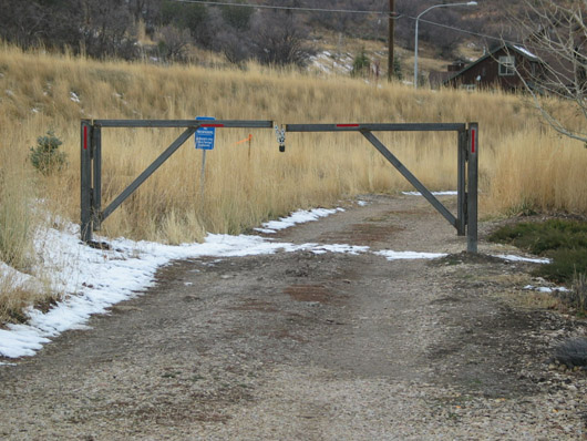
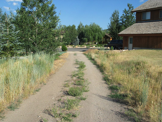
October 2009 – New gate to Parcel R access road built by Bob Radke at cost of $1,300.
Code to open this gate is -4762-
—Parcels J and R could be developed as a 12 acre dog park. The Master Association has ignored this common area resource. As of 2017 the MA is holding over $325,000 in homeowners’ dues beginning with the illegal assessment on the MA property owners in 2010. The MA spends most of its time and resources on the big pond and on the private little pond. The feckless MA Board and manager have had no complete audits of their accounts since the developers began to organize them in 1989. The MA has received no legal authority from Summit County nor the 513 SSMA Homeowners, and has no finalized governing documents for administration, creation of rules, or collection of dues or assessments by the makeshift Master Association. They are in “office” by “the seat of their pants” using parts of their intended purpose only rather than a formal plan or receiving any line of authority.
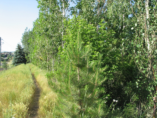
Parcel R – north end – trail along top of berm
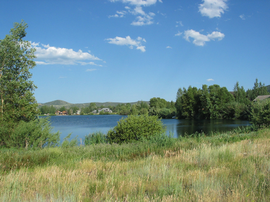
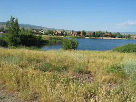
Parcel R – looking east to crescent around west side of lake
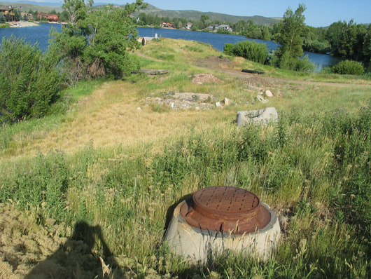
View from trail along berm toward pump house on peninsula
– Pump house and end of this peninsula belong to Mountain Regional Water (PP-98-A-??)
Parcel R -boat launch? beach-park? What are your thoughts? – Summer View
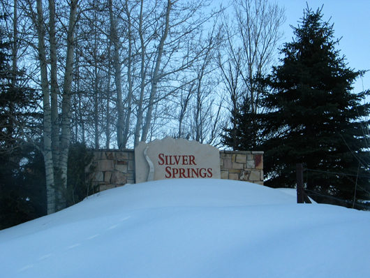
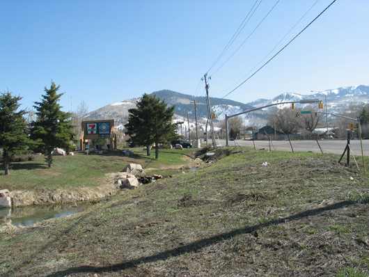
NorthShore entrance to Silver Springs is where the north end of Parcel R begins
Southern portion of Parcel R aka Tax I.D. # South Berm – 6.80 acres
South half of Parcel “R”; extends from main entry by Blue Roof, north along Highway 224 to mid-point to NorthShore entry. Formerly belonged to InSource, Inc.until 1986 bankruptcy, then foreclosed by American Savings and Loan.
“Unassessed” Parcel – View looking south from The Springs subdivision open space.
The Summit County plat shows the parcel between Hwy 224 and Blue Roof as “unassessed”.
Plat indicates Scott Simon has a long sliver of land between the Hwy 224 and Parcel R.
(Add Vern Hardman quote from SSSF minutes stating the “unassessed” parcel should be transferred to the SSHOA”