Parcel A – Wetland
Parcel A : Common area easement parcel/ outlet stream, beginning from under Silver Springs Road at 15′ wide between North Shore Lots 28 & 29, commencing north, and widening to around 40′ then narrowing as it reaches Heather Lane between North Shore Lots 82& 83, then under Heather Lane and joins the “Wetlands” Tract A. This waterway is choked with dense, tall cattails. See 2002 Quit Claim Deed to Master Association, Entry 616573
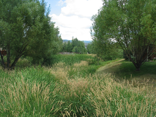
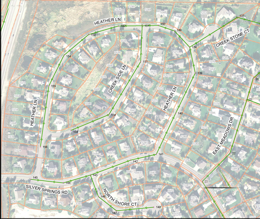
Parcel “A” between homes along Heather Lane and Creek Side Lane -NSS-A-CA – 2008
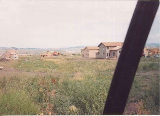
Parcel “A” as seen in 1994 before the trees were planted and grew
and before the cattails took over. -NSS-A-CA
– Photo courtesy of Randy Siebert
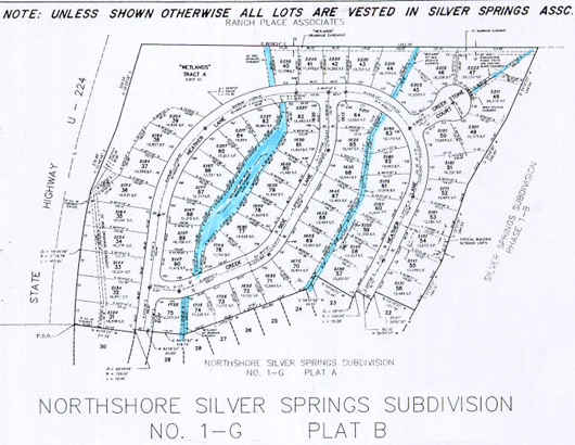
Parcel A in blue is on the left.
Parcel T in blue is on the right.
Both Parcel A and T waterways belonged to NorthShore Subdivision, In April 2002 these were Quit Claimed to the MA.
See at: 2002 Quit Claim Deed Entry 616573
Both waterways are choked with cattails and explain why the trout have not been spawning up the ladders during the last five or seven years.
A drainage channel easement along Creek Stone Court in Northshore -NSS-B-WOS –
Deeded to the Master Associaton April 18, 2002 Quit Claim Deed Entry 616573
Note: Parcel A left just off center and Wetlands Tract A top left.
http://www.lakerestoration.com Recommends Avocet Shore Clear and Cide Kick II
For cattail control:http://www.lakerestoration.com/pc-28-9-avocet.aspx?gclid=
CO3Wpt2UgZUCFSQbagodsEYbrA
Cattail Control
Cattails are colonial plants rising from creeping stems called rhizomes like a branching shrub on its side. The creeping rootstock of underground rhizomes is one means of reproduction to rapidly spread cattails locally while the seeds are another way cattails establish new colonies. The common cattail can grow up to nine feet in height.
Cattails can quickly ruin a pond’s visual and recreational benefits. Control is best achieved through disruption of the root system. Cutting cattails 2 or 3 inches under the waterline 2 or 3 times to drown them can actually stimulate them if done in May. Pulling them out by the roots can be impractical and costly to dispose.
Cattails are perennial wetland plants found growing above the surface of the water in marshes, ditches, shoreline shallow areas of lakes, ponds, slow streams, quiet water up to 4 feet deep, and seasonal flood areas.
Although widespread throughout most of North America, Europe, Asia, and Africa, cattails are not likely to grow in depths exceeding 18″ to 24″ or areas not wet most of the growing season.
Cattail seeds germinate in April and plants mature from July through August.
We recommend Avocet with Cide Kick II for easy control without digging up the landscape or concern over maintaining water level.Using our treatment method, herbicide travels throughout the plant killing both the roots and vegetative portions. Simply spray on the portions of the cattail that can be reached. There is no need to spray from multiple directions.
Restore the visual and recreational value of your property through optimum treatment results.
Contact Lake Restoration at 1-877-428-8898 for application tips regarding timing, affects of weather, results, and more.
2015-2017: The Silver Springs Community Homeowners in NorthShore have been enduring rising retention pond (area) drainage water for years. The clogged retention pond has been inundated with cattails, a situation that has kept even local moose, deer and other wild life from visiting. Some backyards of homes along Highway 224 and Parcel A are flooded with no relief in sight from the deed holders, the Silver Springs Master Association, a group that is responsible for the maintenance and care of the common areas, such as Parcel A. Adding to the problem is the unauthorized berm left by the original developers (Barnes, Widdows, and Spieker). The Master Association has had well-over a quarter of a million dollars accrued by overcharging annual dues from the homeowners. So why does the Master Association continue to ignore the plight and remedy of Parcel A Homeowners? Why have the MA officers, Phil, Paul, Nancy, other Nancy, Gaylynn, Whit, etc., not taken action over the years to remedy the compounding, exasperated complaints of Homeowners they have a mandate and a duty to aid and to serve? Why are you keeping the name of the MA attorney a secret from these protesting Homeowners? Inquiring minds want to know…. what is the hold-up???