–Maps & PLATS of SSSF
 Click on image to enlarge. Then click again for second phase enlargement.
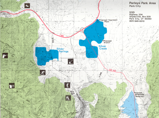
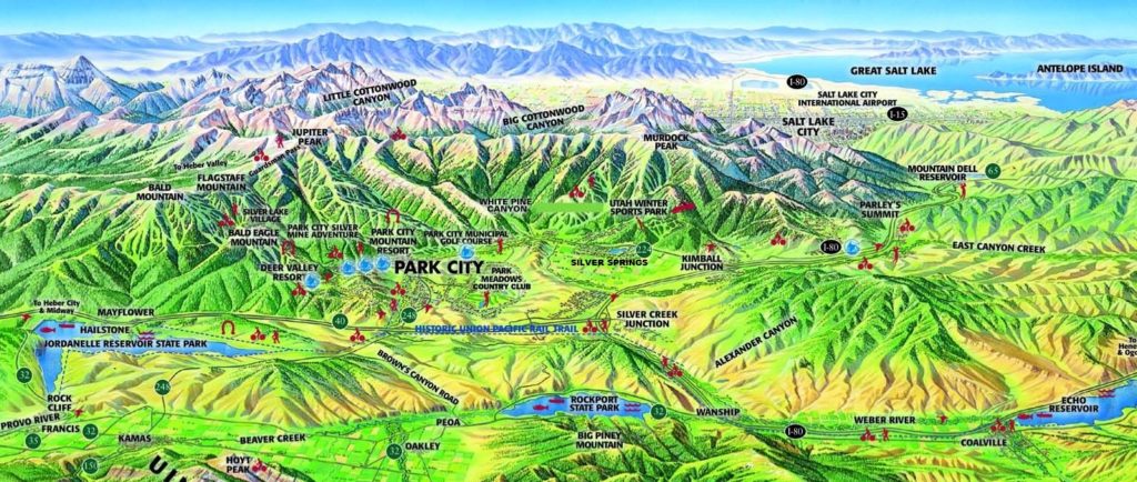
Silver Springs West is divided from Silver Springs East by Highway 224.
What is Silver Springs East?
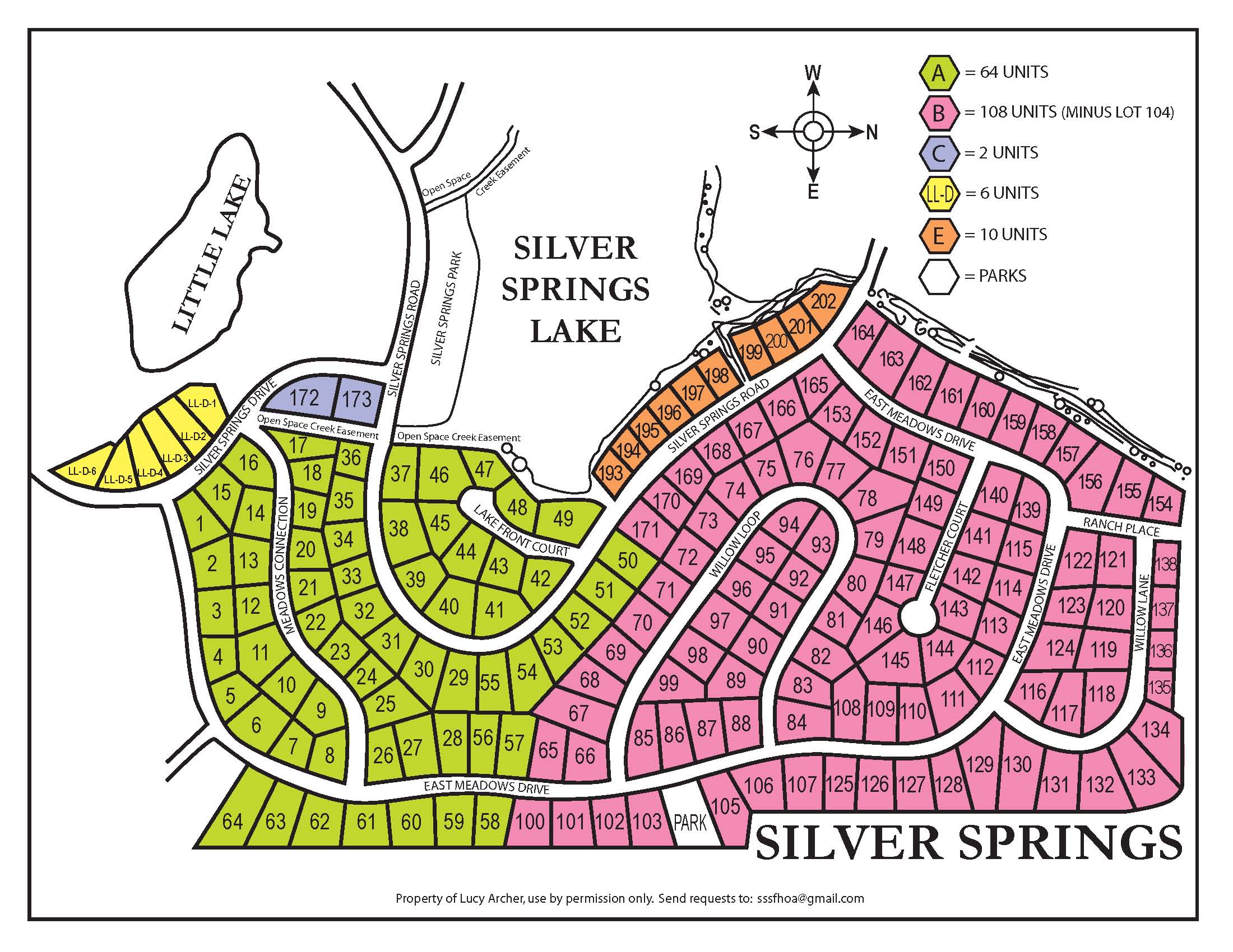
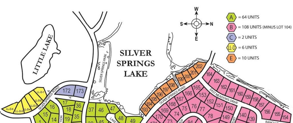
Silver Springs Single Family Map – Plats A through E by Lot Number
Click on map to enlarge the size.
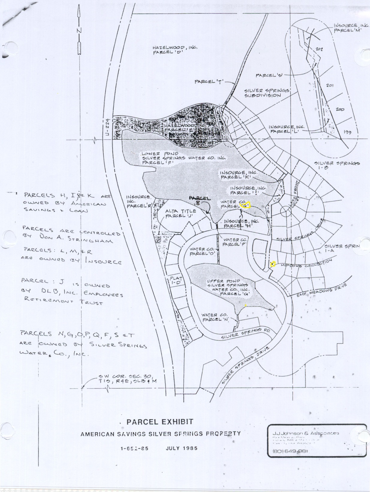
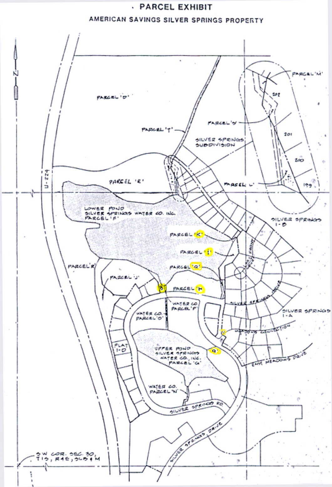 Silver Springs Water Company = Water Channel Parcel Q
also Land now belonging to individual SSSF Owners = Parcels K,I,V
Parcel H is the Community Park
Exhibit by J. Johnson & Associates July 1985
SILVER SPRINGS SINGLE FAMILY PLAT 1-A Lots 1 through 64
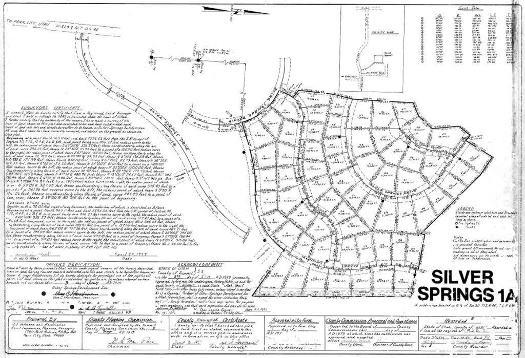 Click on image to enlarge. Then click again for second phase enlargement.
SILVER SPRINGS SINGLE FAMILY PLAT 1-B Lots 65 through 171
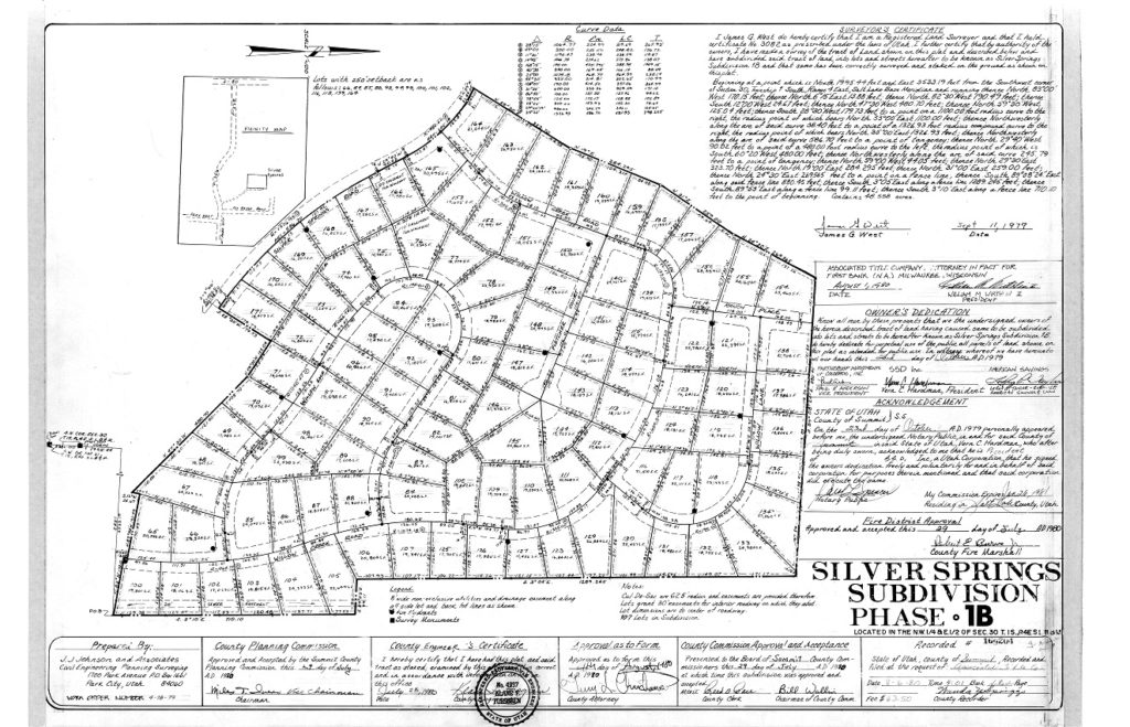 Click on image to enlarge. Then click again for second phase enlargement.
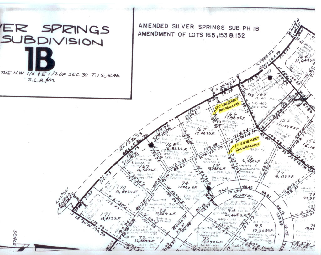 Amended Plat B – details 10′ wide walkway between Willow Loop and SS Rd.
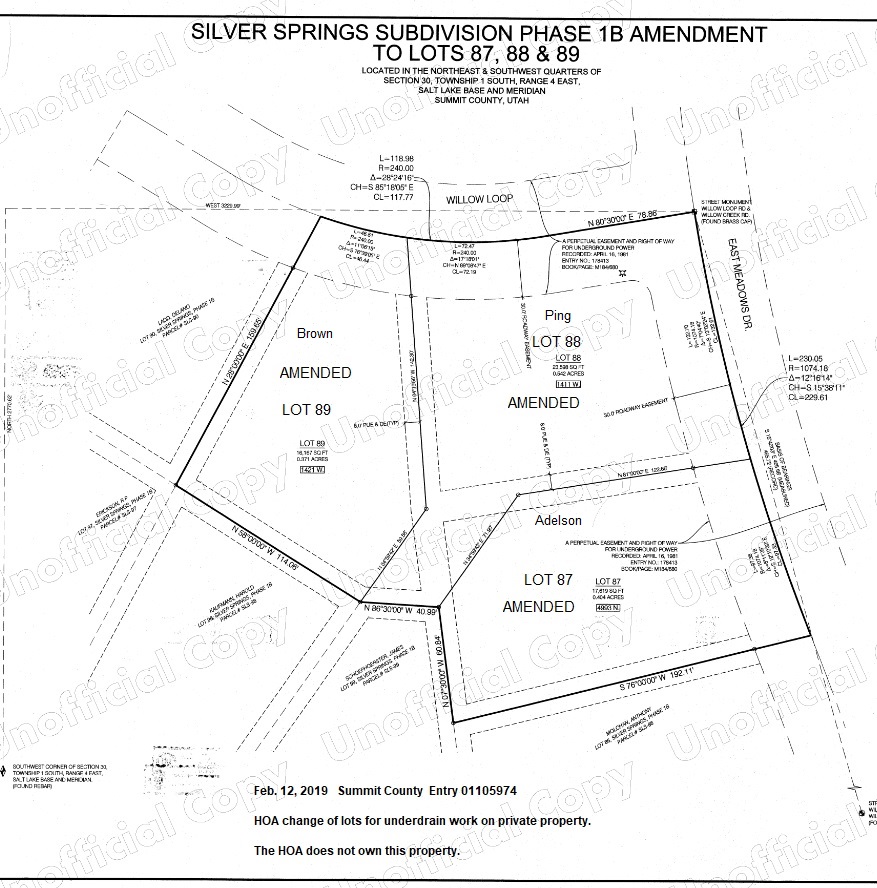
Amended Lots 87, 88 , 89
Click on image to enlarge. Then click again for second phase enlargement.
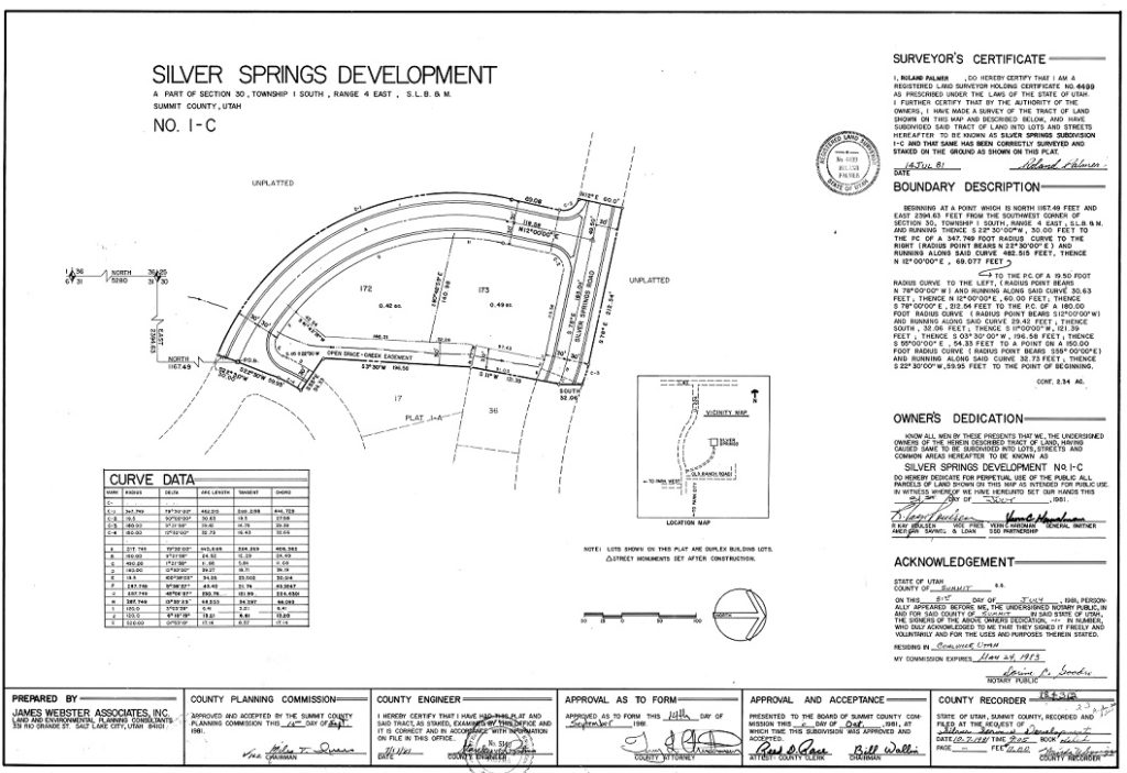
SILVER SPRINGS SINGLE FAMILY PLAT 1-C Lots 172 and 173
On July 31, 1981 Silver Springs Development Plat for Phase No. 1-C was recorded by the Summit County Recorder as Entry 169204, Book “filed”, by LeRoy P. Taylor, William M. Wirthlin III, Miles T. Ivins, Terry L. Christianson. This Plat C includes what Recorder Alan Spriggs called “the black hole” Parcel “V” and the American Savings Parcel “Q” creek easement.
Recorded on October 31, 1981 as part of the Silver Springs Development No. 1-C as Summit County Recorder Entry 184312 (Silver Springs Developer, Inc. Vern Hardman and American Savings Bank (Kay Poulsen)).
On December 21, 1981 a Warranty Deed from SSD Partnership to DLB.Inc. transferred these two lots as Exhibit A to Paul Anderson recorded as Summit County Recorder Entry 186282 Book M Pages 283-284.
Plat No. 1-C was separated from SSD Partnership to become the third of five eventual plats belonging to what became in 1985, the Silver Springs Single Family subdivision.
 Click on image to enlarge. Then click again for second phase enlargement.
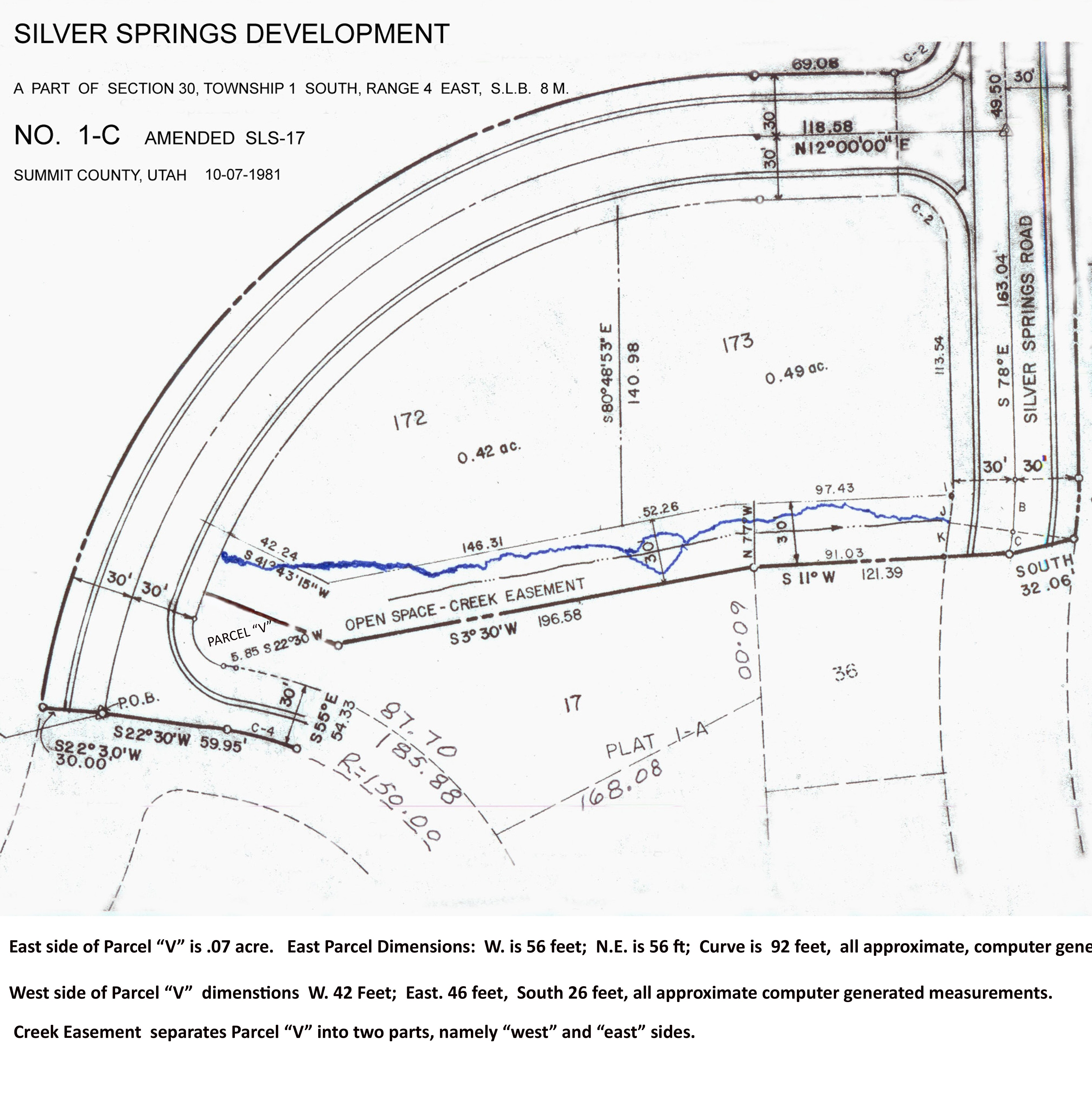
Lot 172 received east and south set backs in 1997
SILVER SPRINGS SINGLE FAMILY PLAT 1-D Little Lake Lots LL-SS-1D-1 through 6
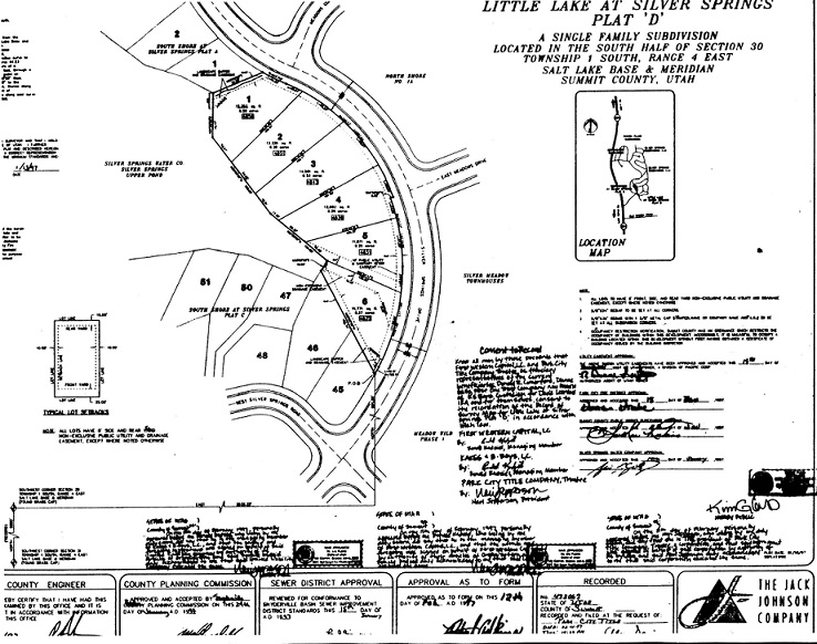 Click on image to enlarge. Then click again for second phase enlargement.
SILVER SPRINGS SINGLE FAMILY PLAT 1-E Lots 193 through 202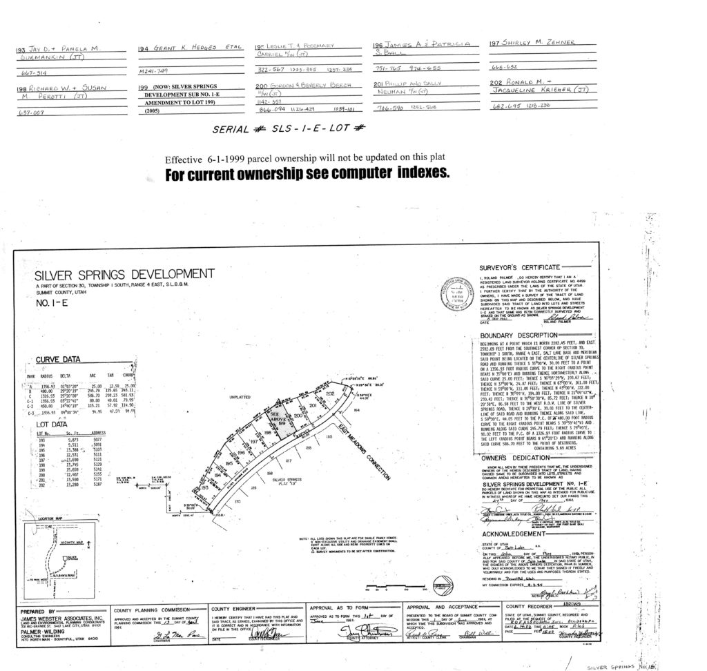
SLS-E-199-AMD (2005)
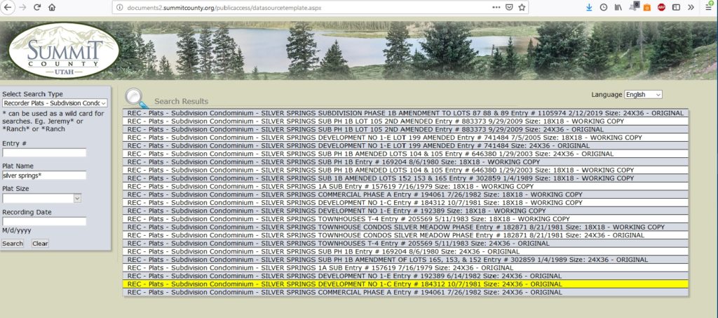
To Find Plat Maps on the Summit County Recorder website:
Go to http://www.co.summit.ut.us/ or http://www.summitcounty.org/
Click on the black header “Services”
Find “Online Services” — “Property Search” that will take you to the next page
On the green bar Click “Onbase Public Documents”
On this next page a grey box titled “Select Search Type” has a search field with a drop-down menu.
Scroll down to select “Records Plats – Subdivision Condominium”
The grey box will refresh providing a new search fields.
In the “Plat Name” field type: “silver springs* ” The asterisk is very important.
Your Search results should look like this: