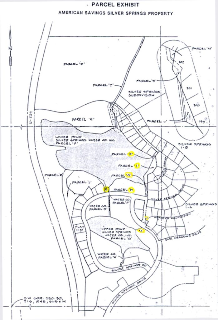
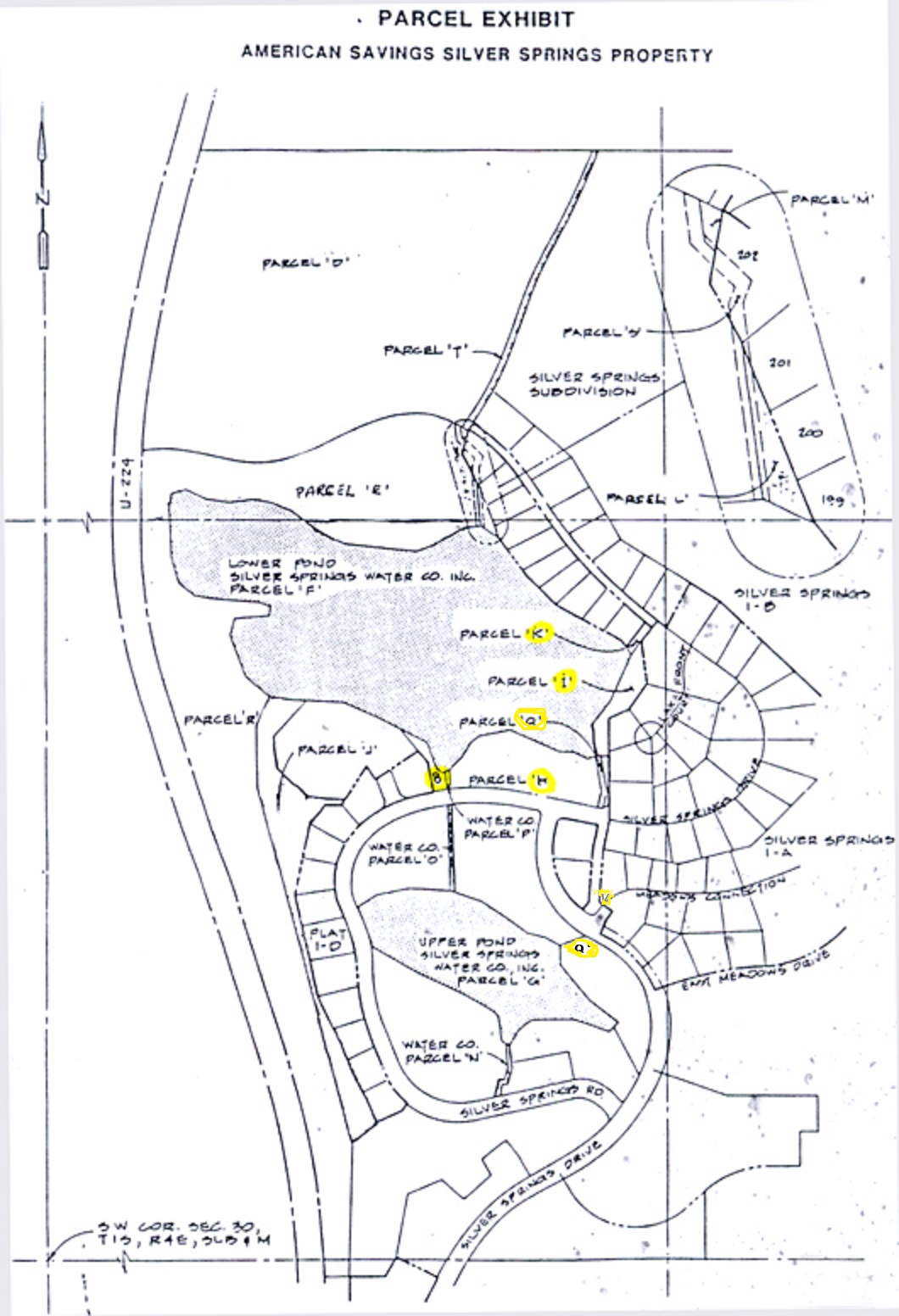
Parcel Q -Ponds Inlet-Outlet
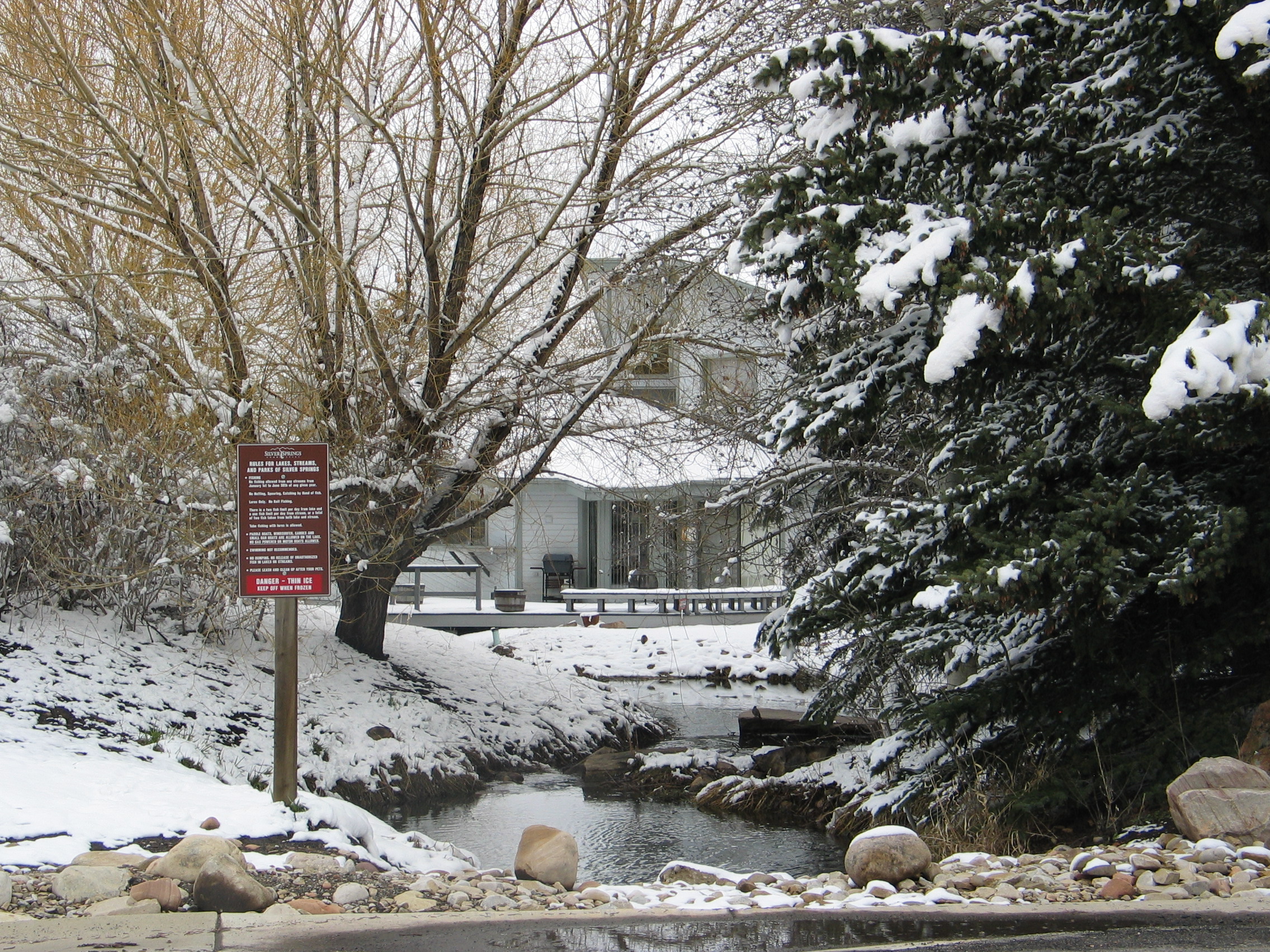
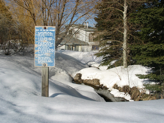
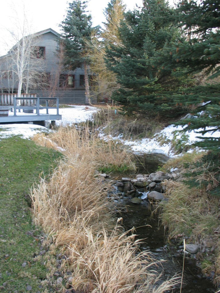
Parcel Q creek and Parcel V in winter
“The Fish Ladder” “Creek Easement” “Lake Water Channel” “Open Space”
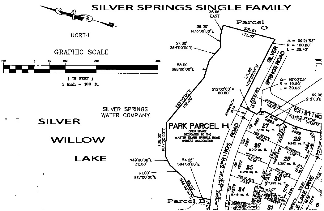
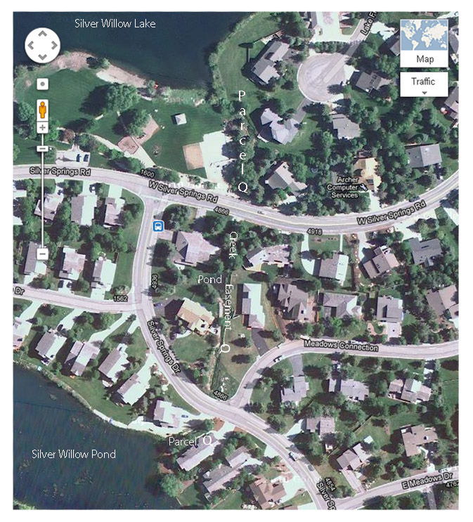
Parcel Q: Begins at Silver Willow Pond, the channel’s water flows east under Silver Springs Drive, through the open creek channel, then under Silver Springs Road and then north along another open channel to deliver water north to Silver Willow Lake. In the 2004 Lake Conveyance Agreement it is part of the “collective water tributaries”.
“The Silver Springs Water Company conveyed all its water rights to Mountain Regional Water
and its land rights under the water to the SS Master Association via the 2004 Lake Conveyance
Agreement” including Parcels N, O, P, Q, S, as “collective water tributaries.”
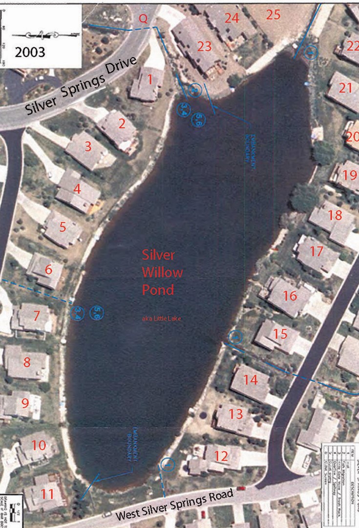
1991 South Shore Plat A – Top blue line shows Parcel Q from Little Pond to Big Pond
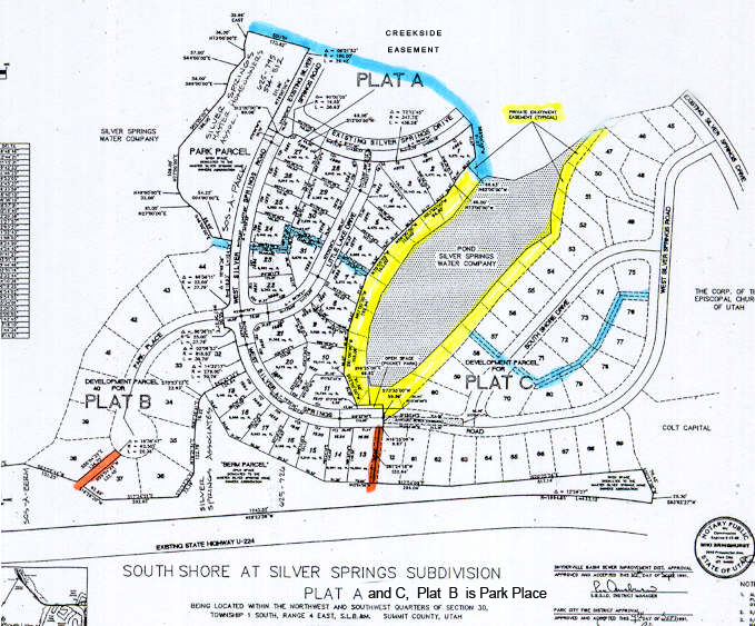
1991 SouthShore Plat A with Parcels B, H, P, Q
Parcel Q channel began as a fish ladder. Elevation creates a flow east from Silver Willow Pond into the Silver Willow Lake.
2006 – Follow the Water by Matt Lindon
 Click on map to enlarge
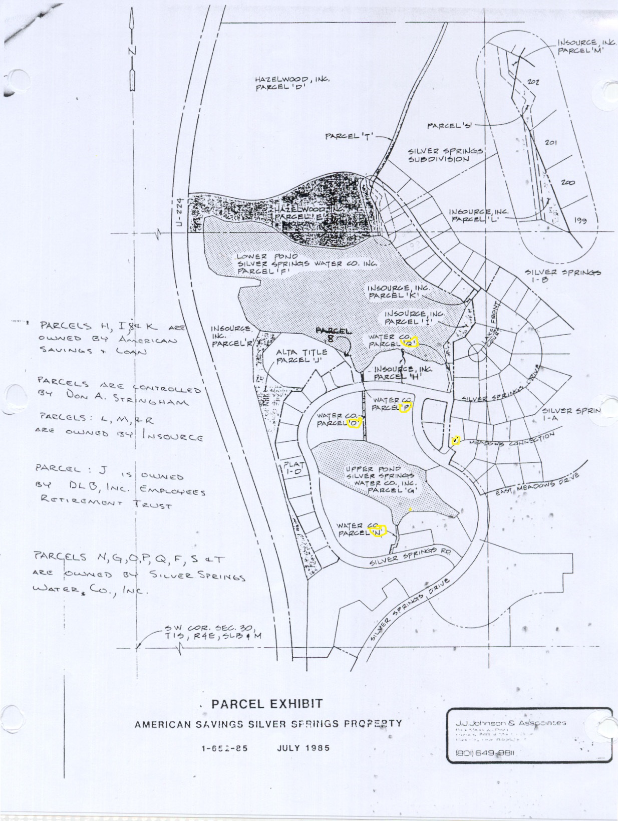
1985–Not all waterways easements belong to the SSMA, some are drainage channel easements belonging to individual property owners and some are controlled by the SSMA.
Mid-2010 the Community Developers 1990 water attorney, Craig J. Smith, who was involved with the 2004 Lake Conveyance Agreement, stated his opinion that the drainages the SSMA is responsible for are for the ones used by Spring Creek Spring past the Blue Roof, down through the west side of SouthShore (American Savings Bank Parcels “N”, “O” and “P”). The drainage that comes into the little lake from the Willow Creek diversion on the east side of SouthShore (American Savings Parcel “Q”), as far as he could determine are not the SSMA Association’s responsibility.
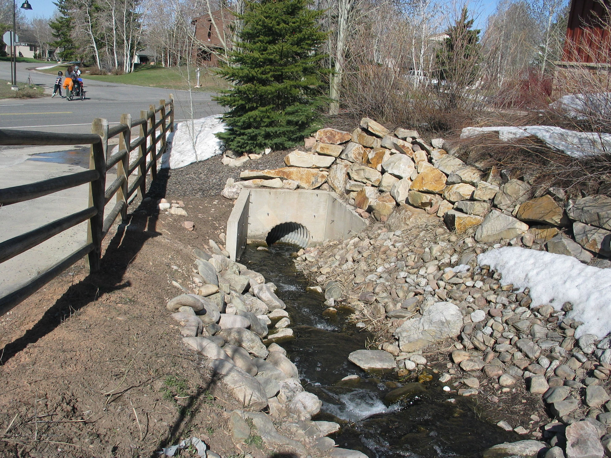
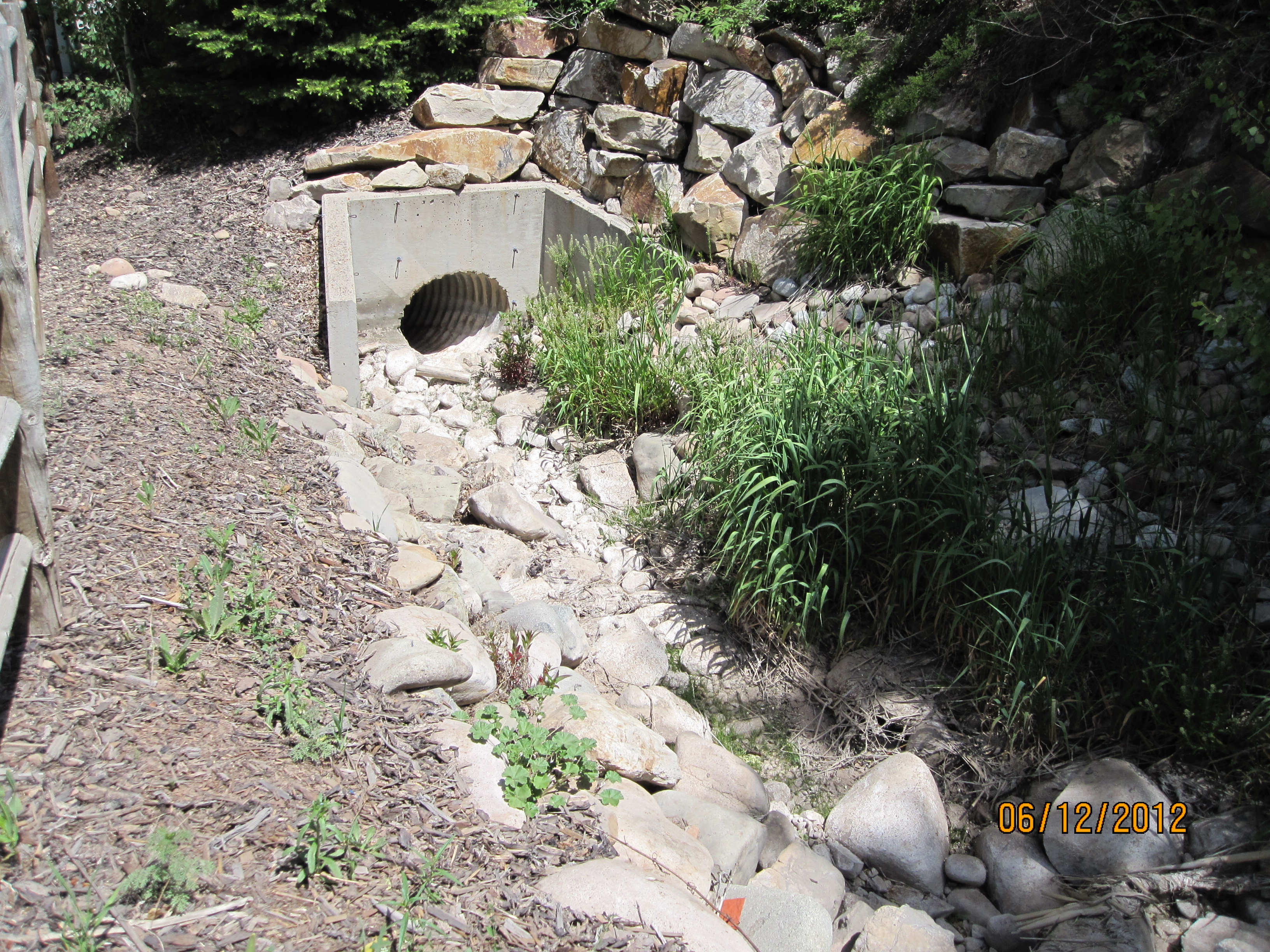
Parcel Q fish ladder on the east end of Duck Lake (Parcel “G”) was built by the SouthShore developers for the U.S. Army Corps of Engineers as mitigation for other culvert work done on Spring Creek (Application number 91-35-18SA). The ladder allows fish to migrate, each spring, from the one lake up to the other lake and up Spring Creek to spawn.
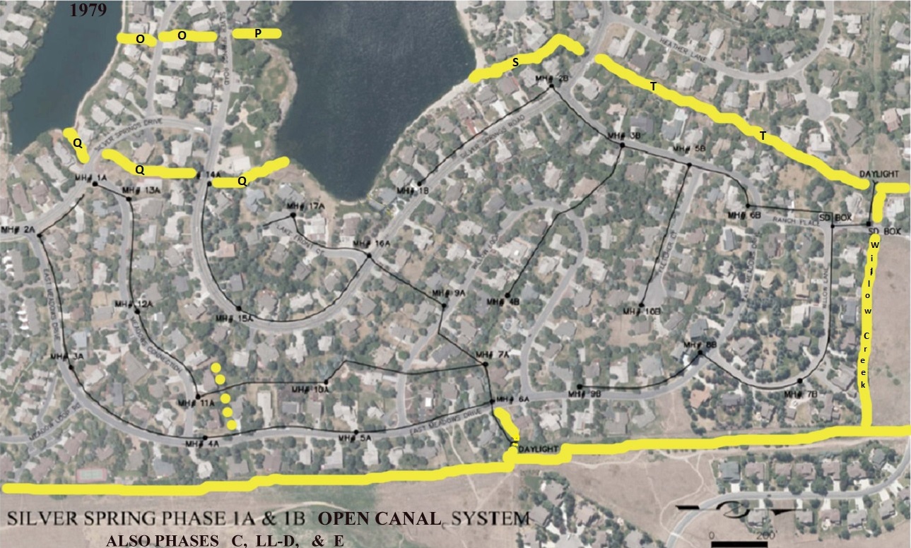
CHANNEL PARCEL Q Outlet and Inlet –Parcels O &, P water channels run along the top left side of this aerial photo.
(not shown is Parcel N, it is on the left of Little Lake)
Parcel Q is located just below Parcels N, O, P; each are marked with yellow lines.
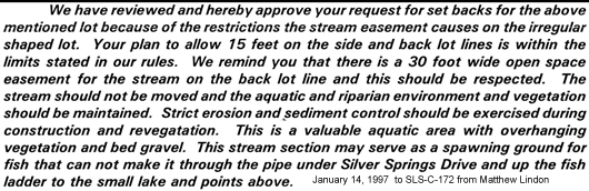
American Savings Aug. 8, 1988 letter: “Waterways: Silver Willow Lake, its inlet and outlet streams and the surrounding riprap together with a 15-foot buffer strip outside the riprap are owned by the Silver Springs Water Company. Use of these by the Homeowners and others will be regulated by the Water Company.”
“The Silver Springs Water Company conveyed all its water rights to Mountain Regional Water and its land rights under the water to the SS Master Association via the 2004 Lake Conveyance Agreement as collective water tributaries.”
 1985 -J. Johnson & Associates Exhibit – Included as part of Ryan Richards’ 1987-8 letter from American Savings Bank.
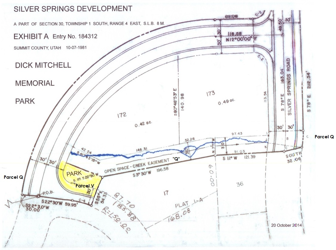
2008 & 2019 – “To the best of my understanding, Parcel Q is now within the Park Parcel H of the ‘South Shore at Silver Springs Subdivision’ Plat A recorded in 1991 (as the result of the 1989 Master Association organization agreement), and Parcel V optionally may or may not be included in the Open Space – Creek Easement within Silver Springs Development Phase 1-C plat recorded in 1981. Parcel V is a title black hole without ownership, tax I.D. or recordation in any County records. “ From Summit County Recorder Alan Spriggs and MRWD surveyor Scott Braun.
Original Weir Gate on east side of the Little Lake pond, at west opening of Parcel Q channel.
A weir is a low dam built across a waterway to raise the level of water or regulate its flow.
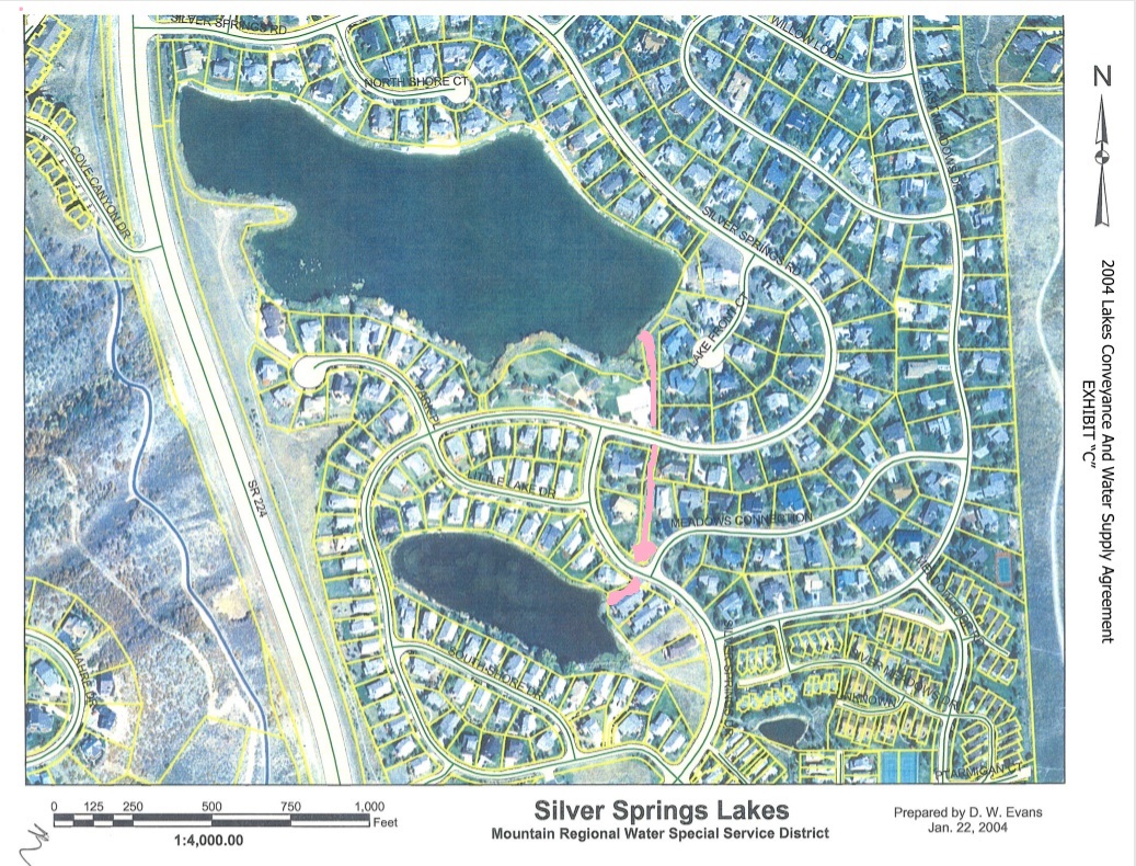
2004 Mountain Regional Lake Conveyance Agreement Exhibit “C” – Parcel Q in pink.
 Click on map to enlarge
Channel Parcel Q is a part of the 1987 American Savings Bank Silver Springs parcels inventory at the time of the many builder bankruptcies. The larger of the listed parcels became the titled property of the MA.
The 2004 Lakes Conveyance and Water Supply Agreement between the Summit County Mountain Regional Water District and the SS Master Association include these terms:
“C. WHEREAS the Association desires both legal title and beneficial use of the property that encompasses [particularly Parcels N, O, P, Q, S, as “collective water tributaries”] the two Lakes and property with subsequent minor holding ponds, together with the dams more particularly described in Exhibit A, formerly owned by the Silver Springs Water Company, (such property and/or the Lakes with such property is collectively referred herein as “Lakes” as the context may require); and …
“H. WHEREAS the [Master] Association and the District both desire to provide for the proper and effective operation of the Lakes [that includes the inlet and outlet creeks and channels Parcels N, O, P, Q, S, as “collective water tributaries.]”…; and
“K. WHEREAS the District and the Association desire to formalize an agreement whereby the Association will take legal title and beneficial usage of the Lakes [sustained by the inlet and outlet creeks and channels including Parcel Q]”.
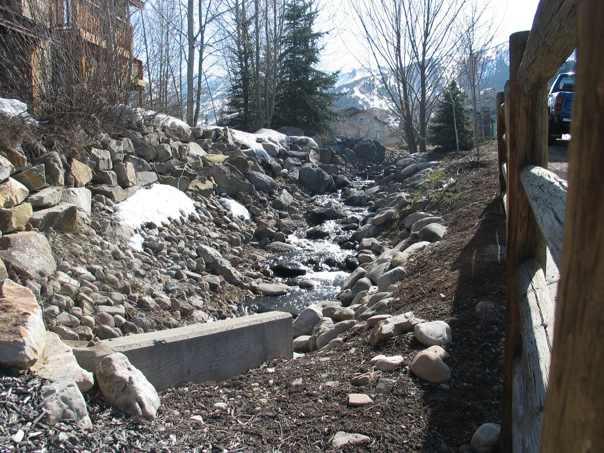
North section of Parcel Q – bottom of photo is Silver Springs Road
Parcel Q – Winter of 2006-2007- photo taken from Silver Springs Road – facing north.
Lake Park Parcel “H” is contiguous with the west boundary of Channel Parcel “Q”
2010 – Parcel Q stream, view north section of Q from Silver Springs Road. House/deck on Lot 46 are visible in the background. Parcel Q channel and landscaping border west side of Lot 37.
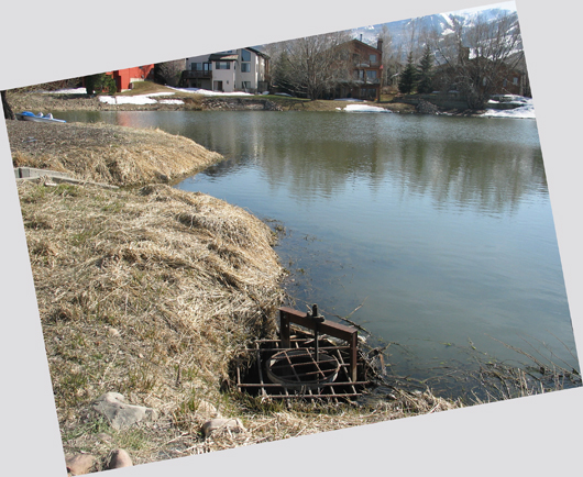
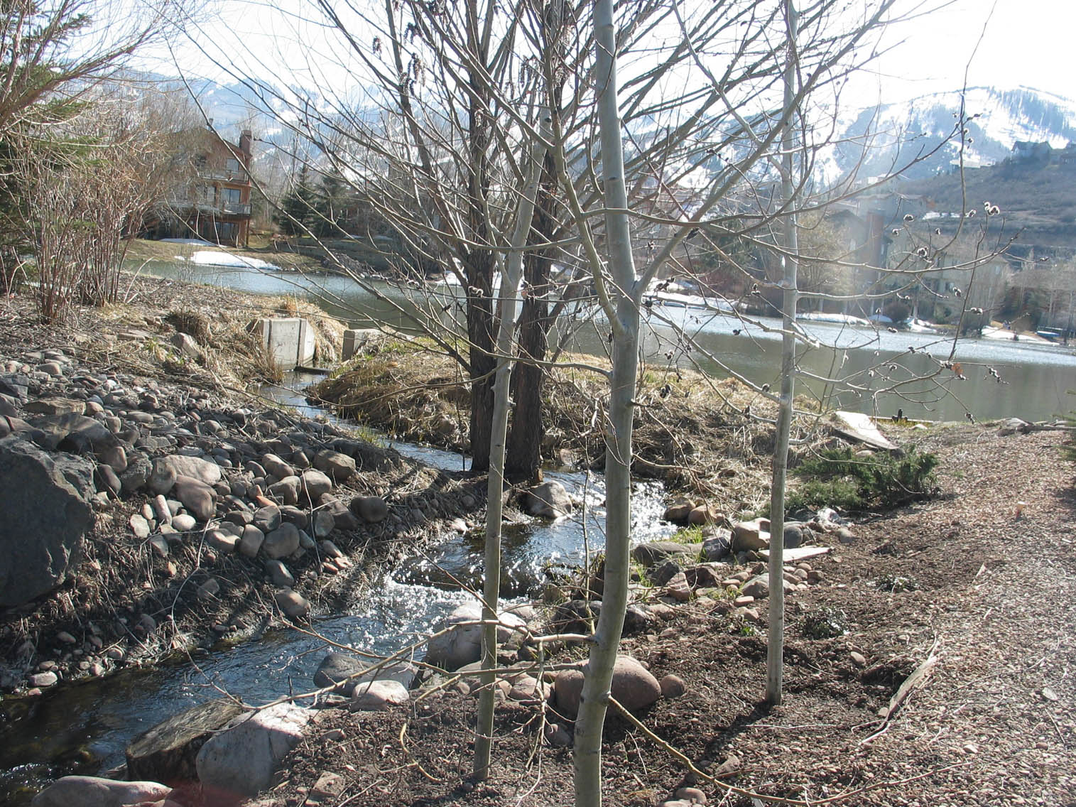
2009 – early November – Common Area Channel Parcel Q – photo taken from beach Parcel “I” – access from the Park is blocked. View to south. . This outlet channel stream receives storm drain water collections. Fills Silver Willow Lake.
It looks like the owners of SLS-037 have privatized Common Area property. They built up this berm on the east side of Park Parcel H. Bushes were planted and spruce trees which in effect has privatized, to their property and use, the stream channel on Common Area Parcel Q. These property owners did not seek, nor did they gain, approval from the State Engineer, County, or Master HOA to change the nature of this Common Area parcel. The river rock, berm soil, and plantings may have been paid for by the Master Association. The MHA manager-bookkeeper is the resident of SLS-037. Steps and a pathway should be built from the Park to the Stream on Parcel Q. If decided soon, the extra spruce trees can be replanted around the perimeter of the Park, or on the new Park (if it is decided to drain the Large Pond/Lake to convert those 20.84 acres into a Community Park).
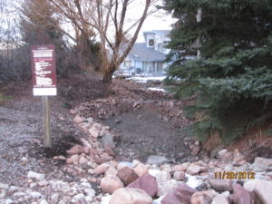
2012 -An attempt to create levies to hold water within dry north Parcel Q

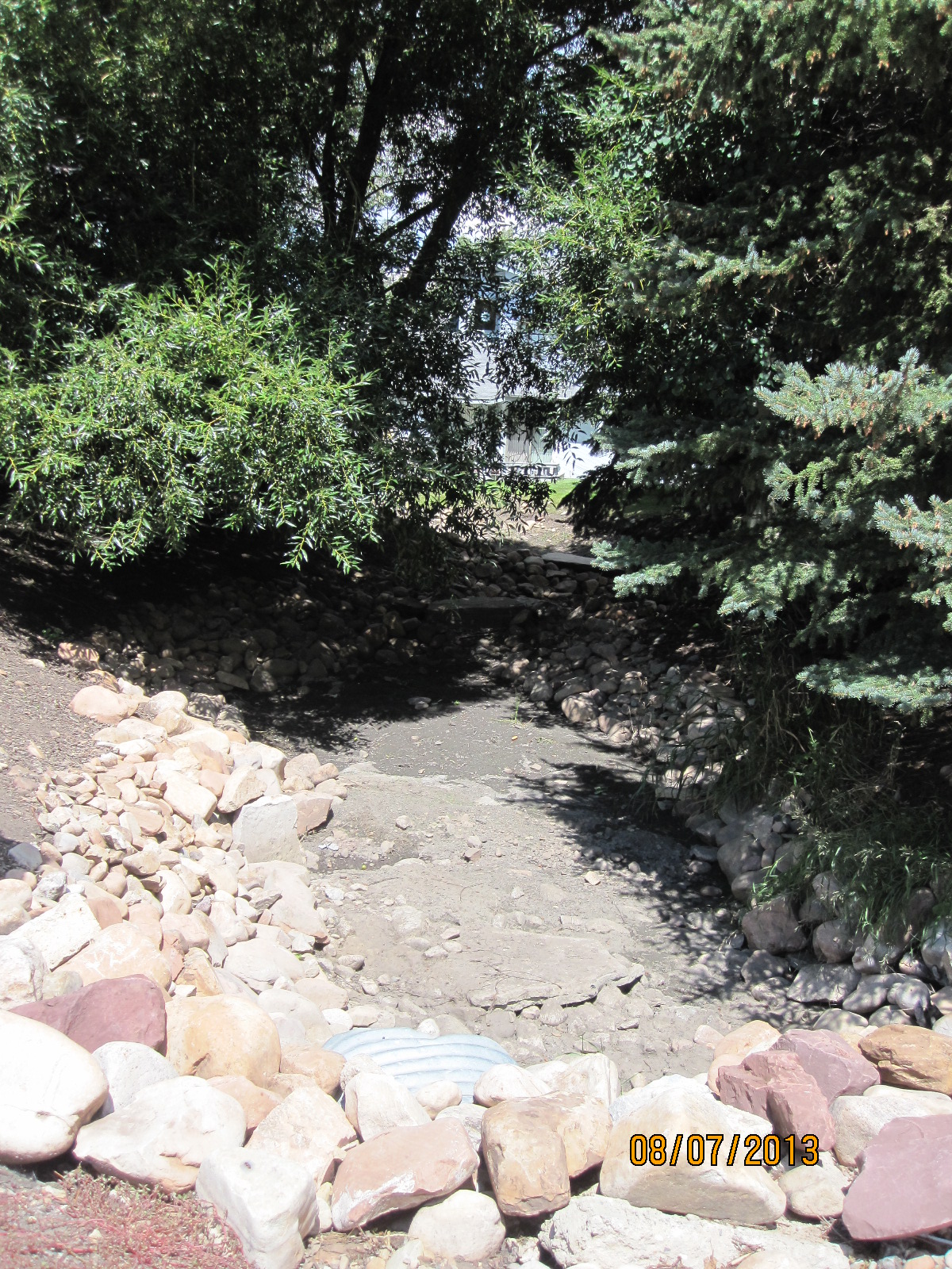
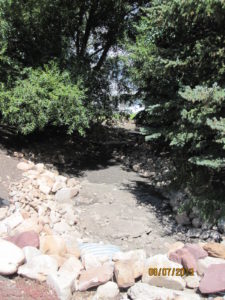 Bone Dry Channel Q in August 2013
Parcel Q water from Silver Willow Pond runs under two streets before spilling into Silver Willow Lake.
PARCEL Q southwest: This section of Parcel Q allows spillway water to flow east from Silver Willow Pond (aka Upper Pond aka Parcel G aka Little Lake), between SOS-A-1 and LLSS-D-1, flows east from Silver Willow Pond under Silver Springs Drive north through the Creek Easement channel, intersecting Lots 17-A and 36-A from Lots 172-C and 173-C . It then continues under Silver Springs Road intersecting the Parcel H Park from Lots 37-A and 46-A to spill its flow into Silver Willow Lake (aka Lower Pond aka Parcel F aka Big Lake). Another function of Parcel Q and the other channels in Silver Springs, is to collect rain water from the storm drains. Photo dated April 2008.
2012 Parcel Q channel from the little lake/pond was originally a fish ladder.
New concrete gate height (see background concrete squares between little lake and Parcel Q stream), built last summer hampers the flow of water from the lake to Parcel Q, leaving it dry most of the year.
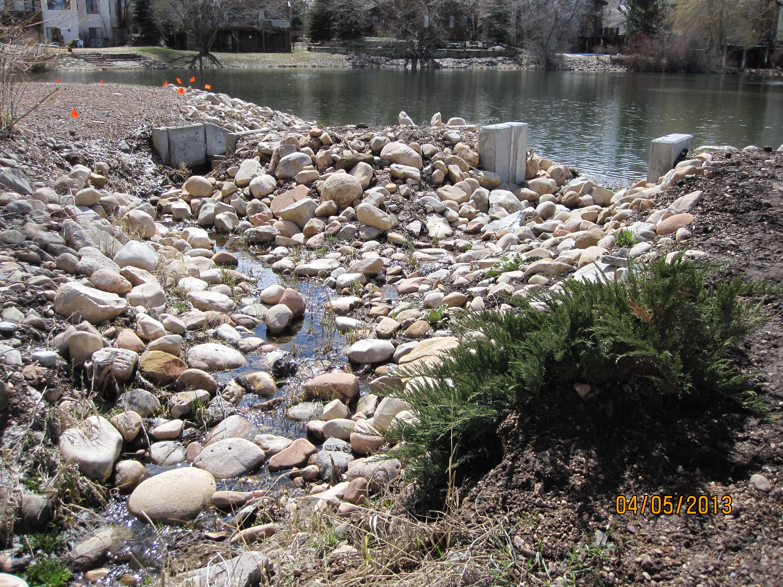
Parcel Q in April 2013. New weir gate construction.
2012 View east toward Meadows Connection. Flow of water is restricted by new gate, now frequently dry. Ground water availability was diminished by the work of the unsanctioned “underdrains committee.” Drought also has contributed to water paucity.
Aerial view shows length of channel Parcel Q from the Pond to the Lake.
Parcel V is the dark corner at 4866 Silver Springs Drive aka 1574 Meadows Connection.
Parcel Q has three sections: (1) the outlet channel west of the intersection of Meadows Connection and Silver Springs Drive; (2) the Creek Easement channel is the center and (3) the north outlet to Silver Willow Lake.
The three sections of Parcel Q are located within SSSF but not owned by SSSF. “Q” is listed on American Savings Bank Parcel Exhibit map, and on the inventory of parcels transferred to the Master Association.
“Fish Ladder” Parcel Q between Little Lake Lot 1 and Southshore Lot 1, when it contains water, heads north heading in the direction of the Parcel H Park, spilling into the Big lake.
Parcel Q, from Silver Springs Road to Silver Springs Drive, goes under the streets, west to the small lake, it was designed as a “fish ladder”.
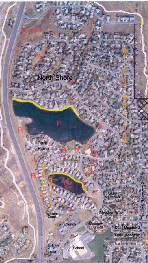
2014 Summer – MA Minutes-“The MA board approved $15,000, spent $12,000 this month, to re-line and add river rocks to the quasi-inactive Parcel Q channel, though the MA does not formally hold title to it, this Parcel Q is a part of the 1987 American Bank Silver Springs parcels inventory at the time of the many builder bankruptcies. Larger of these parcels became the titled property of the MA. With the above 2004 Water Supply Agreement Recitals in mind the Master Association approved the re-lining work for the Parcel Q creek bed to be performed by Arlen, a St. George friend of Les Carriel, a Lake Committee member of the MA board.
 MA bulldozer and scoop loader reline the Parcel Q creek bed.
**** 2014 – Sept-16 – MA Minutes– The MA board approved $15,000, spent $12,000 this month, to re-line with plastic sheathing and cover the lining with river rocks, the quasi-inactive Parcel Q channel, though the MA does not formally hold title to it. It seems the MA board had in mind the above 2004 Water Supply Agreement Recitals when they approved the re-lining work for the Parcel Q channel to be performed by Arlen, a St. George friend of Les Carriel, a Lake Committee member of the MA board.” ****
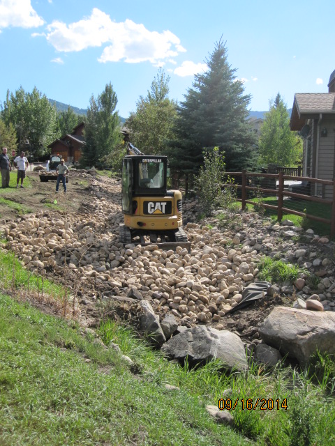
It is revealing to see the 1985 Parcels Exhibit showing the Silver Springs Road jagged layout disparity where it crosses over Parcel Q between Lot 37 and Lot 36. The survey error looks to have begun with the marking of Parcel “I”. A May 2015 DLS survey of some of these lots on the west portion of the curve of Silver Springs Road indicates this road was installed 14.14 feet in error from the recorded Silver Springs Plat 1A Entry 157619 recorded July 16, 1979. This survey error misaligned each succeeding lot, 17, 35, 36, 37, 38, 45, 46, 173, 172, to the south resulting in the diminished size of the corner lot that result in the creation of Parcel V. D.L.S. Survey Narration: “During the course of the May 2015 survey we also discovered a drafting error on the subdivision plat along the lot line common to Lots 37, 38, 45, 46. The error shifts the Lot 37 SE property and Lot 38 SW property corners 14.14 feet south of the center line of Silver Springs Road.” The surveyor inserted a PK cadmium/brass steel marker south of the the center line of Silver Springs Road between Lots 37 and 38, and center to Lot 35.
|
|
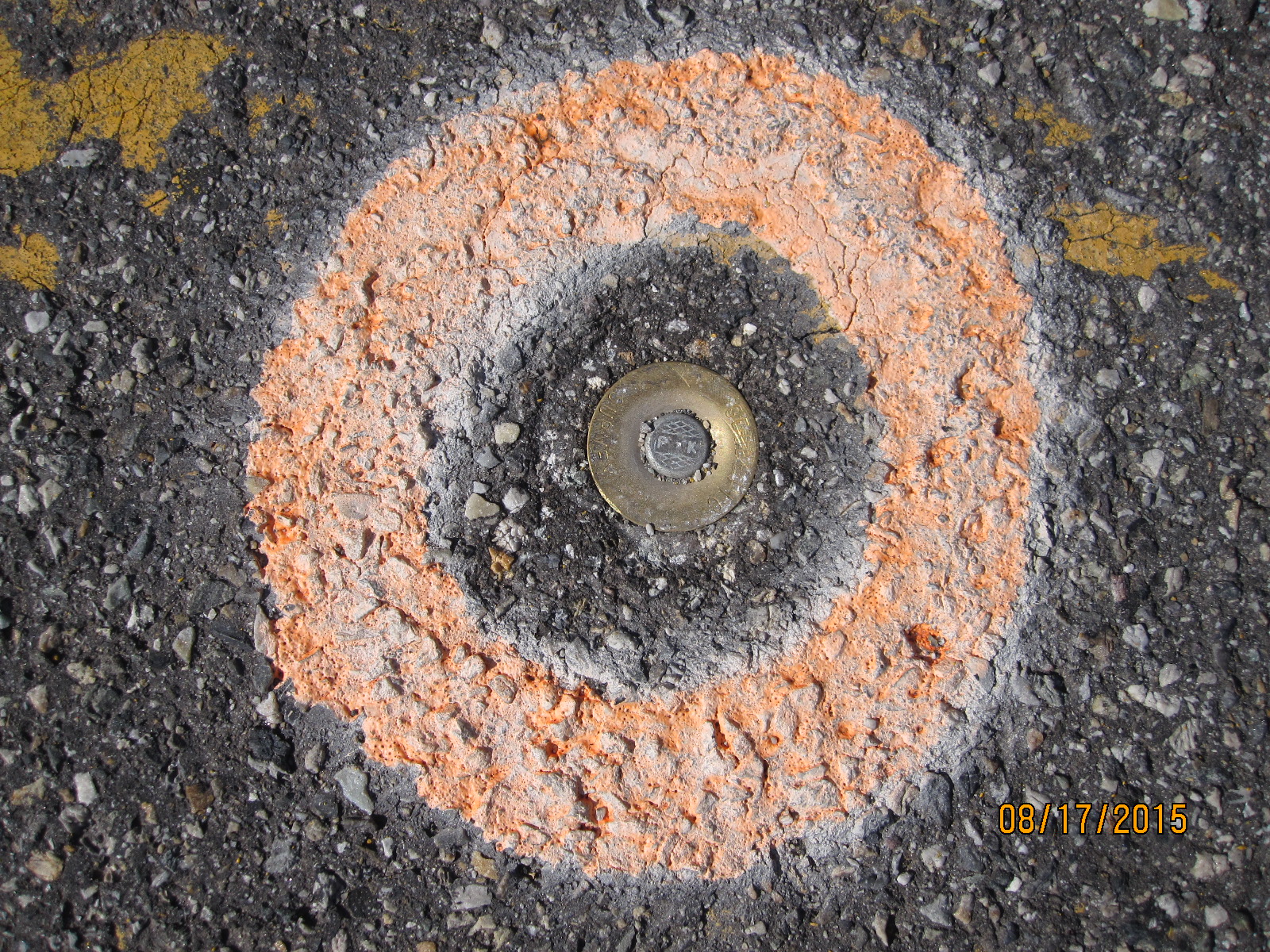
 P-K marker south side of Silver Springs Rd center line
JRIII has changed his October 2, 2018 position to claim that Parcel V at the west corner of Lot 17, via “escheat” (the reversion of an untitled property to the state when no record of an owner can be verified, and when there is no heir. Claimants to the land can only hold a Quit Claim Deed and can only transfer the land via a Quit Claim Deed). After 34 years of disavowing ownership, the SSSF board now chooses to claim this little parcel of ground as theirs, without title, so they can claim “owning a common area” which then they think will support the board’s claim within the draft CCR V.19 to issuing assessments and capital improvements to the Owners.
The board refers to Parcel V as Open Space Parcel 1C.
Category 1C comes from the Silver Springs Development Subdivision designation of Parcels A-E by the 1979 Silver Springs Community Developer that includes No. 1-E-, No. 1-D, and No. 1-C, etc .
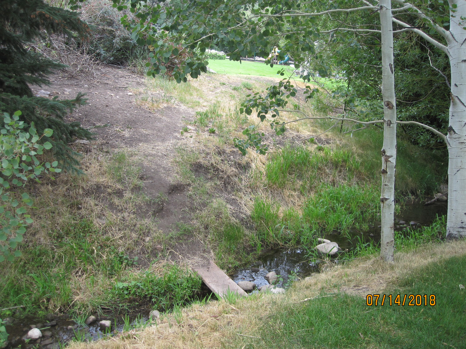
2018- evidence of foot-trail wear and board bridge as attempts by SS residents to use Parcel Q to access from beach Parcel I, the Parcel H Park visible at the top of the photo.
PARCEL W: The perimeter walking trails around the lakes, see at: https://silverspringscommunity.com/master-association/ma-common-area-parcels/parcel-w/
2019 February 7– There is no Alliance Engineering survey or Richard’s Law report on these parcels, the two parties merely had a conversation to discuss Parcels Q & V. With the SSSFHOA board approval Richard’s Law can release the verbal findings between these two parties. I asked whether this law firm had visited the Community webpages for Parcels Q & V. Patsy told me they were very aware of this website. I asked if the information posted for these two parcels correlated with their conversation outcome. She answered that at this time the board has not authorized any further work from their firm. We discussed how we can resolve this very longstanding issue regarding these two Parcels. Patsy offered that the owners of Lot 17 do not need to receive permission from either HOA to initiate quiet title approval through the courts to transfer Parcel V as an annexation to Lot 17.
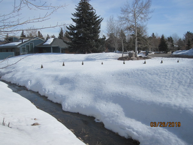
Parcel Q creek and Parcel V in winter