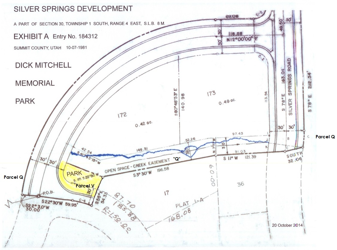
Parcel V – Lot 17 Annexation
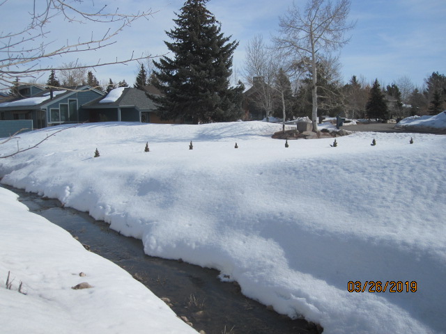
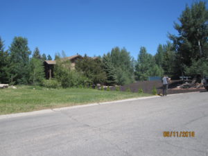
Parcel Q creek and East side of Parcel “V” in winter 2019.
Peaks of small trees peaking above the snow indicate the 60′ east boundary. Paul Reddy and his kleptocratic board are seeking to take this parcel by fiat. SSSF Homeowners majority are in favor of allowing this small property to be claimed by Lot 17’s owners.
 ~ DICK MITCHELL MEMORIAL PARK ~
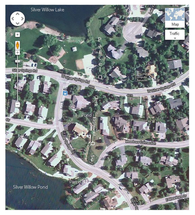
2014-This Aerial view shows on the right a part of the river rock base of Parcel Q, that stretches between the Little Lake and the Big Lake.
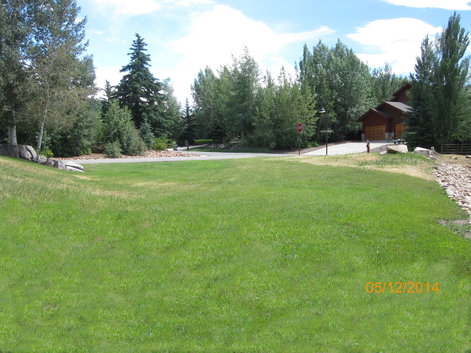
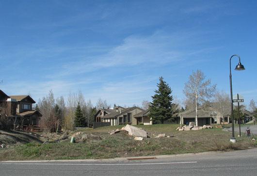
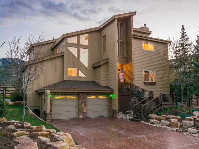
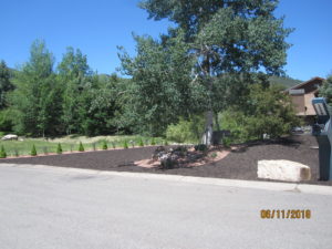
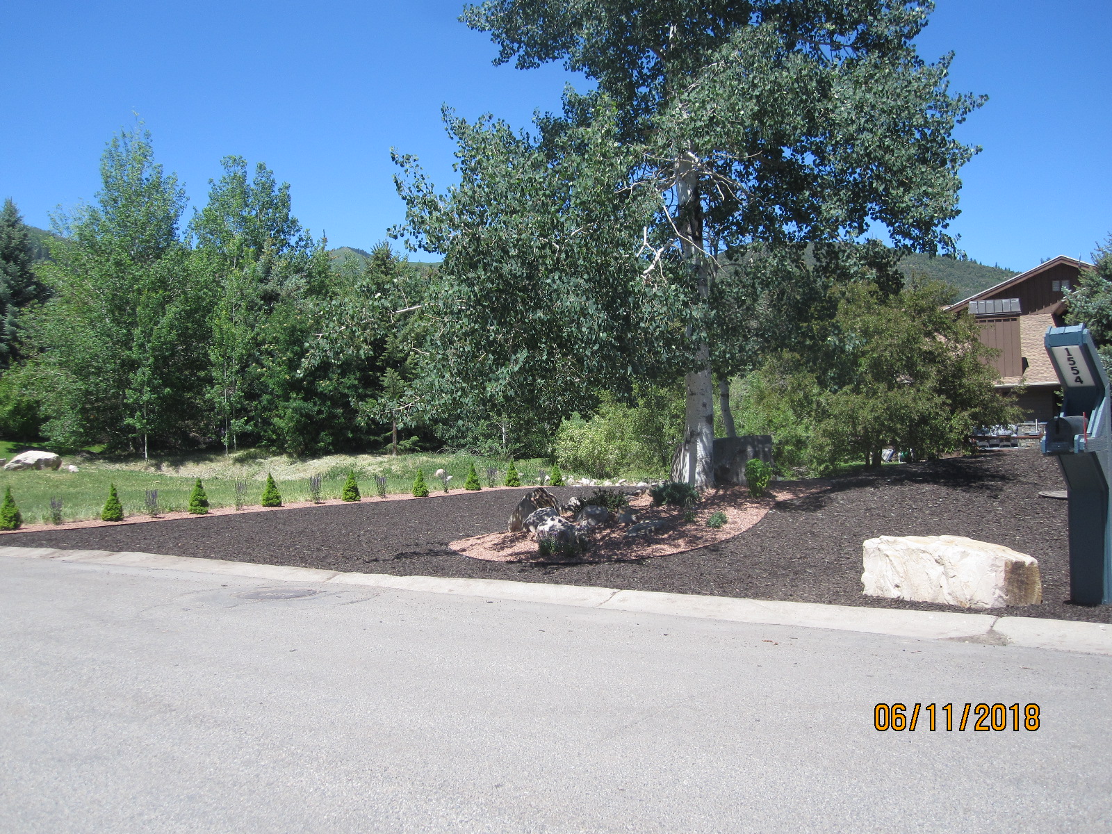
Lot 17’s grassy lawn leads to Parcel V, the drier corner at 4866 Silver Springs Drive aka 1574 Meadows Connection.
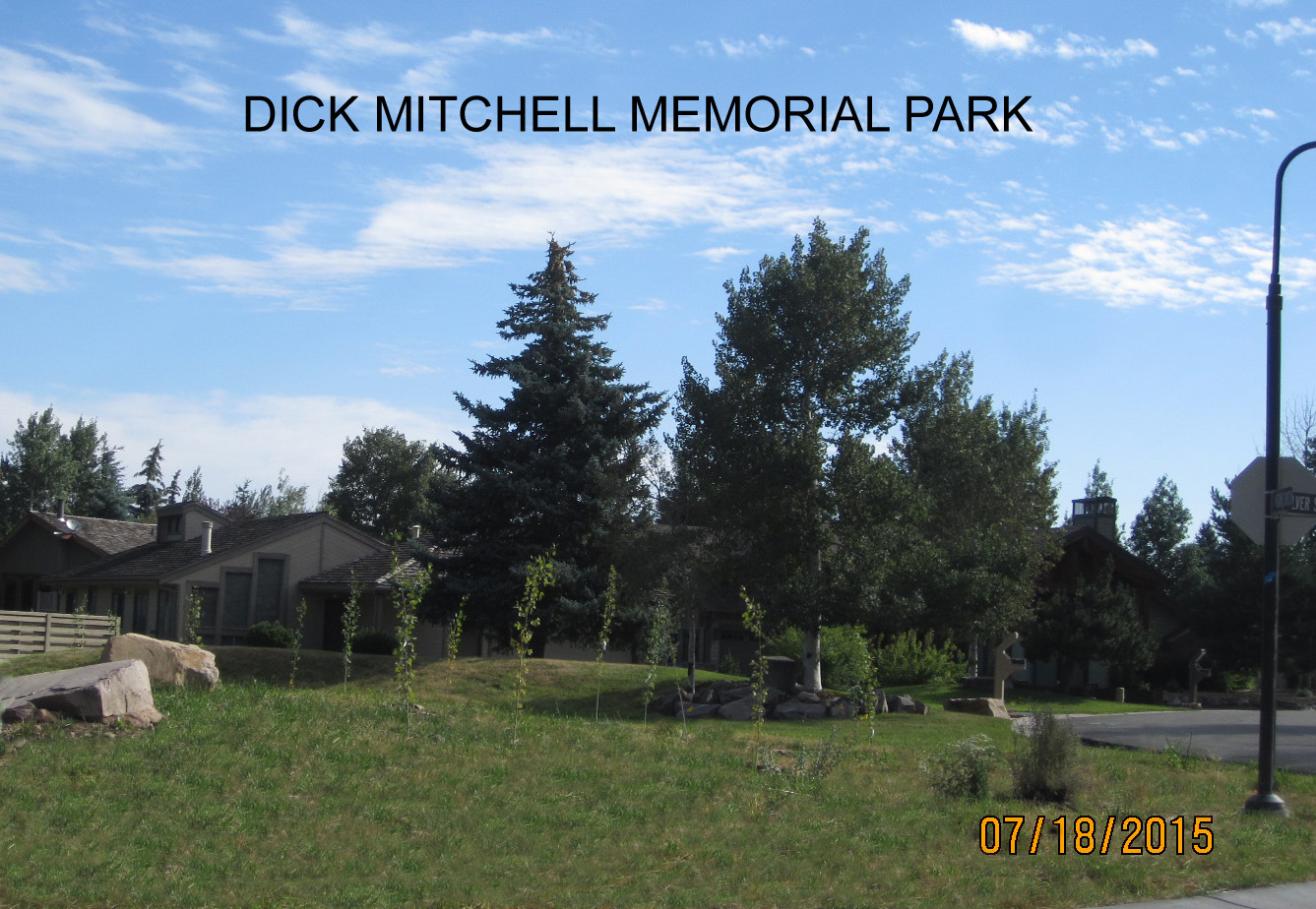 John Richard Mitchell, Isabelle, and Bruno planted fifteen aspen trees for future shade enjoyment by the residents.
In 2015 Dick Mitchell’s Family received a commitment from the Silver Springs Master Association to maintain and landscape the Dick Mitchell Memorial Park in perpetuity for the use and enjoyment of the Silver Springs Community. A promise not kept.
1981 Plat Map Shows SW area next to Lot 17 that was to be dedicated as the Dick Mitchell Memorial Park (86′ by 60′ by 90′)
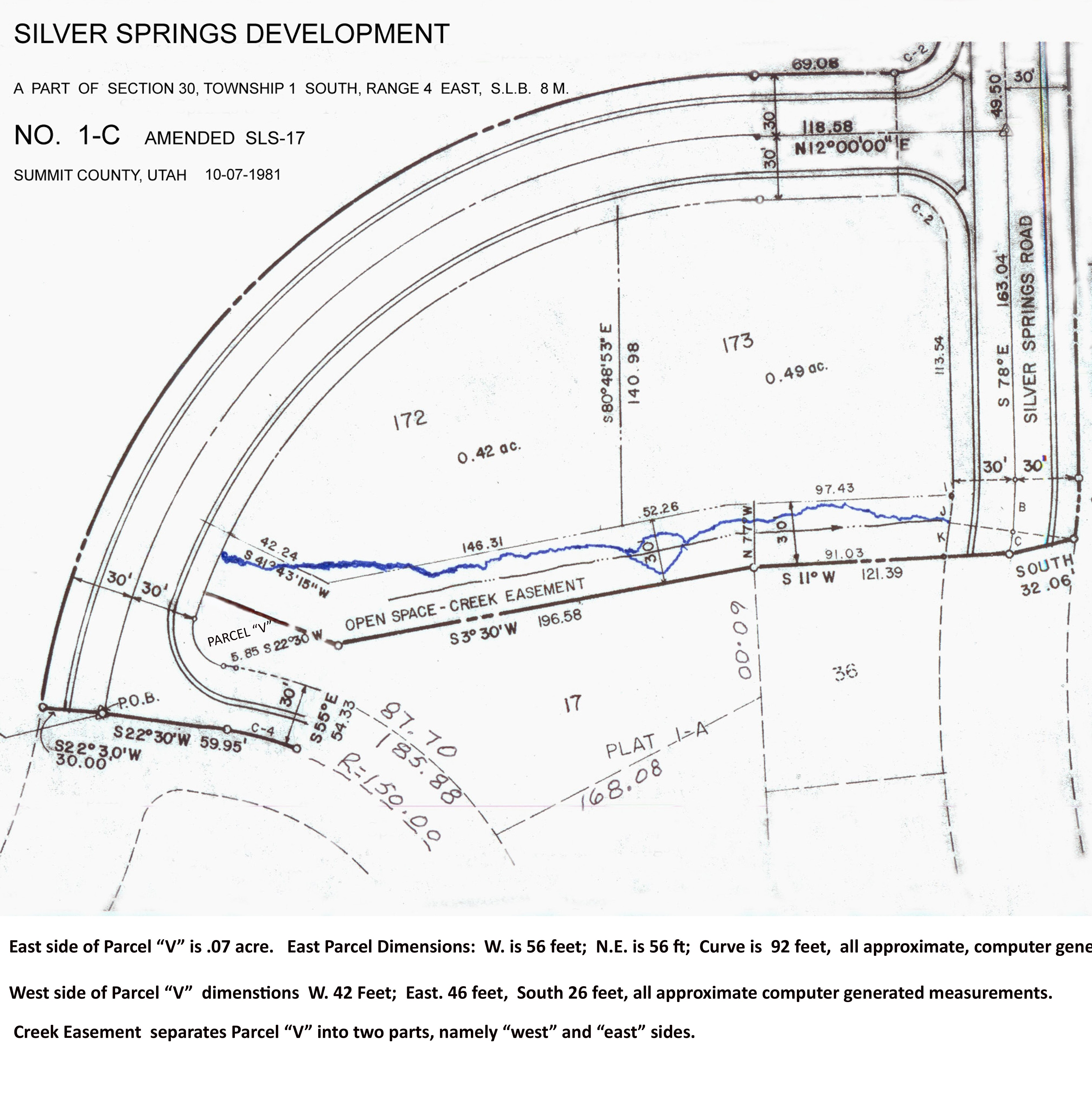 Since 1984 the chain of custody of Parcel “V” has been reviewed repeatedly as one of several remainder portions of the entire Weber Basin Conservancy District and PIC -Partnership Investments of Colorado, Inc. The entire Snyderville Basin parcel included the 857.50 acres to be identified as the Silver Springs East parcel. Approved by Rep of Sec. of Interior — David L. Crandall. The sale, began in July 1973 by George D. Vogt, Pres P.I.C.= Property Investments of Colorado. with
Weber Basin: J. Clifton Linford. Approved:
Rep of Sec. of Interior — David L. Crandall. The original developers, the 1988 bankrupt American Savings Bank of Arizona/Utah, the Silver Springs Water Company, Summit County and Mountain Regional Water Company, and the Silver Springs Master Homeowners Association.
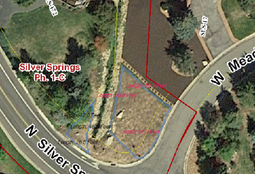
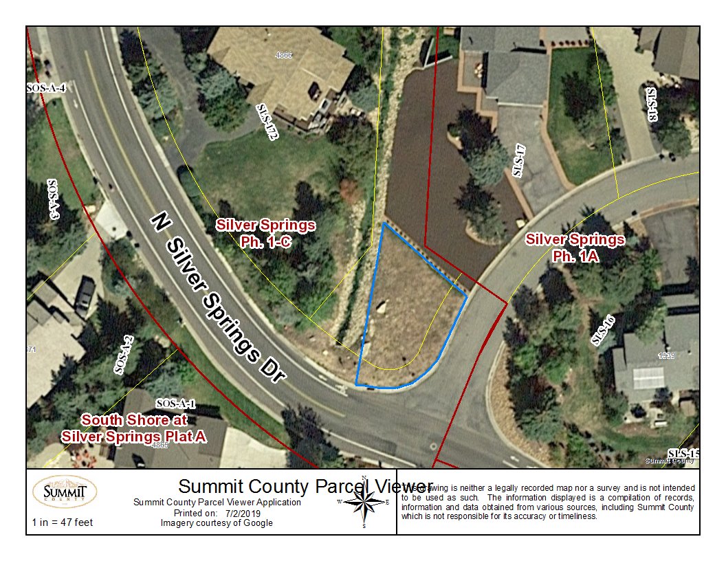 *East Parcel V, as indicated above within blue lines, is .07 acre,
*Dimensions are East 60.3 ft; West 86.7 ft; 90.5 ft along the curved south boundary;
*And is joined to SSSF Plat A, Lot 17.
*West Parcel V on the west side of the “Creek Easement Parcel Q” is joined to SSSF Plat C, Lot 172.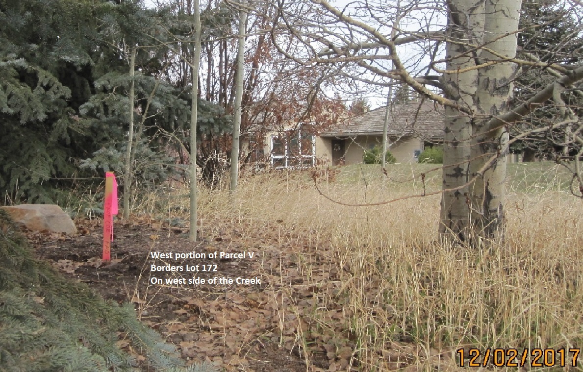
According to a 2017 survey, Parcel Q separates Parcel V into two parts, as it flows under Silver Springs Drive.
Parcel Q Creek Easement also serves to separate Lot 17 from Lot 172.
Parcel Q runs contiguously past Lots LLSS-D-1, NS-1, SLS-C-172, SLS-C-173, SLS-A-17, SLS-A-36, SLS-A-37, SLS-A-46, and Parcel H Park.
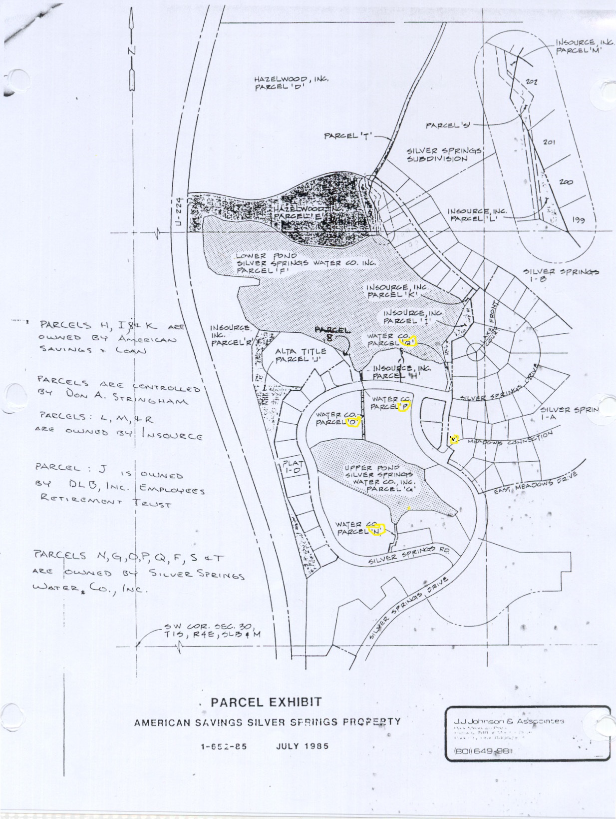
-1985 Silver Springs Parcels Exhibit- J.Johnson — used in 1987 & 1988 as American Savings Bank Exhibit
 Click on map to enlarge
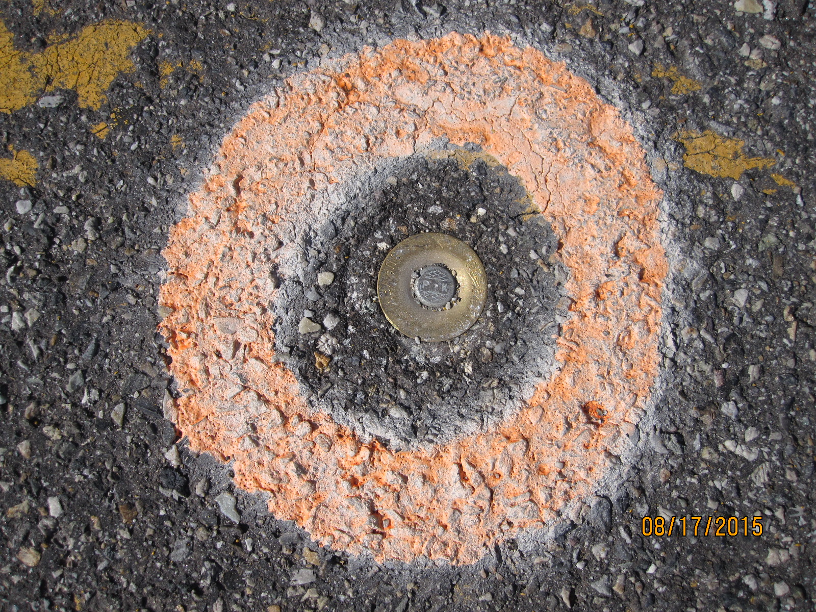
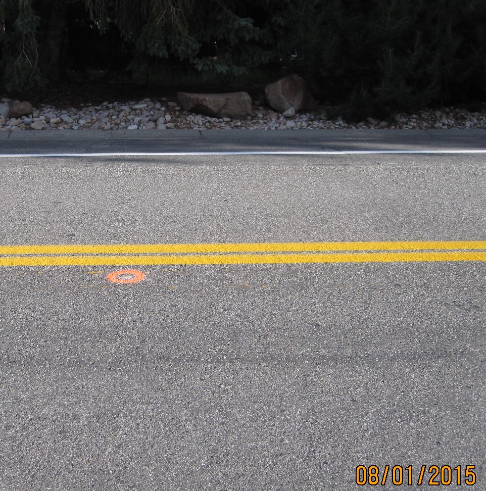
It is revealing to see this 1985 Parcel Exhibit showing the Silver Springs Road layout disparity where it crosses over Parcel Q between Lot 37 and Lot 36. The survey error looks to have begun with the marking of the beach Parcel “I “. A May 2015 D.L.S. survey of some of these lots on the west portion of the curve of Silver Springs Road indicates this road was installed 14.14 feet in error north of how it is recorded on the Silver Springs Plat 1A Entry 157619 recorded July 16, 1979. The 1979 survey error misaligned each succeeding lot, 17, 35, 36, 37, 38, 45, 46, 173, 172, to the south resulting in the diminished size of the corner lot that resulted in Parcel V. You should also note that the measurements are as much as 14′ off from “ground truth” in some areas of Silver Springs. Especially along that end of Silver Springs Road / Drive. Plat map doesn’t match “ground truth”. Survey Narration: “During the course of the May 2015 survey we also discovered a drafting error on the subdivision plat along the lot line common to Lots 37, 38, 45, 46. The error shifts the Lot 37 SE property and Lot 38 SW property corners 14.14 feet south of the center line of Silver Springs Road.” The surveyor inserted a PK cadmium/brass steel marker south of the the center line of Silver Springs Road between Lots 37 and 38, and center to Lot 35.
|
|
JRIII has changed his October 2, 2018 position to claim that Parcel V at the west corner of Lot 17, via “escheat” (the reversion of an untitled property to the state when no record of an owner can be verified, and when there is no heir. Claimants to the land can only hold a Quit Claim Deed and can only transfer the land via a Quit Claim Deed). After 34 years of disavowing ownership, the SSSF board now chooses to claim this little parcel of ground as theirs, without title, so they can claim “owning a common area” which then they think will support the board’s claim within the draft CCR V.19 to issuing assessments and capital improvements to the Owners.
Noland refers to Parcel V as Open Space Parcel 1C.
This category comes from the Silver Springs Development Subdivision designation of Parcels A-E by the 1979 Silver Springs Community Developer that included No. 1-E-, No. 1-D, and No. 1-C .
TITLE SEARCH
In August 1988 at a Summit County Planning Committee meeting, Jerry Tulley, one of the original planners of Silver Springs with Jim Webster and Associates, 1979-1983, said back when Silver Springs East was developed by Vern Hardman and his S.S.D. Inc. company, Summit County could not require the recordings of open space parcels on plats. It was never designated what was open space. Mr. Tulley said this open space, and a number of others were never recorded.
In 1990 when the Master Association was established Parcel V was not included in their list of common area properties, and it remains an unclaimed parcel. Master Association board members have disavowed ownership or responsibility, as has the Silver Springs Single Family Homeowners’ Association. At one point a new Master Association board thought this property was one of their parcels. Ralph Stanislaw drew up a landscape plan but the uncertainty of ownership precluded the MA from going forward with the work. Neither HOA owns or holds jurisdiction over this parcel, therefore it is not a part of either Association. In 2008, board secretary Lucy Archer was given permission to engage High Country Title Company to research this parcel’s ownership records. The officer called it the same name as was used by Alan Spriggs, Summit County Recorder, it is a “title blackhole.” During the early P.I.C. ownership of the entire Silver Springs East 857.5 acre tract, this piece has never been designated or attached to an owner or entity. Care and maintenance of this parcel has been provided by Dick Mitchell since 1984. Archer was encouraged to proceed with plans to landscape this parcel at the intersection of Meadows Connection and Silver Springs Drive between Lots 17 and 172; and to dedicate this ownerless parcel to a very worthy tri-decade resident of Silver Springs, missionary, 1956 VII Winter Olympics ski racer, Viet Nam pilot veteran, yacht and sloop racer, actor, ski coach, founding member of our Silver Springs Single Family HOA and enduring chairman of the Architectural Compliance Committee, to our friend and neighbor, James Richard “Dick” Mitchell. However, a former neighbor of Mitchell’s, the 2013 to 2015 HOA president, stood in the way of completing these plans.
2000 Webpage
Creekside Easement Channel Parcel Q and Parcel V are at the corner of
4866 Silver Springs Drive aka 1574 Meadows Connection
– 4/2008 House in right side background belongs to Dick Mitchell.
House on NW left side belongs to James and Elena Gladson.
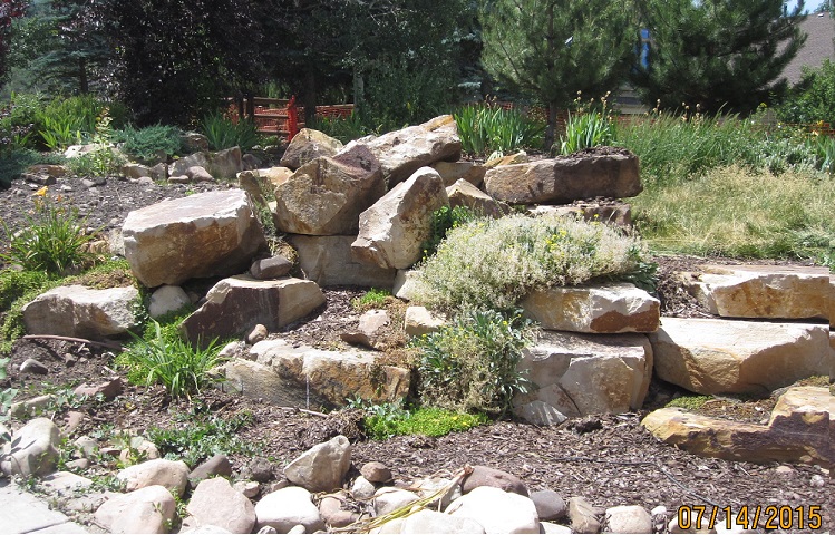
Parcel V includes land with large boulders to be Mitchell’s Memorial Park.
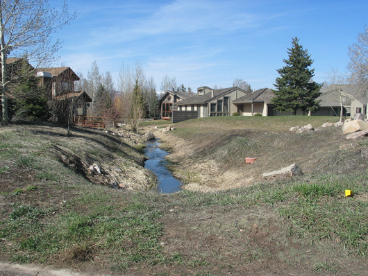
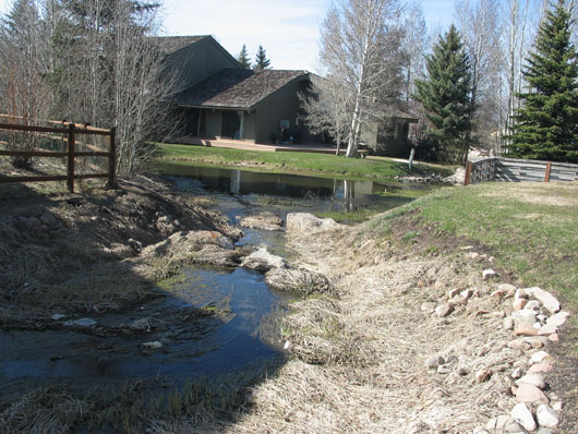
Parcel Q Creek runs from Little Lake, along side Little Lake Lot D- 1, then under Silver Springs Drive diagonally under the corner of Parcel V. The flow then spills from the steel culvert into the Parcel Q open channel to the edge of Silver Springs Road. Under the Road to an extension of the open channel, there it flows into Big Lake.
2000 – Landscaping Plan proposed by MA Trustee Ralph Stanislaw
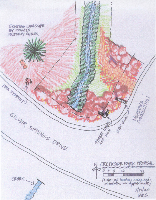
July-2000- Ralph Stanislaw’s early sketch for Park corner landscaping.
Note where the Parcel Q Channel opens to receive the underground water flow.
2007 – Standing at the corner of Silver Springs Drive looking east.
Large boulders on front center of Parcel V were removed by the MA in 2011.
April 2008 – Center of Parcel Q creek easement next to Lot 17 and Parcel V
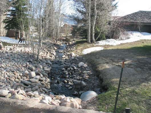
Parcel Q Creek between Silver Springs Road Lot 173 and Lot 36 looking south.
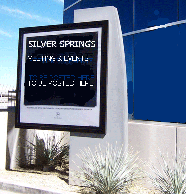
A SIGN SIMILAR TO THIS DRAFT WOULD BE INSTALLED ON
THIS PARCEL TO PROVIDE INFORMATION TO
THE NEIGHBORS, USING LOW ILLUMINATION SOLAR LIGHTING
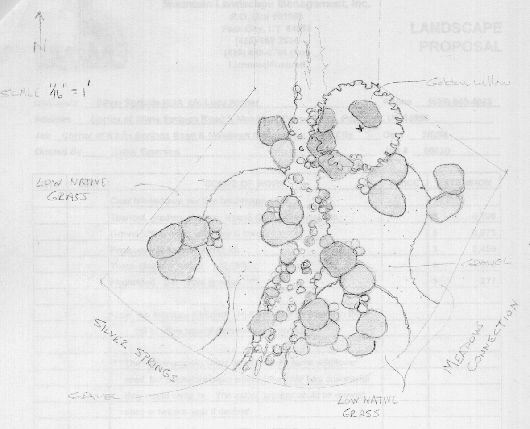 2008 Proposed Landscape Plan from MLM Landscaping
This rendering shows the Park at corner of Meadows Connection
and Silver Springs Drive
2000 – Minutes – Ralph Stanislaw drew up a landscape plan but the uncertainty of ownership precluded the MA from going forward with the work.
2008 – Dick Mitchell and Lucy Archer, SSSFHOA secretary, inquired of the MA and SSSFHOA whether either of these HOAs owned this Parcel V. Both stated that they did not own nor hold any jurisdiction on this parcel. High Country Title Company’s Jeff McCluskey performed a title search and found no identification on plat, no County property number, no tax I.D. for this “title black hole” parcel. The MA website does not list it as one of their common areas.
2008 – “To the best of my understanding, Parcel Q is now within the Park Parcel H of the ‘South Shore at Silver Springs Subdivision’ Plat A recorded in 1991 (as the result of the 1989 Master Association organization agreement), and Parcel V optionally may or may not be included in the Open Space – Creek Easement within Silver Springs Development Phase 1-C plat recorded in 1981. Parcel V is a title black hole without ownership, tax I.D. or recordation in any County records. ” From Summit County Recorder Alan Spriggs.
SSSFHOA April 22, 2009 New Business
Chris Butler mentioned that the Gladson’s (lot 172) may be interested in buying a portion of Parcel V open space land adjacent to their lot. Lucy Archer informed the Board a couple times during 2008 that she has discussed this parcel with Alan Spriggs, Summit County Recorder, and was told that this parcel has no tax id# and no legal owner (that can be found within County documents). The board suggested that if Gladson’s would do the legwork to identify the owner, the Board would consider Quit Claiming their interest. All the discovery and title documents for the Creek Easement parcel Q and Parcel V have been searched for Dick Mitchell by High Country Title Company. Contact Lucy Archer for details.
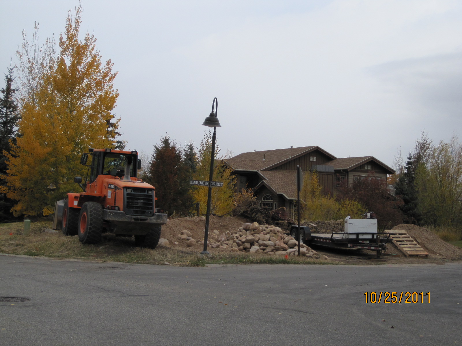
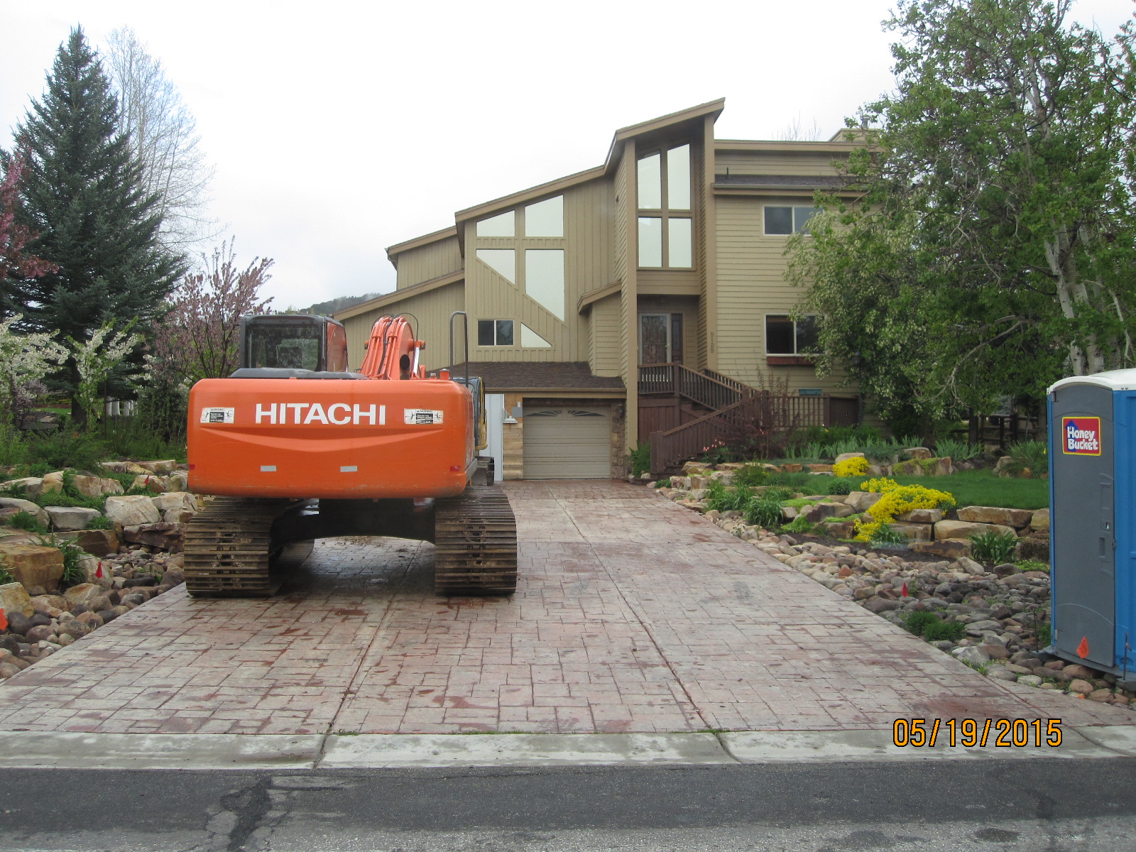
2011 October – During the summer and fall, the MA dumped several types of materials on Parcel V. The materials and equipment on the Memorial Park property were for work on the Little Lake located west of this parcel, and later for the repairs on SouthShore Lot 1, that was used for egress and ingress of the heavy construction equipment moving the materials that facilitated the Little Lake repairs.
2014 – MA Minutes– the MA discussed that the Little Lake east weir at Parcel Q was blocked in 2011 due to the drought conditions and the taking of water resources by the Canyons Resort developments. Blocking assisted in keeping the little lake full to capacity causing this Parcel Q creek and Parcel V Memorial Park to be dry a majority of the weeks each year. The Parcel Q creek, formerly called a “fish ladder” in the 80’s and 90’s, now flows primarily when the storm drains empty into it during wet weather.
2014 Summer – MA Minutes-“The MA board approved $15,000, spent $12,000 this month, to re-line and add river rocks to the quasi-inactive Parcel Q creek bed, though the MA does not formally hold title to it, this Parcel Q is a part of the 1987 American Bank Silver Springs parcels inventory at the time of the many builder bankruptcies. Larger of these parcels became the titled property of the MA.
The 2004 Lakes Conveyance and Water Supply Agreement between the Summit County Mountain Regional Water District and the SS Master Association include these terms: “C. WHEREAS the Association desires both legal title and beneficial use of the property that encompasses the two Lakes and property with subsequent minor holding ponds, together with the dams more particularly described in Exhibit A, formerly owned by the Silver Springs Water Company, (such property and/or the Lakes with such property is collectively referred herein as “Lakes” as the context may require); and …”H. WHEREAS the [Master] Association and the District both desire to provide for the proper and effective operation of the Lakes [that includes the inlet and outlet creeks and channels including Parcel Q]“…; and “K. WHEREAS the District and the Association desire to formalize an agreement whereby the Association will take legal title and beneficial usage of the Lakes [sustained by the inlet and outlet creeks and channels including Parcel Q]”.
With the above Water Supply Agreement Recitals in mind the Master Association approved the re-lining work for the Parcel Q creek bed to be performed by Arlen, a St. George friend of Les Carriel, a Lake Committee member of the MA board.
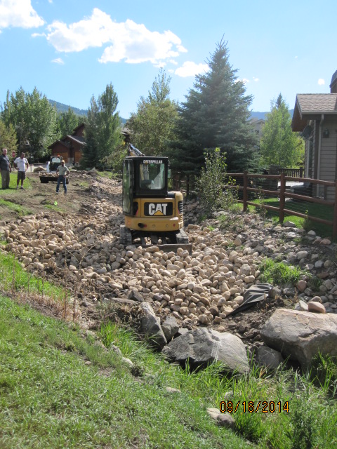
The MA and its representatives tore up the quasi-dry stream bed to add river rocks, they also removed a valuable tree that was enjoyed by neighbors on both sides of this section of Parcel Q. The large boulders at the front center of the property were also removed. (See 2007 photo above.) The MA does not hold title and have told us they have no legal jurisdiction of this property. The dump trucks, scoop loader, and bulldozer again tore up lawn area and damaged irrigation lines. Dick Mitchell decided at this time to begin a Quiet Title disseisor action to protect this parcel from another MA instance of damage. When the MA crew was finished Mitchell’s Parcel V Park lawn needed to be reseeded and Mitchell’s irrigation system also required repairs. The repairs were completed by the MA. The 15′ tree torn out during this work was not replaced. Dick Mitchell despaired that the large boulders visible on several photos above, were not replaced after the crew left his property.
2015 March 10 – MA Minutes: (c) SSSFHOA asked about Meadow Connection/Silver Springs Dr. corner Parcel V (the HOAs had been made aware c.2008 and 2013 that Lot 17 owner, contiguous with this corner, was soon to take disseisor action): This area is not plotted on any County map. This appears to be a common parcel with the Creek Parcel Q. We have just spent money on the stream there and it had to be reseeded (to compensate for the damage left by Arlen’s heavy equipment last September). However, there is no water source for landscaping (all watering originates from Dick Mitchell’s Lot 17 irrigation system). The concern (from 1981 to 2015) is to keep the parcel from becoming an eyesore.” (for instance when the MA dumps materials, damages the lawn and irrigation system and parks equipment and construction waste on it.)
House on SLS-198 with large landscape boulders that would have been donated to Parcel V.
Another view of landscape with large boulders prior to house being razed.
2015 July – The Dittmer’s purchased a property (Lot 198) in August of 2014 that was landscaped with large, handsome, blonde, flat sandstone boulders. It was learned they were going to remove them from the parcel they now owned and intended to commence building their new house on the soon to be leveled lot. Lucy Archer asked the Dittmer’s whether they would consider donating these flat boulders to the Memorial Park. The photo below shows a corner of the Dittmer parcel boulders during demolition of the original house.
2015 July 11 – Email – between owner of 5129 Silver Springs Rd and Parcel V Memorial Park supporters-
Hi Lucy, Of course!! I am happy to donate the boulders from our property. That would be great – would love to know they are in the neighborhood and for Dick Mitchell’s Memorial Park. How many do you want? We have a ton! We will deliver them to the Memorial Park at our cost.
–Reply: “We can use quite a few of your flat boulders. Some along the stream, some along Meadows Connection and also along Silver Springs Drive. Flat ones that people can sit on will be great! You are over the top nice to include delivery at your cost!”
2015 July 14 – Email from Rick Hovey to Lucy Archer: “Allison Dittmer called me last night asking if it would be acceptable to deliver her landscaping rocks onto the Black Hole Parcel. She explained that you had contacted her knowing the rocks could be available. Allison understood you have the intention to use the rocks to landscape this “Dick Mitchell Memorial Park.”… Although Masters and the Single Family HOAs have no ownership or jurisdiction over the parcel, we feel it is important to maintain the parcel for safety reasons. If rocks are delivered to that parcel without approval, we will consider that action as dumping in an illegal and unapproved area which the Dittmer family will be responsible for. ” [See above MA use of this parcel for dumping and altering this Park’s attributes. Hovey was over-stepping his authority. ]
2015 July 14 – Email
“Rick Hovey has threatened to thwart our plans to develop what is called “the Black Hole Parcel” and to create more problems for all of us. The Memorial Park Parcel V is not HOA property so he laid the onus on the Dittmers who have to get all the rocks off their lot before the end of this week. They already have locked horns with Hovey enough times that has set back their home construction more than ten months. No one can blame them for not wanting to add their donation of the boulders to their home building delays. It looks like the boulder deal is off. Hovey could have taken a completely different position in order to facilitate our arrangement and the Park improvement, Hovey knows time is of the essence for the Dittmers. Is this abuse of authority by Hovey, again?! ” Hovey’s position and threats restrained delivery of the Dittmer’s wonderful large, flat boulders from their property to the Dick Mitchell Memorial Park. The boulders ended up in Silver Creek Estates at the Schaede’s new property.
Parcel V at the corner at 4866 Silver Springs Drive aka 1574 Meadows Connection.
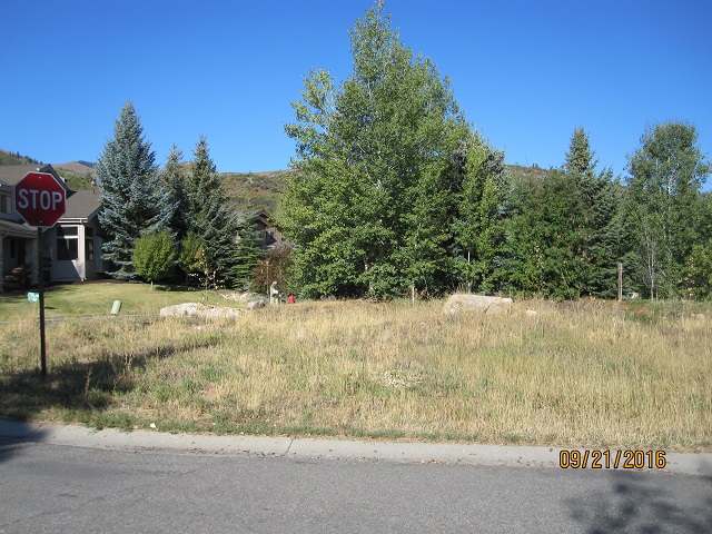
2016- Unmaintained Orphan Parcel V, the MA and SSSFHOA have yet to release a QCD to Lot 17 and 172 Owners.
2017-05-09-MA Minutes V-d.: Meadows Connection and Silver Springs Drive Orphan Parcel V. Bill Salmon (Park Place Lot 42 homeowner) volunteered to look into ownership of this parcel. He spent time at the county recorder office looking through the records from the original developer forward, his search confirmed there is no record of the Memorial Park parcel being transferred to any entity. In the documentation, it is not clearly a common area to be incorporated as part of the Masters Association. Salmon recommends we get all parties involved together to resolve ownership.
We should reach out to the previous owner (Dick Mitchell who maintained the property from 1984 to 2015) and/or the new owner (Mehregan who has maintained it since 2015). It is premature to ask either owner to withdraw the affidavit that creates disseisor action in support of the Mitchell ownership claim. The Mitchell’s would have had the parcel dedicated as The Dick Mitchell Memorial Park if it hadn’t been for the interference of the SSSF board president c2014. The Masters recently lined the mostly dry waterway Parcel Q creek that runs along the west property line of this parcel. Past Masters work on the lakes has more than once created an eyesore on this parcel. Photos available above. Also see emails “Black Hole Parcel.”
2017-07 SSMA Minutes Item IV-g. Unclaimed Parcel: The resident who bought Dick Mitchell’s home reached out to Phil Tisovec to talk about this corner that is adjacent to his property. He would like to append ownership of this area, not including the waterway. This way he could take care of the area under legal ownership. The area would then be under SSSFHOA and subject to their landscape restrictions. The Masters is primarily concerned about the line of site for traffic safety reasons and would like to ensure there wouldn’t be a fence or swing set on that corner. The new resident is amenable to working out a suitable agreement.
https://www.silverspringscommunity.com/silver-springs-parks/dick-mitchell-memorial-park/sssf-creek-easement-parcel/
2018 -UPDATE ON HOA INTERFERENCE
— M.A. MODUS OPERANDI IS FOOT DRAGGING
(Remember the MA board is yet to get on point in producing the 1989 Summit County requirement to complete and record a set of Bylaws for this Association. The MA Board has not produced their CC&Rs.)
The corner of Silver Springs Drive and Meadows Connection ownerless Parcel V since 1977 has been a divisive problem due to the intrusion of the MA and the SSSF BOT. Two neighbors who sought to divide ownership and care of this parcel are giving up on the frustrating situation. After spending over $5,000 on an attorney and survey, the owner of Lot 17 has partitioned off his deeded portion with a 60′ border of trees and flowers. Lot 172 has offered to pay for the portion on their side of Parcel Q, but pay who? No one has legal ownership. Blather and HOA nonsense.

This corner Parcel V continues to not have a legal owner. Though the Master Association and the Silver Springs Single Family Board have no legal right, no ownership of this parcel, and nothing within their Governing Documents to support their ownership, they continue adding to the frustration of forty-one years of trying to resolve the ownership transfer to the two contiguous property owners on Lot 17 and Lot 172.
Do the Association Trustees really place the best interests of the Neighborhood first?
Let me amend this, the transfer of ownership is being blocked not by the Master Association comprised of our 511 Community Homeowners, it is being blocked by 2 or 3 men outside of their realm of authority. The owner of Lot 17 seems to think he has an advocate on the board in this matter. If that were the case the so-called pal on Lot 16 would have put bias aside and allowed Lucy Archer to work on behalf of these owners since she has first-hand knowledge of the situation since 1982, she is able to contact the original developer and his son who purchased the 857 acres of which this .07 acre “Black Hole” parcel is a part. Summit County said this Parcel V has no Tax I.D. number, no Parcel Number, no owner of record, the only remedy they can see is to procure the 1977 developers’ signature on Quit Claim Deeds on behalf of the two contiguous owners. Instead, this so called advocate, the protege of the unsanctioned “underdrain committee chair,” has put the UD chair in charge of working out a resolution. Which should be to allow the two neighbors with contiguous property, and who are willing and able to resolve this lingering issue by having the Quit Claim Deeds signed, separating the very small .07 acre of land not suitable for a building lot, to be annexed to the adjoining lots. This situation if far past time to assign the ownerless Parcel V “Black Hole” to the Lot 17 and Lot 172 owners who will take care of it.
Board of Trustees Meeting
After debate, the motion was seconded and passed. Ed Robertshaw [Lot 16, directly across the street from this parcel] and Elena Gladson [Lot 172, next to this parcel] recused themselves from the vote.
See aerial view photo map above.
2018 October 02 – discussion with John Richards of Richards Law, Lucy Archer, Brian Mehregan, and Ed Robertshaw after “Town Hall” meeting.
Attorney Richards, has done some due diligence regarding this parcel “that he paid for out of his own pocket (adding this conflict of interest to his part)”. He is the fifth or sixth party who has done so. He and his office found the same information that Lucy Archer and High Country Title Co. found in 1984 and again over a decade ago, confirmed by Summit County Recorder Alan Springs, and more recently by County Recorder MaryAnn Trussell. Richards stated that the property is potentially in a state of escheat wherein its ownership may be reverted to the state or county of origin if no legal persons qualified to inherit or claim the property are located. (Mitchell had filed a disseisor claim in 2014) Lucy said that Vern Hardman the c.1972 title holder for the entire 857 acres of the Silver Springs East subdivision told her this parcel and a few smaller ones exist throughout Silver Springs where the individual subdivision platting does not entirely match up leaving unclaimed pockets of untitled land. When Archer was looking into this in early 1984 and 1990 for Dick Mitchell, Hardman was ready to Quit Claim the parcel to Mitchell. Vern and the Hardman family might be able to locate this signed document to complete the transfer. Richards suggested that the SSSFHOA could also perform on a Quit Claim Deed transferring any interest they might have, they would not be saying the Association had an interest in the property but if it is ever found they did, the Quit Claim Deed would convey the title interest to Mehregans. Robertshaw said that he was willing to see this transfer to its conclusion. Robertshaw’s two year term on the board expires on October 9th, 2018. The SS Master Association has never claimed any interest or ownership of this parcel though they did have someone do a title search, and this and Silver Springs pocket parcels are listed on the 1987 American Savings inventory that in 1989 was transferred to the Master Association, some with titles.
2018 November 5, Town Hall Meeting 3 – JRIII then offered to the attendees the reversal of what he had told us at the October 2, 2018 meeting. In order to be able to claim, for the first time since long before 1985 when our Association was organized, that our HOA does own common area property, he paid for the 6th title search of the small “black hole” property adjoining Lot 17 “out of his own pocket”. JRIII told us last month that the HOA after exhaustive search had no certifiable proof the HOA had any ownership interest in the property. JRIII offered the Lot 17 owner a “Quit Claim Deed” from the HOA explaining to him that this type of deed transfers any interest, without guaranteeing there is any interest, from the first party to the second party, without monetary involvement. It is a deed that states, if it was mine I would give it to you, but I do not know whether I hold an interest so I will give to you this QCD.
JRIII has changed his October 2, 2018 position to claim that via “escheat” the HOA now, after 34 years of disavowing ownership, the SSSF board now chooses to claim this little parcel of ground as theirs, suddenly without title, so they can claim “owning a common area.” I have a difficult time seeing this opinion reversal as ethical behavior. If he is acting on this matter using duplicitous verbal illusions, can we really trust that he will not again act against the Owners in the same manner as he is acting now on behalf of the board CCR draft, as he is doing against the Lot 17 owner?
2019 February 7– There is no Alliance Engineering survey or Richard’s Law report on these parcels, the two parties merely had a conversation to discuss Parcels Q & V. With the SSSFHOA board approval Richard’s Law can release the verbal findings between these two parties. I asked whether this law firm had visited the Community webpages for Parcels Q & V. Patsy told me they were very aware of this website. I asked if the information posted for these two parcels correlated with their conversation outcome. She answered that at this time the board has not authorized any further work from their firm. We discussed how we can resolve this very longstanding issue regarding these two Parcels. Patsy offered that the owners of Lot 17 do not need to receive permission from either HOA to initiate quiet title approval through the courts to transfer Parcel V as an annexation to Lot 17
 Parcel Q Creek runs from Little Lake, along side Little Lake Lot D- 1, then under Silver Springs Drive diagonally under the corner of Parcel V. The flow then spills from the steel culvert into the Parcel Q open channel to the edge of Silver Springs Road. Under the Road to an extension of the open channel, there it flows into Big Lake.
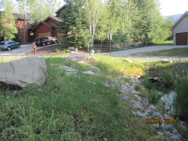
Agenda Item 5) Open Space Parcel “V”: This parcel does not belong to the SSSFHOA nor to the Master Association. Talk about making assessments to Homeowners to maintain the parcel are irresponsible as the costs greatly outweigh the benefits to our Neighborhood. At previous meetings a raised hand vote by Homeowners to allow the Lot 17 Owners to take title to this small parcel are always unanimous. The board seems to have ulterior motives for insisting on delaying the contiguous Lot 17 Owners to annex this “black hole” property. If the board wishes to own this Parcel “V”, it must prove the HOA owns it. Over the last three decades here have been six title searches, none of which conclusively reports any entity owns this Black Hole Parcel “V” that has no Tax I.D. #; no County Serial or Entity #, no identification on any plat map, no title, and ownership is identified by attorney John Richard III, as an “escheat” situation.
Meeting attendees discussed expenses that would be incurred if the board chooses to take over Parcel “V”: A new survey will cost $7,000; a conclusive ALTA title report another $1,000+ that would not likely change the report from Summit County Recorder Alan Spriggs, from High Country Title Co., from a researcher “Saman” in South Shore or Park Place, from another search by the Master Association, from the search and survey we were told by attorney John Richards that he “paid for out of his own pocket”; from the same legal work performed by the Lot 17 contiguous Owners (cost another $5,000). All have reported the same results: No one owns this tiny “black hole” parcel. The board has yet to deliver a single reason for our HOA to take over this small plot.
For the SSSF board to take this title-less parcel would require several thousand dollars for quiet title legal work to make the property recordable; including an engineering report and another survey. To keep the parcel attractive an irrigation system will need to be installed. Then there will be landscaping, the weekly maintenance-mowing cost, water use, liability insurance (proximity to a main road SS Drive and to the Parcel Q water channel), property taxes, etc. Adding Parcel “V” as an open or common space to the SSSF CCRs creates the first ownership by our subdivision of a “common area” and an ongoing hassle and expense without a quantifiable use or benefit to the Owners. Paul Reddy and his kleptocratic board are seeking to take this parcel by fiat. SSSF Homeowners majority are in favor of allowing this small property to be claimed by Lot 17’s owners. Reddy’s ulterior motive seems to be to burden the Owners with “annual assessments” to be included in Reddy’s “As Is” 1994 CCR Declaration. Since 1984 the Owners of Lot 17 have sustained the Parcel V watering and maintenance and should be allowed to annex this small parcel as a part of their Lot. Contrary to what Reddy wrote in his report earlier today, the closing statement by Edy, chair of this group, was that the board not burden the Homeowners by making expenditures for land the HOA does not own.
Parcel “V” is separate from the Creek Easement water channel, “Parcel Q” is a part of the “collective water tributaries” mentioned in the 2004 Lakes and Water Agreement with Mountain Regional Water District.
After the above discussion, Lucy Archer asked Brian Mehregan if he and his family were still interested in annexing Parcel “V” into their adjoining Lot 17. Brian answered that much had been discussed and promised since he moved into the neighborhood, it was becoming overwhelming. “Yes, in a perfect world, and without rousing the animosity of the board and neighbors, we are still interested in gaining title to “V” to annex it to our Lot 17.” Isn’t this the perfect solution?