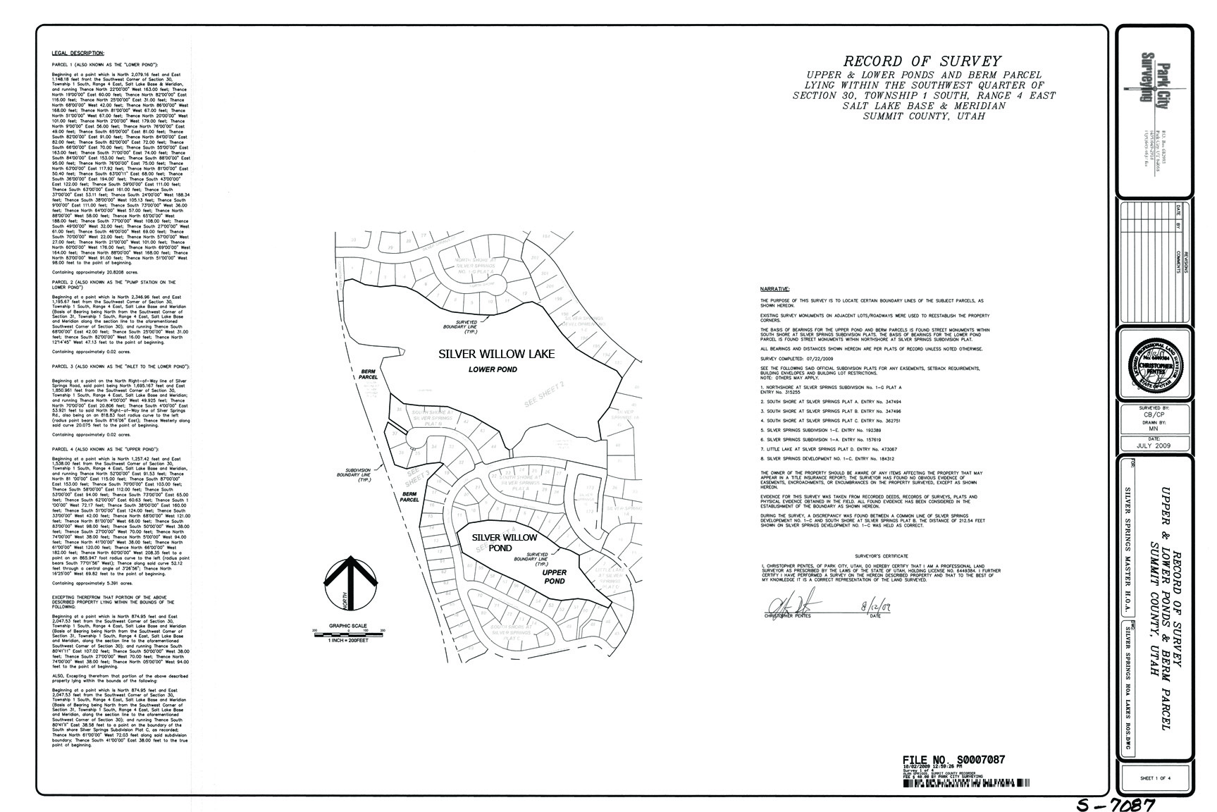
Parcel G – Little Pond
LITTLE LAKE aka SMALL POND aka UPPER POND aka
SILVER SPRINGS SILVER WILLOW POND
This pond is 5.24 acres in size. Water Storage Capacity: 25 acre ft.
This Private Pond’s perimeter easement land, belongs to Southshore.
The water that fills it belongs to Mountain Regional Water Co.
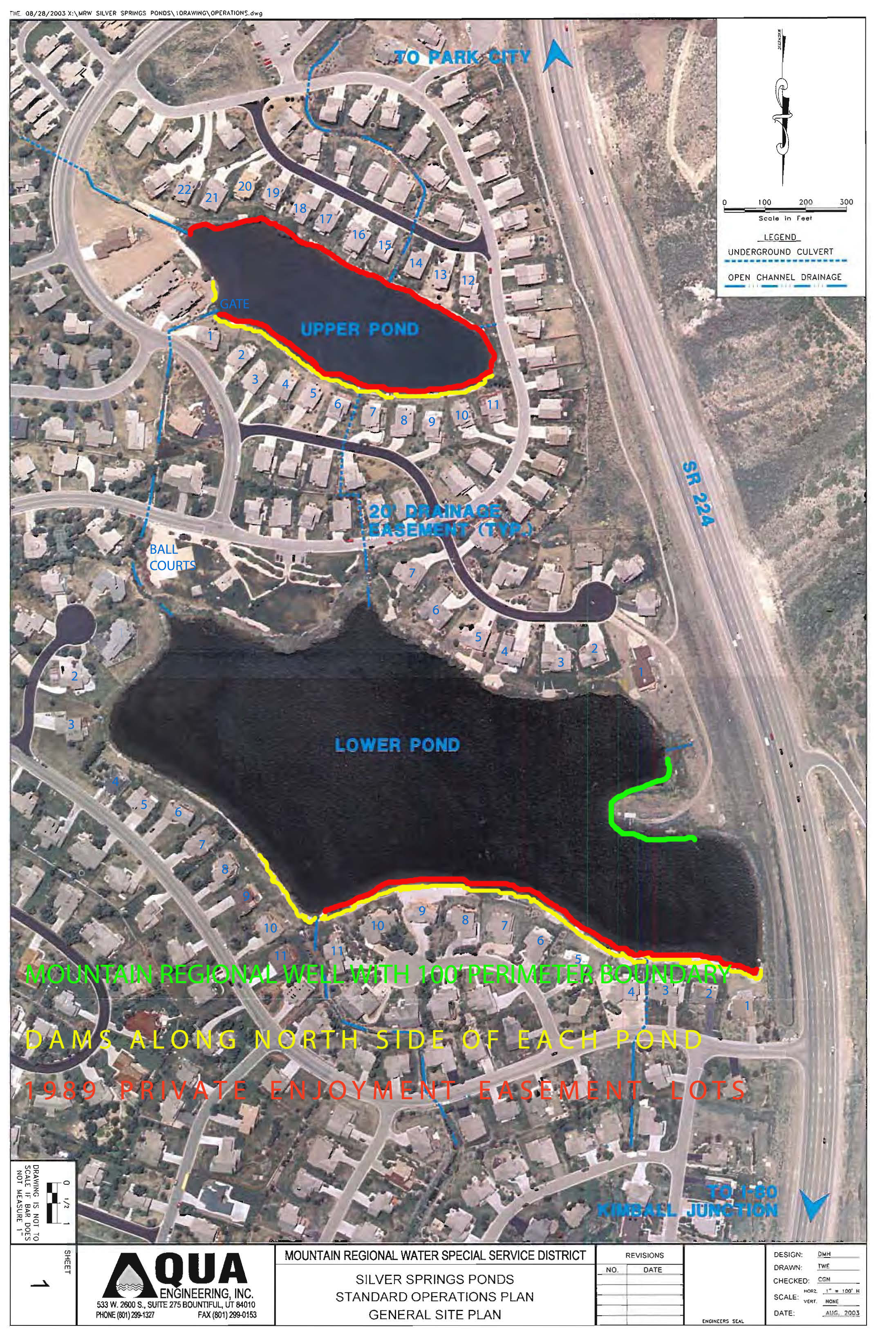
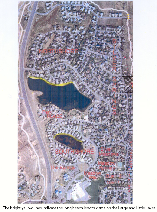
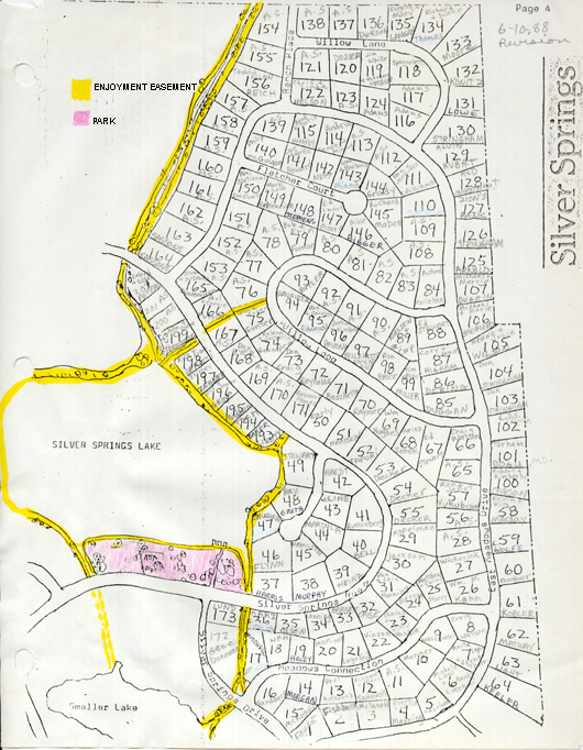
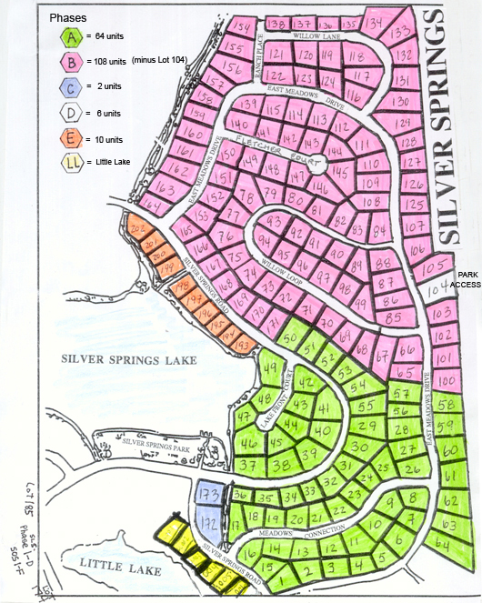
SILVER WILLOW POND aka Upper Pond aka Little Lake aka Parcel G aka Duck Pond aka PP-98-A-6 ~ Situated in the center of SouthShore subdivision. This retention pond is a private amenity owned by Southshore subdivision for water front property owners located contiguous to its perimeter. The 1989 Barnes Exclusive “Private Enjoyment Easement” grants the perimeter of this pond/lake to the SouthShore lake view property owners lots 1-22; the six SS Little Lake properties (Lots 23, 24, 25, etc. on map below) are not included in the 1989 agreement. There is no access provided to the Enjoyment Easement, it is accessible only by contiguous property owners. Lots 1-11 in NorthShore, as lake view property owners are included in Barnes’ 1989 agreement on the large pond/lake. Essentially the properties/subdivisions originally owned and developed by Barnes and Widdows beginning in 1989 around the ponds in Silver Springs are the properties having exclusive access to the Private Exclusive Enjoyment Easements. See maps below red line indicates private enjoyment easement.
Silver Springs Water Company sold their water rights in this pond to Mountain Regional Water around 1990. These water rights maintain the pond capacity and flow. When Mountain Regional transferred the Lakes/ponds land, liability, and maintenance costs to the SSMA in 2004 they retained the water rights. The Silver Springs Master Association owns the ground under the water yet is expected to maintain the water quality and safety.
- Southshore plat map includes the Ross Lloyd pocket park and all access to the Silver Willow Pond.
- 1989 August 2 Private Exclusive Enjoyment Easement runs with the land deeds for Southshore Lots 1-22 and Northshore Lots 1-11.
- 2004 May 25 Lakes Conveyance and Water Supply Agreement with check to MA – signed only by MA Pres. R. Anthony Sands. Not presented to the Silver Springs Property Owners for their vote, nor for the vote of their representatives to the MA.
- 2004 July 13 letter from attorney Craig Smith regarding Warranty Deed for Lakes
- 2004 – July 14 recorded Warranty Deed from Mt. Regional to MA
- 2009 – October 20 Noland and Bailey created an affidavit that is denied by the listed HOA representatives.
- 2010 – April – Q&A for Small Lake Assessment
The small retention pond in the center of SouthShore. Private access and use by only the contiguous ‘lake’ view owners. See Exclusive Enjoyment Easement.
Fall of c.1993 – Neighbors on Dick Mitchell’s Lot 17.
Background shows backhoe working on Little Lake formation.
Hold down the Ctrl key while you press the + key a number of times to enlarge photo.
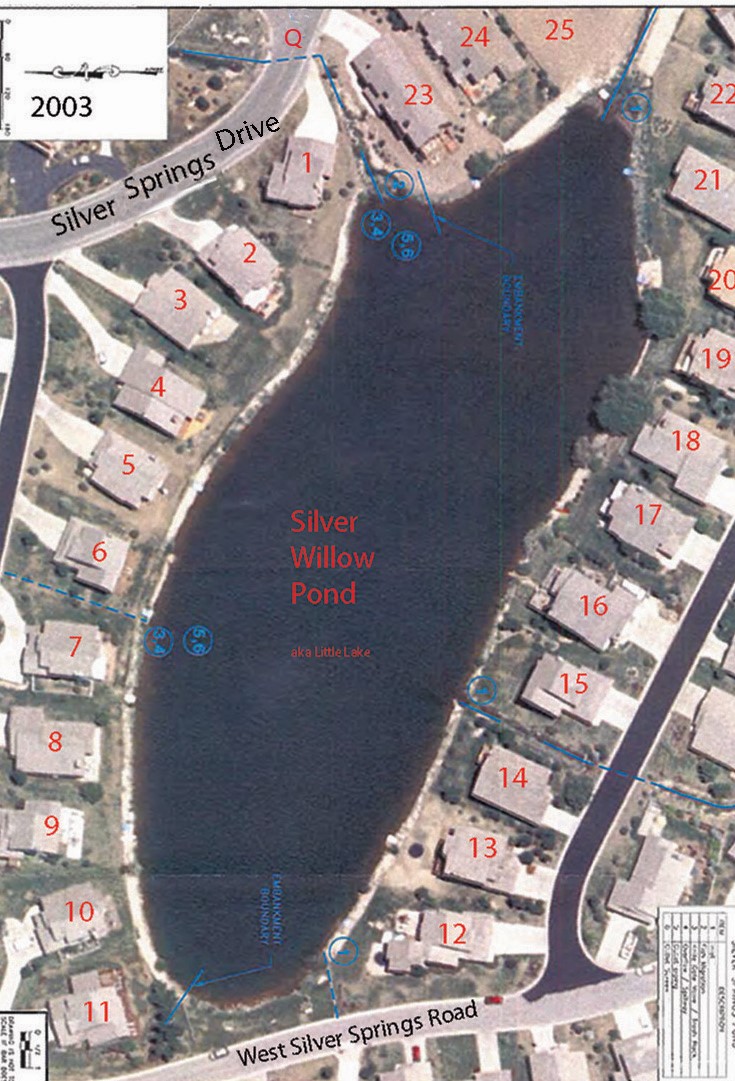
1989 Exclusive “Private Enjoyment Easement” for Lots 1-22 (red line) surrounds perimeter of this pond/lake
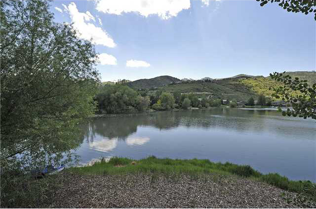
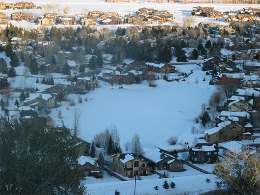
Little Silver Willow Pond in SouthShore
1982 Enjoyment Easement map
Click link to view map.
1981- Yellow areas on map are route of original Community Enjoyment Easement and access to waterways
– Pink area is the Community Park
1983 – HOA member big lake shore access = 4,221.71 linear feet X 15′-25′ wide
1991 to present – for their own purposes some lake view owners in SSSF and Park Place closed access for the HOA property owners to the easement contiguous to their property line.
Big lake shore access was reduced to 444′ linear feet along the community park plus the undeveloped west shore.
See Exclusive Enjoyment Easement page
Silver Willow Pond is surrounded by a 1989 Private Enjoyment Easement Agreement. The easement was recorded on the 1991 SouthShore subdivision plat map. This Agreement grants access and use of the perimeter of either lake only to the 22 SouthShore small lake view lot owners and 11 NorthShore large lake view owners. The 11 SSSF lake view owners are not included in the 1989 Easement Agreement nor are the six SS Little Lake properties along Silver Springs Drive. Silver Willow Lake Enjoyment Easement perimeter was originally intended for ALL Silver Springs Community property owners to have access and use. However, some lake view owners have encroached on these rights over the years. From 1990 to the present, the Park beach area has been the only access to the Silver Willow Lake and Pond usable by ALL Silver Springs Community property owners yet the cost of maintenance, insurance, management, taxes, repairs are assessed to all Silver Springs Community property owners without their consent because they have been disenfranchised from voting on these assessments and special assessments.
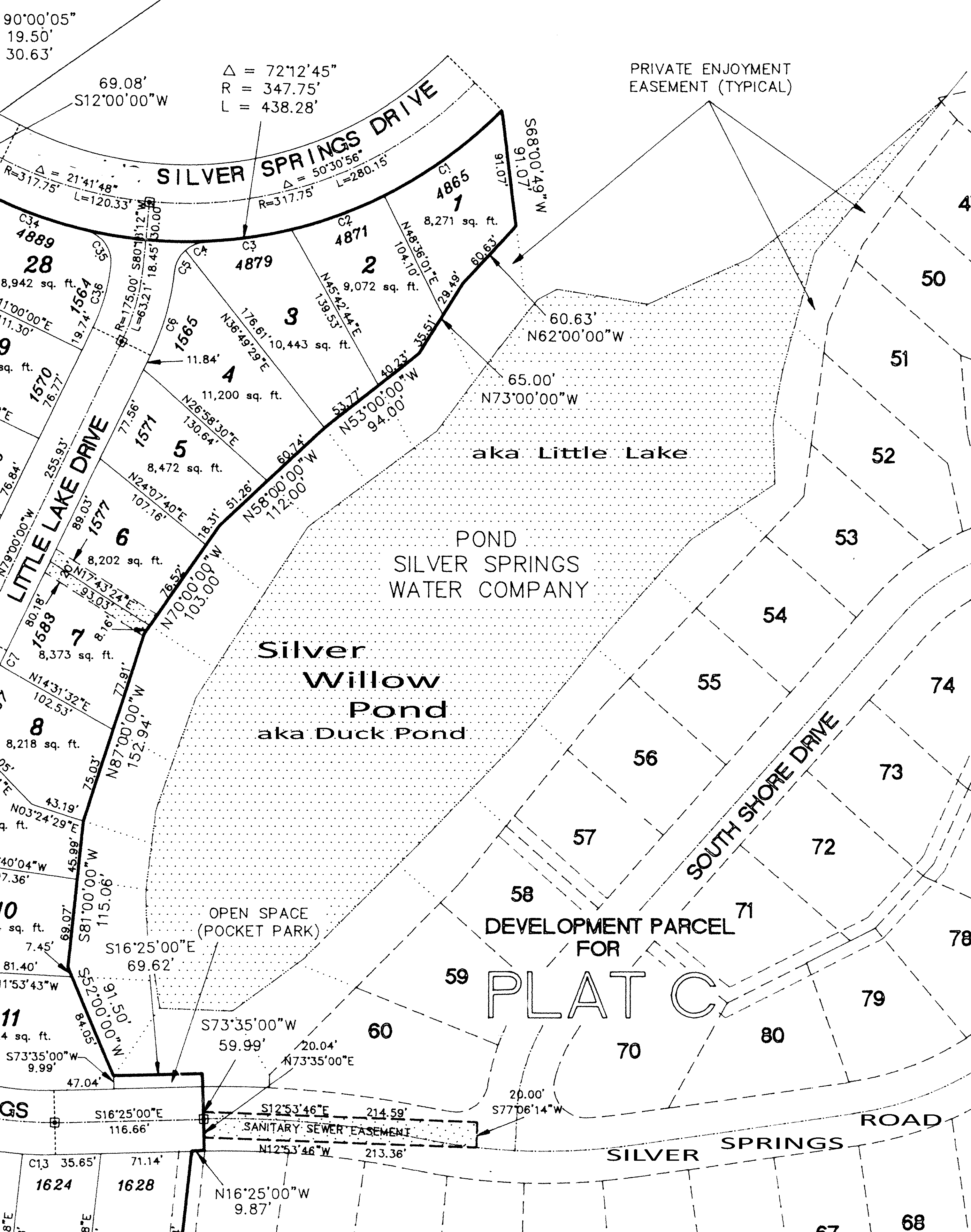
SURVEYED IN 1990, RECORDED 1991; Pocket Park is outside of Enjoyment Easement
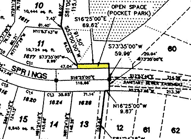
Close up of Open Space (Ross Lloyd Pocket Park 9.99′ X 69.62′) located outside the Exclusive Private Easement and along Silver Springs Road. The park is not contiguous to the pond and it does not provide legal access to the pond.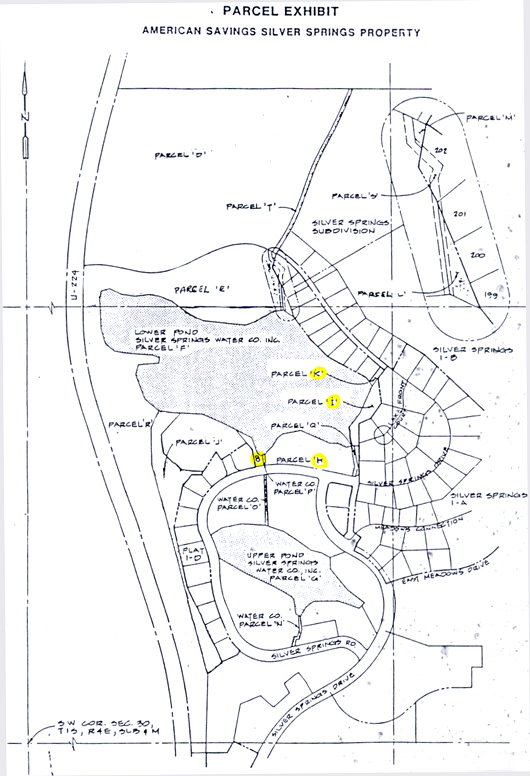
1986 American Savings Bankruptcy Exhibit map.
Lower Pond is Parcel F, Upper Pond is Parcel G.
Parcel G shows two water ingress points and two water egress areas, “O” and “Q”
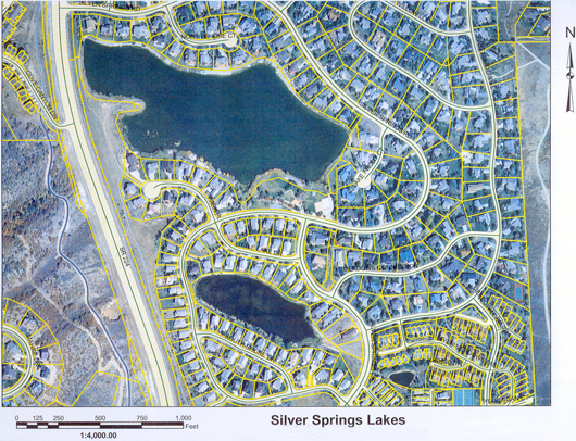
The Three Silver Springs Community Ponds.
(Created in compliance with the 1972 Clean Water Act -CWA)
(1) The Silver Willow Lake a.k.a. the Lower Pond is on the top, access along Park.
(2) The Silver Willow Pond a.k.a. Upper Pond is in the center, access by contiguous lot owners only; deeded to SouthShore subdivision as recorded on their plat map, not to the SSMA.
(3)On lower right is Silver Minnow Retention Pond was deeded to Silver Meadow subdivision and is recorded on their plat.
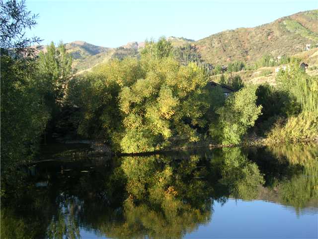
Some may call this vegetation an encroachment. We call it living ambiance… privacy…lovely….
1981 – September 8 – Summit County Planning Commission Meeting Minutes. “Jim Webster – Silver Springs recreational facility – tennis court & swimming pool, …as well as 1-D (South Shore) exact location of the lake and buffer strip. The cul-de-sac [Park Place] may still be eliminated.”
Account 0216543
|
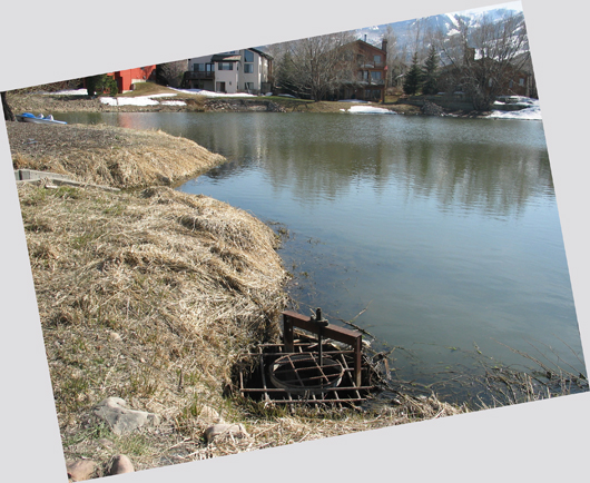
2008 – Gate weir on east side of the small pond at opening of Parcel Q
Located at Upper Pond aka Silver Willow Pond aka Silver Springs Little Lake was replaced in 2011
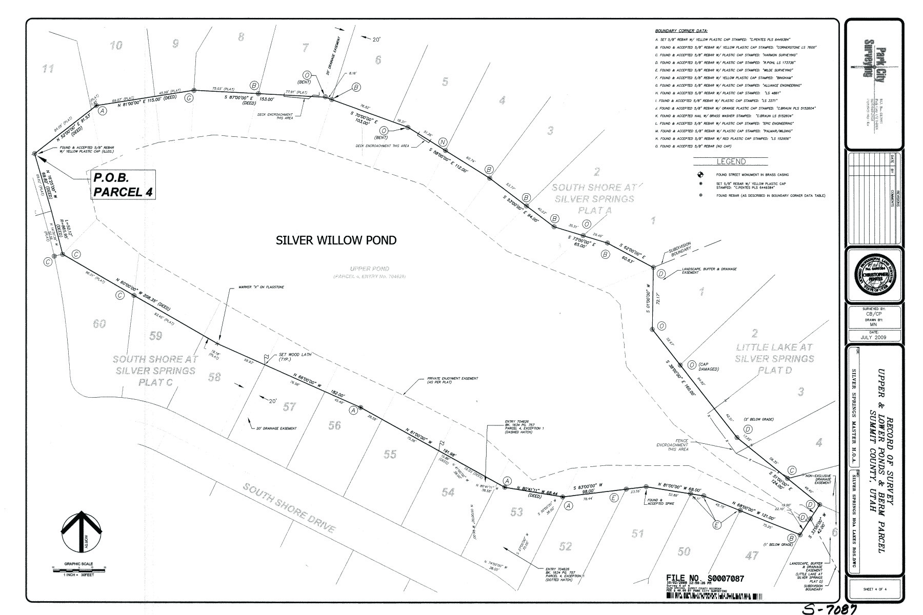
2009 October 2 – Small Pond-Lake Survey showing Private Easement
Click on image above for expanded view.
|
Name SILVER SPRINGS MASTER HOMEOWNERS ASSOC |
|
C/O: SMITH J CRAIG ATTORNEY |
|
215 S STATE ST STE 650 |
|
Market (2008) |
$0 |
|
Taxable |
$0 |
|
Tax Area: 10 Tax Rate: 0.007418 |
|||
|
Type |
Actual |
Assessed |
Units |
|
Land |
1.000 |
||
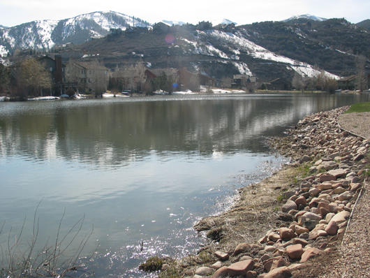
The private Silver Willow Pond – north dam / beach area – looking northwest. The dams are part of the Exclusive Private Enjoyment Easement and therefore private property useable and accessible only to contiguous lake view lot owners.
View https://www.silverspringscommunity.com/lakes-in-silver-springs/silver-springs-dams/
for lake dams cost and liability imposed on unsuspecting SSMA Members.
Large pond is 913,717 SF; Small pond is 225,488 SF
Account 0216543 ViewingDocLand
|
General Information |
|
|
March 2008
Account 0216543 Viewing Doc Warranty Deed
From
SILVER SPRINGS WATER CO INC
To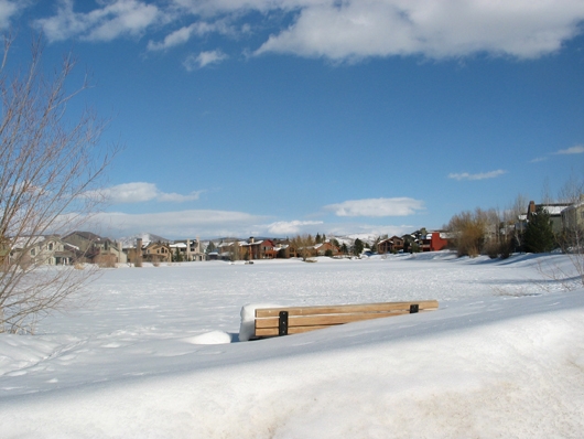
March 2008 – View from Pocket Park parcel to Exclusive Private Enjoyment Easement & Pond
The 69.62′ X 9.99′ Pocket Park is located as part of the 1989 “Exclusive Private Enjoyment Easement” as an Open Space. The Lloyd Pocket Park is located along Silver Springs Road, recorded as a SouthShore subdivision property not a Master Association common area parcel. In either case this Park does not provide legal access to this Pond by all the Master Association property owners. Only those property owners with lots contiguous to the Exclusive Private Enjoyment Easement and Upper Pond (Silver Willow Pond) have legal access to this pond and easement.2010- December 10 – Lakes Enjoyment Easement – At this SSMA meeting Bill Noland announced that the attorney’s he hired to research the Silver Springs documents have found that the 1989 Enjoyment Easement Agreement around the Little Lake runs with the land and is a valid Agreement from the developer to the SouthShore purchasers of the lake front properties and their successors for the use and access of the perimeter of the lake. The six Little Lake homes located on the east border of the Little Lake along Silver Springs Drive, and annexed in 1997 as part of the SSSF subdivision, are not included in this Agreement as these six lots were not part of the (Mike Barnes) developer’s property. View at: https://www.silverspringscommunity.com/our-community/silver-springs-sf/little-lake-at-silver-springs/ The same situation exists for the Large Lake in that the 7 or 8 homes along the east border of the lake and the Lake Front Court 4 houses, are part of Silver Springs Single Family since the beginning in 1980 and were never part of the developer’s (Barnes’) Enjoyment Easement Agreement. Therefore the 1989 Agreement does not guarantee exclusive use and access to lake front properties SLS-E Lots 192-199 and SSSF Lots 46-49. Click here to view SSSF lot map.
Does this mean there is NOT access to all the ponds/lakes and easements to all SSMA Members along these Private Enjoyment Easements? If the Easements are Private and Exclusive why does the SSMA bill ALL 504 SSMA members for maintenance, repair, insurance, taxes, and management of properties owned by SouthShore and/or private owners? The MA board and Noland would not answer Lucy Archer’s question. SSSF lake view lot owners (Fuller -Lot 193, Hedges -Lot 194, Carriel -Lot 195 , Robinson -Lot 196) not within the 1989 Private Exclusive Easement petitioned the board in Fall 2010 to allow them to purchase the easements from the Master Association. The request was tabled until further information was confirmed.Account 0216543 Viewing Doc Quit Claim Deed Entry No. 00362047 Bk 672 Pg 88
Fee $8.00 Consideration $0.00 Instrument Date 07/10/1992
From SILVER SPRINGS WATER COMPANY, INC.
To SOUTHSHORE PARTNERS Parcel PP-98-A-6 Account 0216543 Account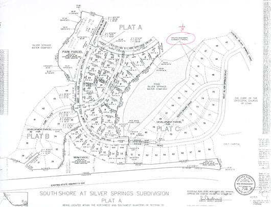 1991 SouthShore Plat A with “Private Enjoyment Easement”.
Parcel G is the private Little Lake in the center area.
The Ross Lloyd pocket park lies outside of the Private Enjoyment Easement.
Read the Conatser Law of July 18, 2008 regarding access from top (east) Parcel V.Account 0216543 Viewing Doc Warranty Deed Entry Number 00641012 Bk 1495 Pg 1037
Recording Date12/11/2002 02:31:00 PMFee $0.00 Consideration $0.00 Instrument Date 06/29/2001Transferred From SILVER SPRINGS WATER COMPANY, INCTo MOUNTAIN REGIONAL WATER SPECIAL SERVICE DISTRICT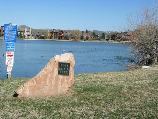 Silver Willow Pond at Ross Lloyd Park – west bank mid-May 2008 – with old signs
This Park was lies outside the “Private Enjoyment Easement” of this Pond.
The monument, bench, and signs were installed within the Enjoyment Easement. 2011 September 26 THE UPPER SMALL POND IS DRAINED FOR REPAIRSClick here for details.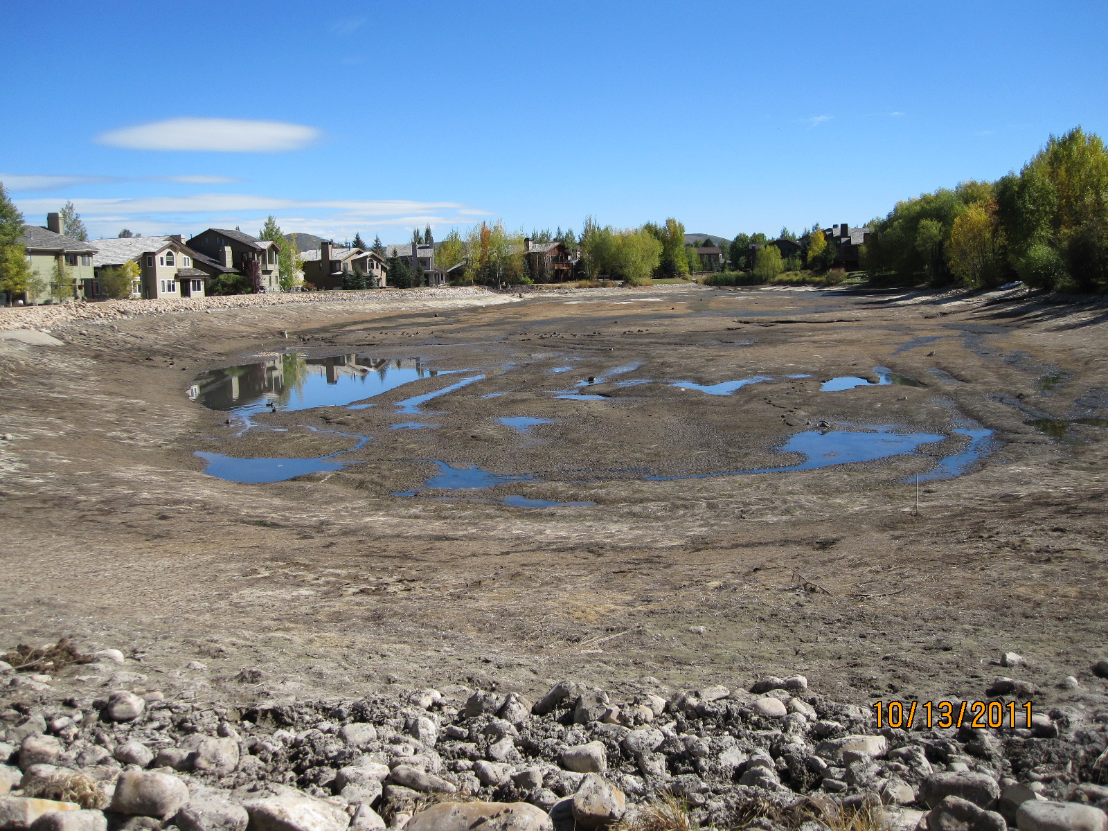
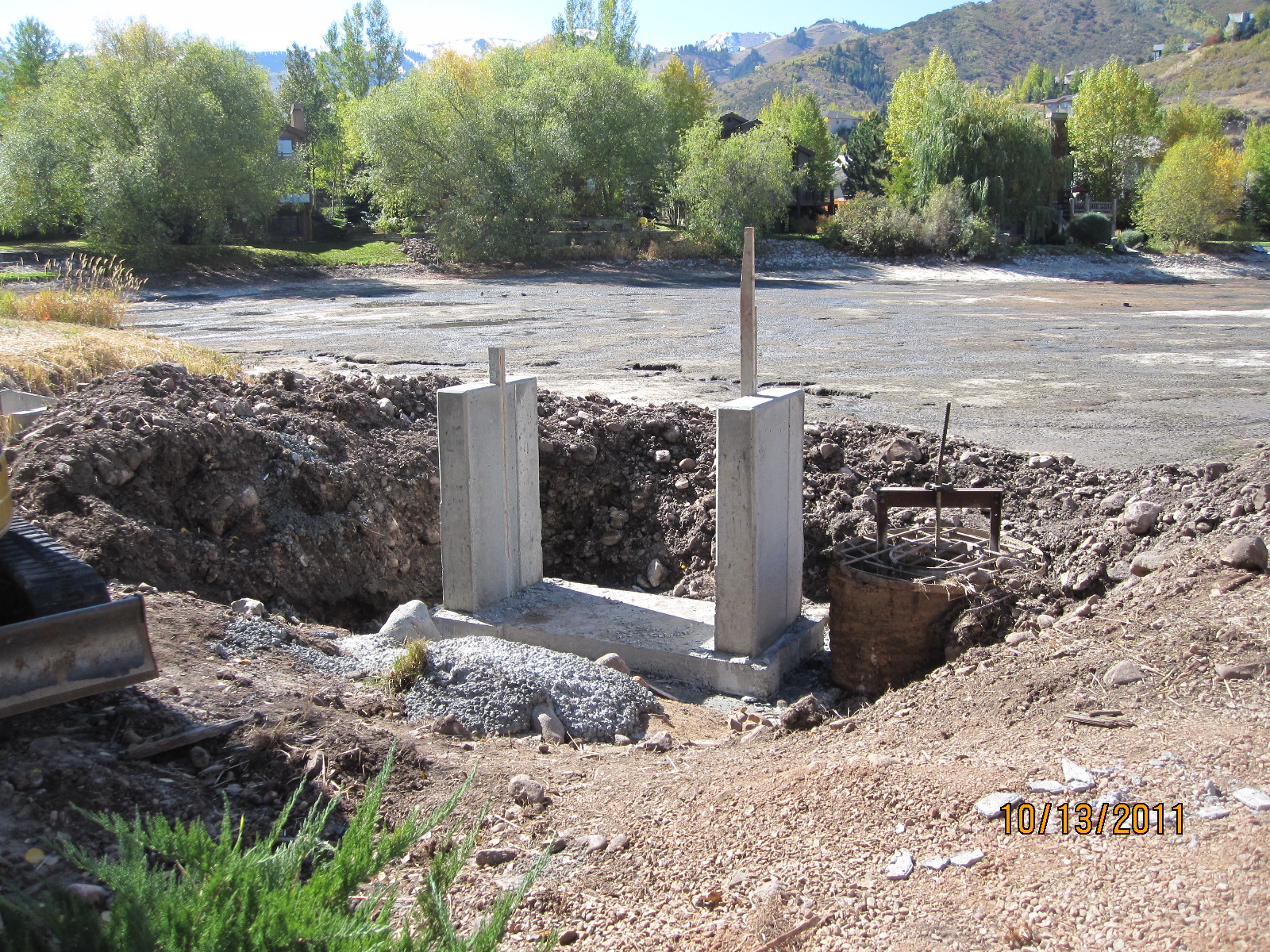
2011 – New pond cement gate structure. Old metal gate on right. See photo at page middle.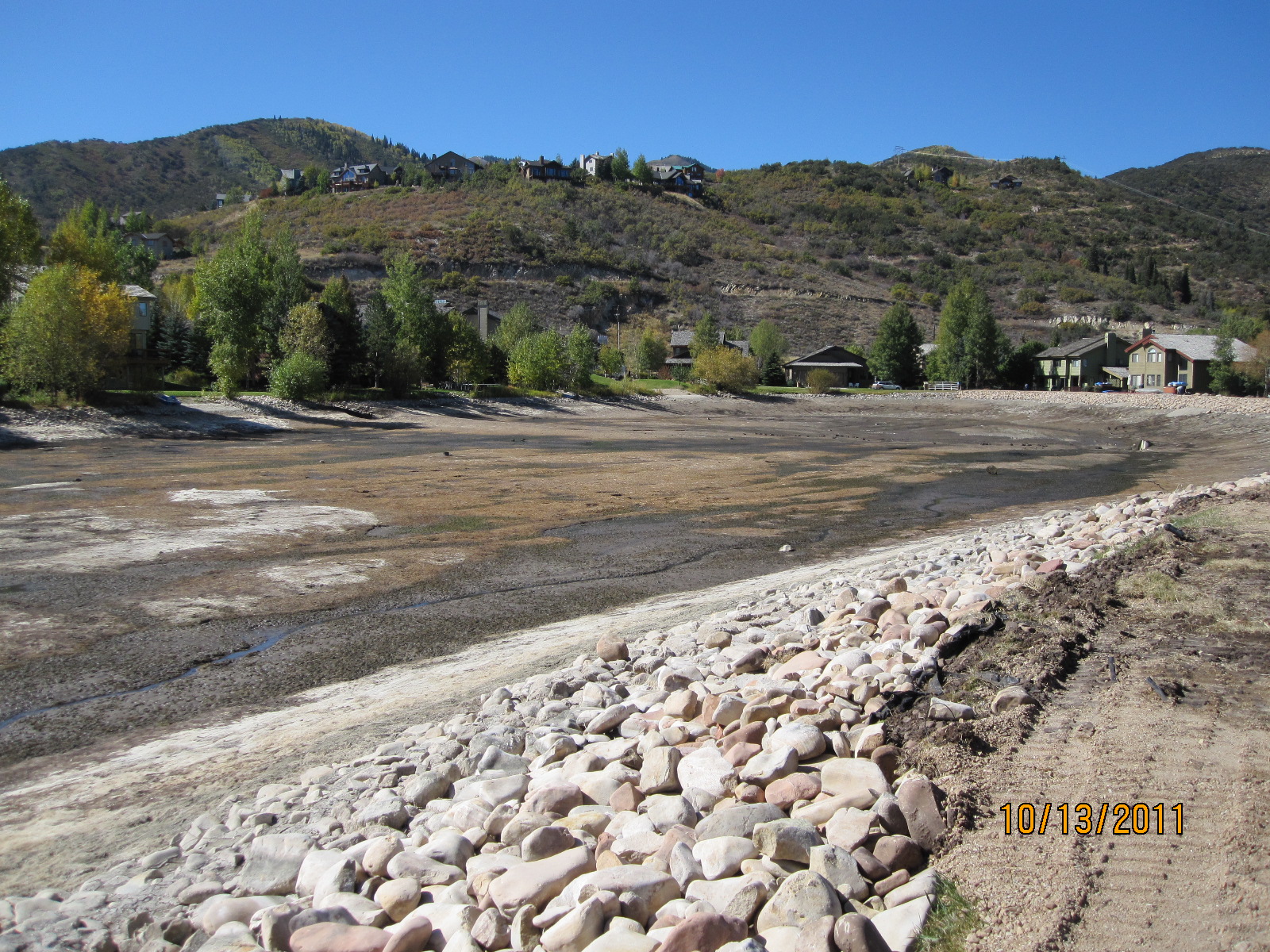
2011 – Little Silver Willow pond drained from end of September until end of October.
This north side easement is also known as ‘the small pond dam’.
The SSMA paid for this work though it is a private pond and the Park belongs to SouthShore.
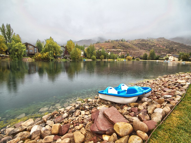
SouthShore lakefront owners enjoy storing their boats on their Private Exclusive Easement.
Only lot owners contiguous to the water have access and use of the Silver Willow Pond perimeter.
The SSMA bills the entire SS community for repairs, maintenance, taxes, insurance, and management of this pond and its Private Exclusive Enjoyment Easement (the north side easement is aka ‘the dam’) though only contiguous owners have use and access.