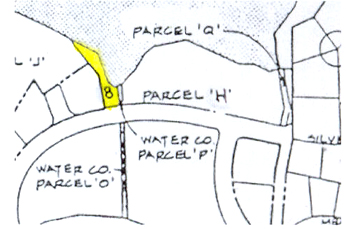
Parcel H – Park
Also see Other Silver Springs Community Parks
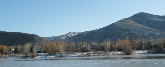
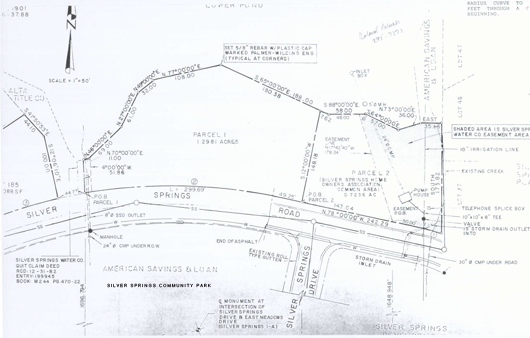
SILVER SPRINGS COMMUNITY PARK
SOS-A-PARK a.k.a. American Savings Parcel H a.k.a. Community Park 2.01 acres
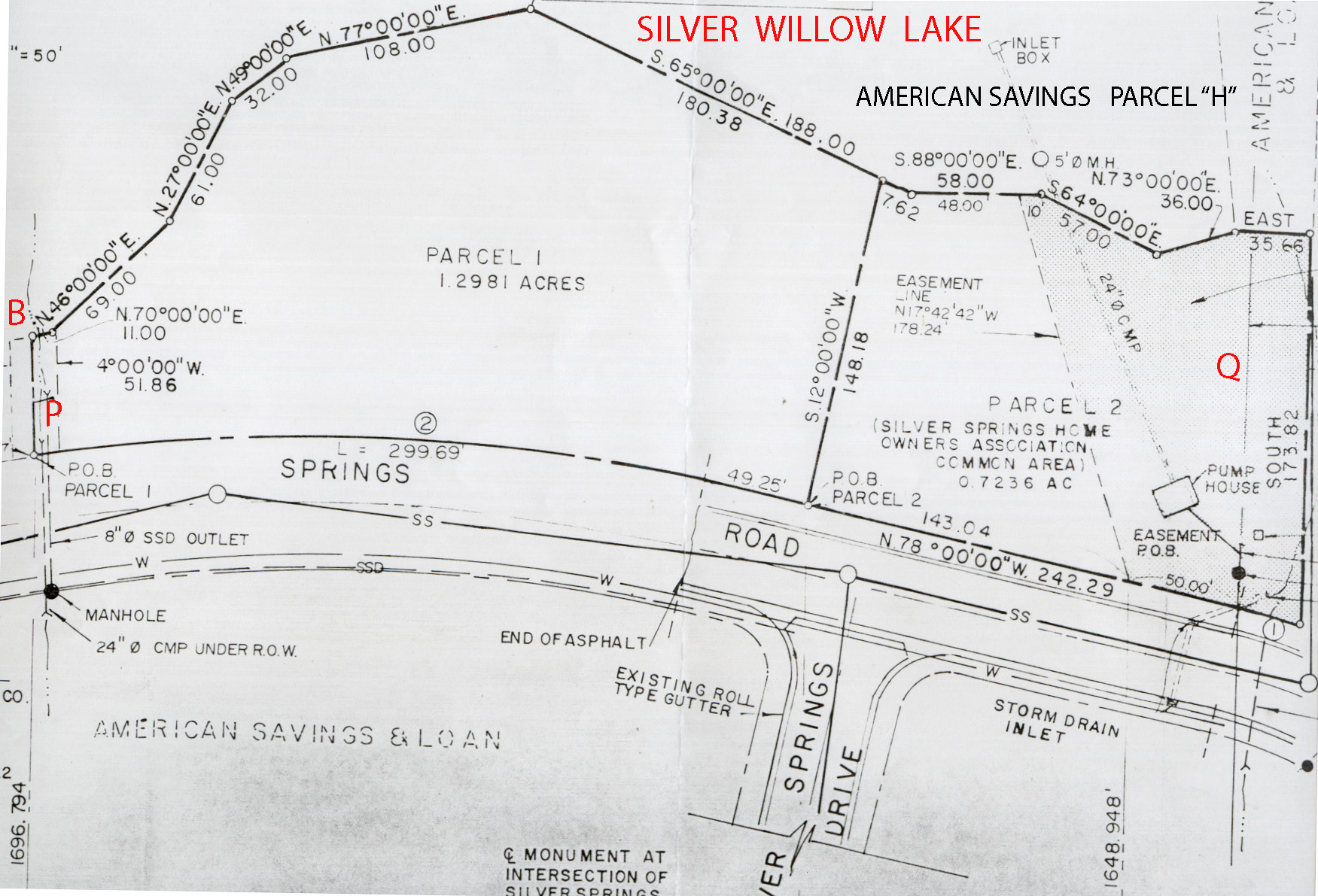
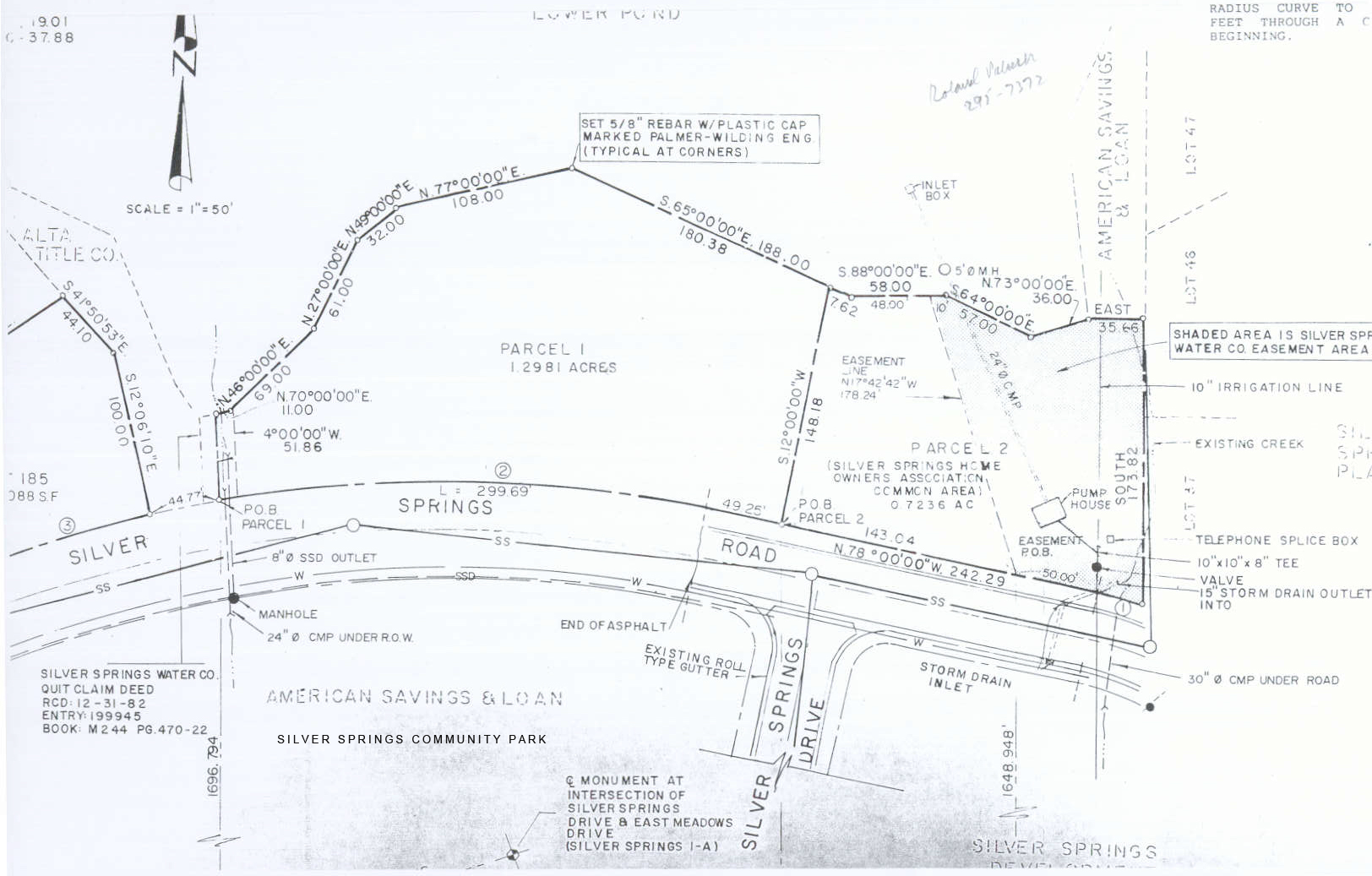
Plat Parcel 1 = 1.2981 acres; Plat Parcel 2 = 0.7236 acres; Total = 2.01 acres
Title was transferred from South Shore at Silver Springs Developers on 9/23/1991 to the Master Assoc. in exchange for Summit County allowing a zoning change from multi-family units to single family units.
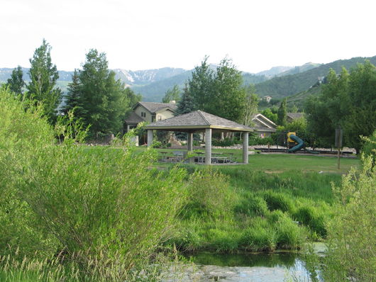
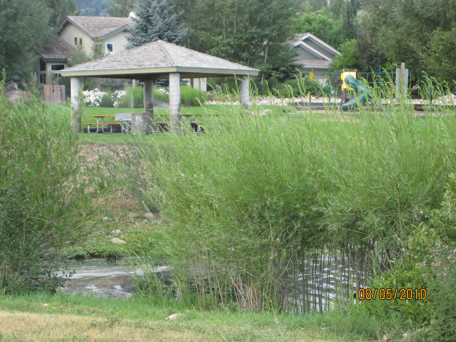
Silver Springs Park Pavilion June 2008
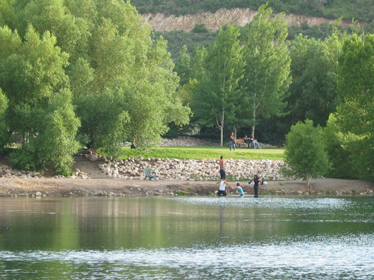
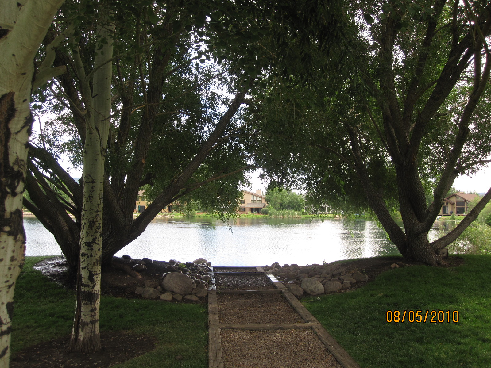
2008 -Beach fun (before the Aug. 2009 “pruning”)
2008 – Silver Springs Park viewed from north side of Silver Willow Lake
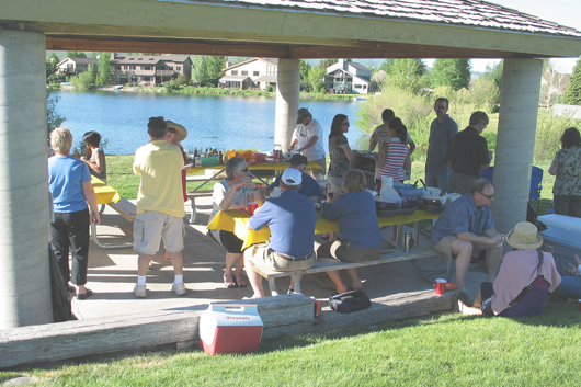
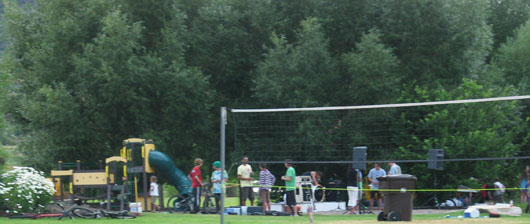
2008 Community Picnic
2009 – Silver Springs Winter Park view from north after Greenleaf crew cut the trees and bushes
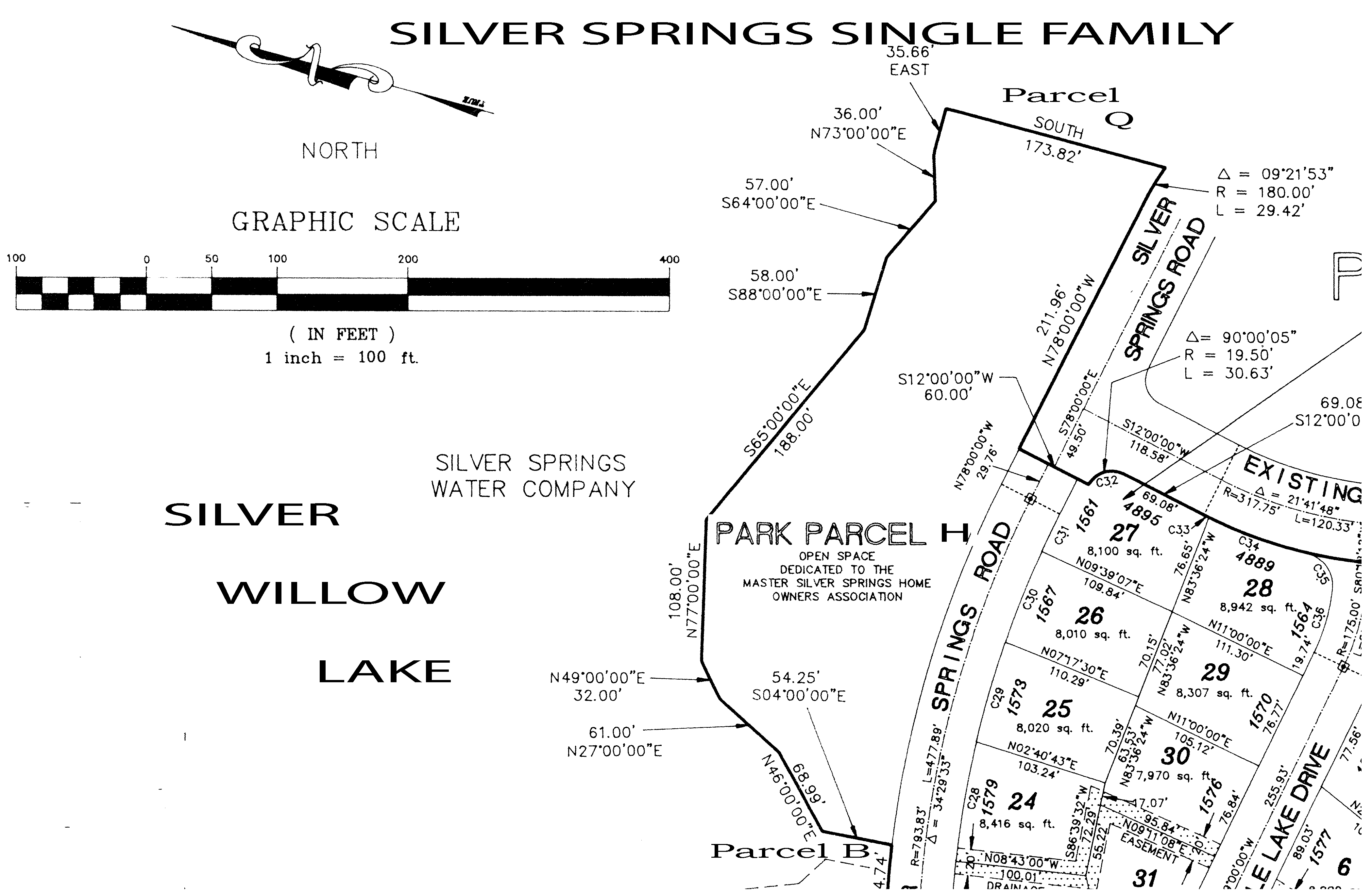
Park Parcel H on SouthShore Plat A – 1991 – Parcel B at bottom
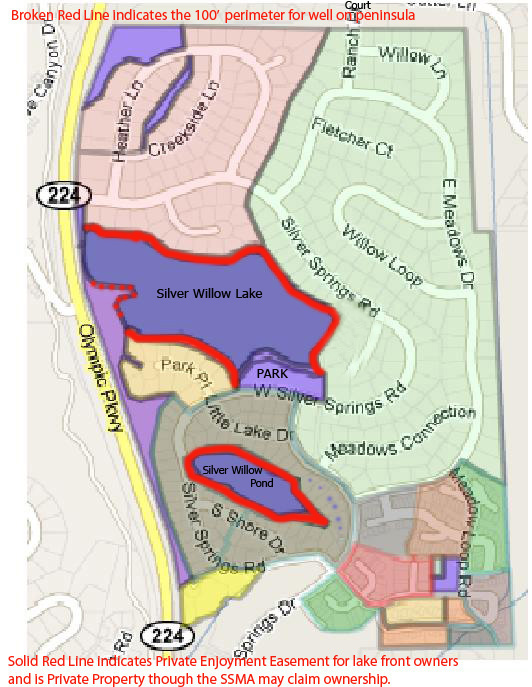
Silver Willow Pond is surrounded by a 1989 Private Enjoyment Easement Agreement that was recorded on the 1991 SouthShore subdivision plat map. This Agreement provides access and use of the perimeter of either lake only to the 24 or 25 small lake view lot owners and the 29 large lake view owners (54 total).
Silver Willow Lake Enjoyment Easement perimeter intended for ALL Silver Springs Community property owners has been piecemeal absorbed over the years by the contiguous lake front property owners. From 1990 to the present, the Park beach area has been the only access to the Silver Willow Lake usable by ALL Silver Springs Community property owners.
1988, August 8 – American Savings Letter describing Parcels: ” Parcel H: “I have been able to locate three undated versions of the [Silver Springs] Master Plan. The one which the Planning Commission believes to be the original depicts Parcel H as subdivided into single-family lots. Another shows four single-family lots at the west end of the Parcel [Parcel 1] and the east end [Parcel 2} dedicated for use as a park. The third shows the entire Parcel H to be used as the location of a number of recreational facilities. Our decision was to convey the east one-half of the Parcel H to the Homeowners and subdivide the other half.”
 Parcels B, I, O, P, Q, and Park Parcel H – Located north of the Lower Pond a.k.a. Big Lake
American Savings Parcel P Inlet Stream is west of Park Parcel 1
American Savings Parcel Q Inlet Stream is east of Park Parcel 2
More detail: Parcels 1 and 2 comprise the American Savings map Parcel H a.k.a. The Park
Quit Claim Deed Recorded 12-31-1982 Entry 199945 Book M244 Pages 470-22
Wilding Engineering has been contacted for more map information.
Parcel F “Big Lake” aka Silver Willow Lake aka Lower Pond is located here:
1990 Diagram by Linda Karz
Adds up to lake access of 444 feet.
SSSF Parks Development Committee Representative – Randy Arnold
This sketch of the Park parcel shows the Stream Channel Parcels P (west side) and Q (east side) as part of the
Park Parcel “H”.
The west side stream Parcel “P” is not separated by a rock berm, bushes, etc. The east side stream Parcel “Q” has evergreens, aspens, shrubs and mature trees, berms, and several tons of river rocks.
Access paths to and from Parcel “Q” should include a pathway with handrails be built accessing these two Park areas to and from the streams.
1986 American Savings sketch map shows Parcel H between streams B (8) and Q.
1982 – May 11 – Summit County Planning Commission Minutes – “Recreation Facility at Silver Springs.” Original approved proposal discussed to include: 4 tennis courts, boat dock, swimming pool, and an athletic or sports facility.
1988 – August 23 – Minutes of the Planning Commission for Meeting -Jerry Tulley, one of original planners of Silver Springs with Webster and Associates from 1979-1983. Tulley said the lake front lots were priced as premium lots. Mr. Tulley said at one time there was a path system around the majority of the lake in the master planning, as consultants were brought on line discussing marketing, property values and liability to the water company it was decided to omit the pathways, specifically those areas adjacent to the lots. …The original intent was that these lots owners would have privacy along the lake. …It was decided that lake access would be limited to controllable areas…Mr. Tulley said this was one of the few parcels (H) that was intended to be access for the homeowners to the lake. (the 444′ along the Park Parcel H).
1988 – September 13 – Minutes of the Planning Commission for Meeting
 1992- June 6- SSSF – Report on the Development of this Park on Parcel H,
written by Fred Stayrook, SSSFHOA Board President.
In 1990 a Capital Improvements Assessment is announced as $160 per Living Unit.
In 1991 a Special Assessment of $115 per Living Unit is approved by the vote of the Homeowners, per guidelines in our CCRs. The Park was completed under budget with the help of many volunteers.
Seven existing Silver Springs East subdivisions Property Owners provide the money for this Park’s completion.
The stream on the other side of this berm (Parcel Q) has become secluded by means of the extreme landscaping seen in this picture. This landscaping was paid for by the MA, placed by the homeowners situated on the other side of this berm who are also the MA “manager” and the landscape and maintenance company owners.
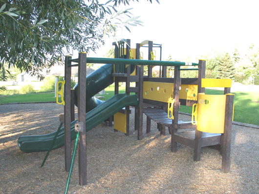
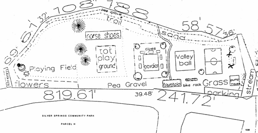
Around 1998 it was reported the MA spent $80,000+ on this playground equipment.
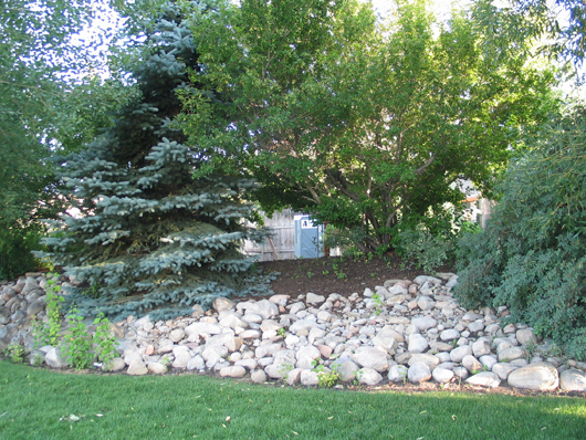
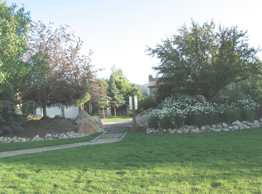
Trees. river rock, shrubs, berms are used to landscape the east boundary between the park
and the Parcel Q stream. This extra landscaping is not included in the Park plans.
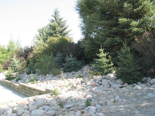
August 2009 – Contrast to the east boundary berm of Park Parcel H and Inlet Channel Parcel Q in photo above to the Parcel P lack of landscaping.
Lake Park Parcel “H” is contiguous with the west boundary of Channel Parcel “Q”
The east portion of Parcel 2 is the inlet stream Parcel Q
American Savings Parcel H was divided into Parcels 1 and 2.
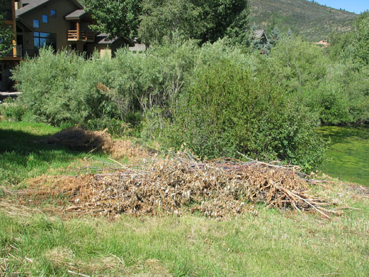
August 2009 – Silver Willow Lake vegetation removed by GreenLeaf Maintenance crew, employees of the owners of SLS-037 aka the manager of the MHOA, cut down the vegetation on the north and west Park Parcel H and west stream inlet Parcel P, a duck nesting area.
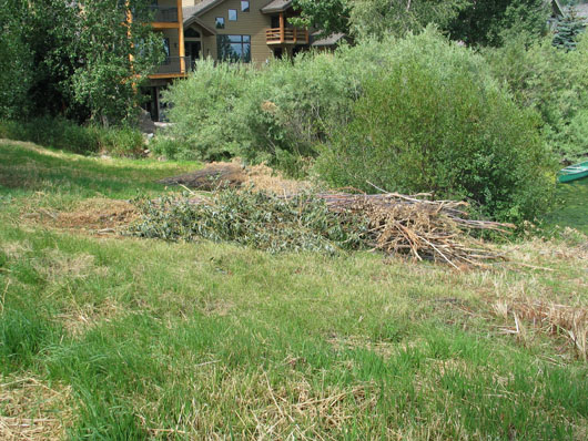
2009 – Thanksgiving Weekend – Some action has commenced to thin out the vegetation on the east side of the Park. Someone has severely cut branches from the large trees. This is an effort but a poor one. What needs to be thinned out are the many bushes blocking ingress and egress from the Park to the Parcel Q stream and back again to the Park. The willows and cottonwood trees needed very little trimming. The long. low-hanging branches shade the roots of the trees and surrounding ground cover, they also shade the water which encourages some insects which in turn become feed for the fish.(See Keith Clapier article on life cycle of streams.). Many of the young spruce trees on the Parcel Q berm should be transplanted elsewhere around the Park and beach areas. Where they are now growing close together will create excessive crowding and sickly specimens as they age and enlarge.
2009 – August- By contrast, the other end of the Park and the Parcel B (8) stream has only natural vegetation and much of that has been cut down. Remaining bushes are mostly on the Park Place side of the Parcel B stream.
 – Duck nesting area –
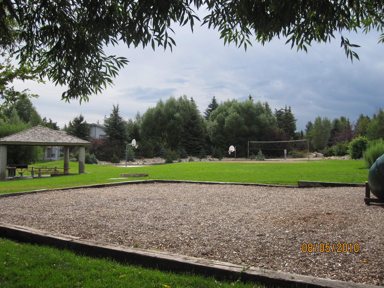
– Volleyball area –
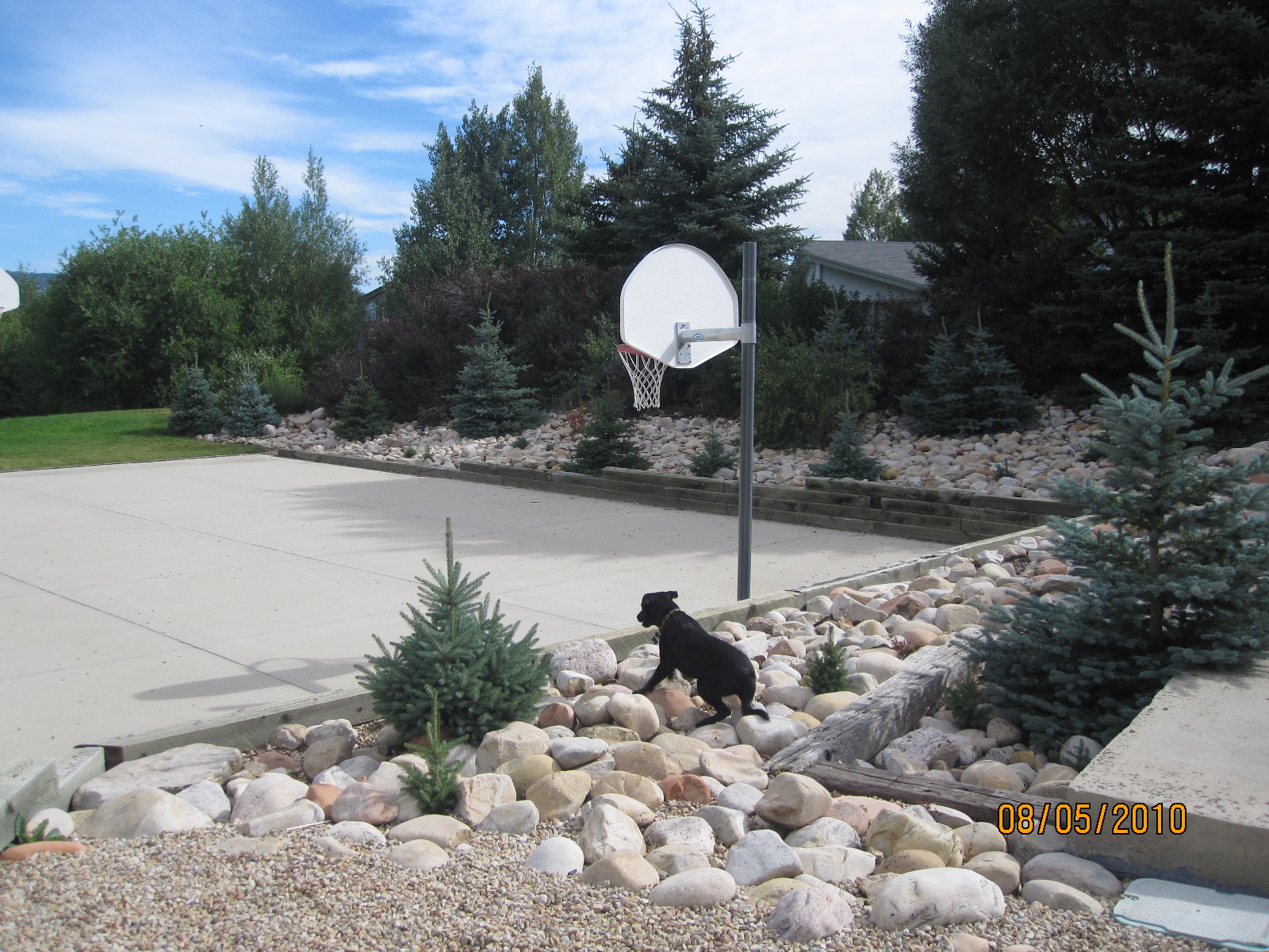
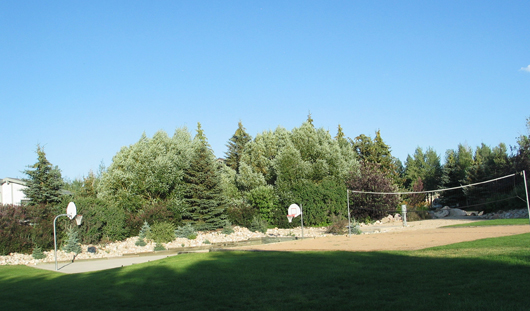
– New basketball court –