—Drainage Channels
SILVER SPRINGS COMMUNITY
STREAMS AND DRAINAGE CHANNELS
 Click on map to enlarge
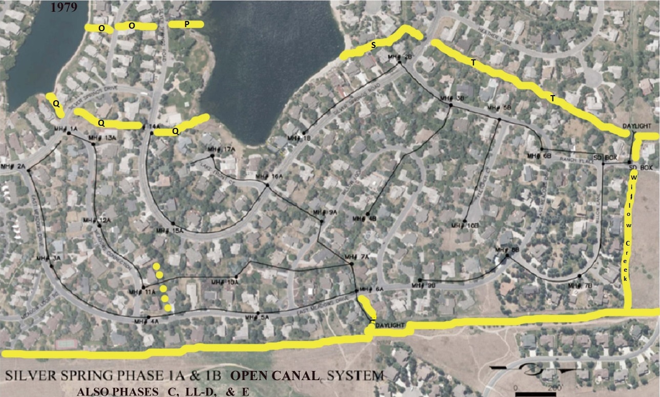
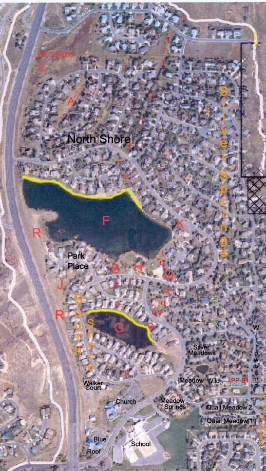
Parcels O & P water channels run along the top left (west) side of this aerial photo exhibit.
Parcel Q connects the Little Lake to the Big Lake, traverses under SS Drive and SS Road.
Parcel S & T are on north side of Big Lake (and a bit east).
All SSSF water channels are shown with yellow lines.
It is believed the long line along the bottom of the map is Silver Creek Creek, which converges with Willow Creek.
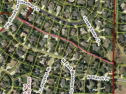
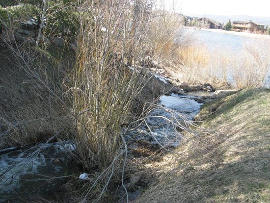
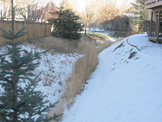
SSSF Lots #154 through #164 share Parcel T, the tree-lined water run-off drainage channel (pink line) with the Northshore Plat B homes on the east side of Heather Lane and Creek Stone Court. The boundary is recorded on NorthShore No. 1-G, Plat B.
After heavy snow winters this channel swells with snow melt-off to a point where some of these houses turn on their sump pumps. These eleven SSSF lots are located within proximity of street storm drains, and arguably by the subterranean 6′ to 10′ underground “under drainage” along the south side of East Meadows Drive.
 |
1982-06-25 – Silver Springs East Developers HOA Agreement with Summit County.
The 1982 Developer’s SSHA CCRs Article IX. Easements. Section 3: Easements for installation and maintenance of utilities and drainage facilities are reserved as shown on the recorded tract plat and over the rear and side five feet of each lot. Restricted uses of the five feet are listed, no use allowed “which may change the direction of flow through drainage channels in the easements or which may obstruct or retard the flow of water through the drainage channels in the easements. [Underdrains change the direction of flow.] The easement area of each lot and all improvements in it shall be maintained continuously by the owner of the lot, except for those improvements for which a public authority or utility company is responsible.”
The State Water Engineer has not issued any stream alteration permits allowing modification of the course or volume of water that flows through the subdivision streams or its underground water table. It is illegal to do so without State authorization and permits.
 Click on Parcel Exhibit to enlarge.
2006 – Follow the Water by Matt Lindon
The Developer’s 1982 SSHA CCRs Article IX. Easements. Section 3: Easements for installation and maintenance of utilities and drainage facilities are reserved as shown on the recorded tract plat and over the rear and side five feet of each lot. “ Restricted uses of the five feet are listed, no use allowed “which may change the direction of flow through drainage channels in the easements or which may obstruct or retard the flow of water through the drainage channels in the easements. The easement area of each lot and all improvements in it shall be maintained continuously by the owner of the lot, except for those improvements for which a public authority or utility company is responsible.”
There is nothing in the Community Developer’s CCR’s that directly transfers or assigns the temporary underdrains to the Master Association, and definitely not to the Single Family HOA, two distinctly separate Associations. Owners experiencing water issues should have had a Property Inspection completed and carefully read their Real Estate Purchase Contract, Property Inspection Report, and their Title Report, before agreeing to accept and purchase their property as is. A property in Silver Springs Single Family is the responsibility of the Owner who approved the terms of each of the foregoing documents for their lot and house. No one else has the authority or right to make changes to an individual parcel of land and its improvements. The State Water Engineer has not issued any stream alteration permits allowing modification of the course or volume of water that flows through the subdivision streams or its underground water table. It is illegal to do so without State authorization and permits.
Click here to read Developer’s 1982 CCRs Article IX. Easements Pages 503-505 at this link.
There is nothing in the SSSFHOA CCR’s regarding the temporary underdrain system.
Click here to read the SSSFHOA 1985 CCRs
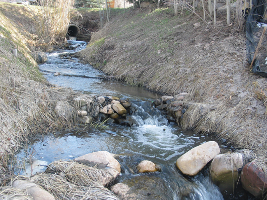
August 26, 2003 – “Mountain Regional Water Remediation Plan: Open drainage channels will be cleared of debris, tall grass and vegetation to promote a flow of water into and out of the ponds. Also, riprap will be placed as needed to prevent erosion. This will probably require divers or drainage of ponds.” -Yellow lines on photo at top of this web page show location of open drainage channels in Silver Springs SF. Lines broken at streets indicate where the channels are located, tunneled under the roadway/street.
Parcel B on west side of Park between Silver Springs Road and the Silver Willow Pond

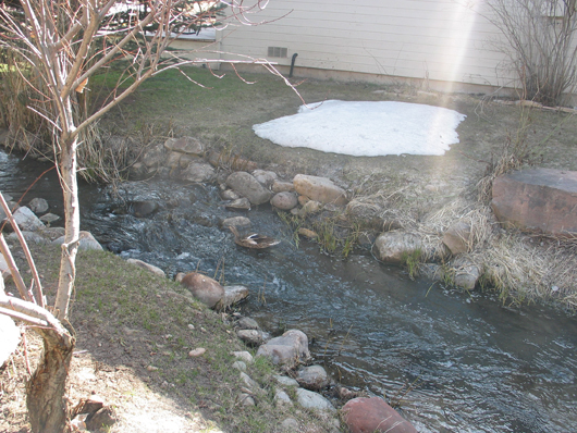
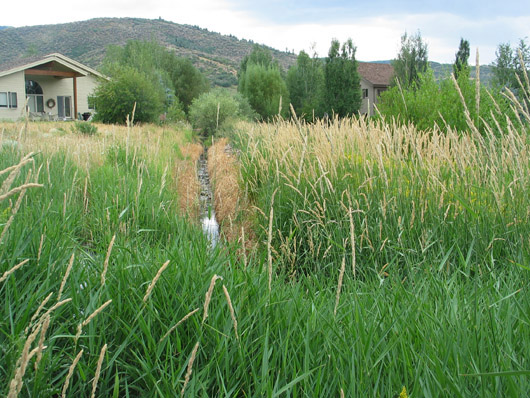
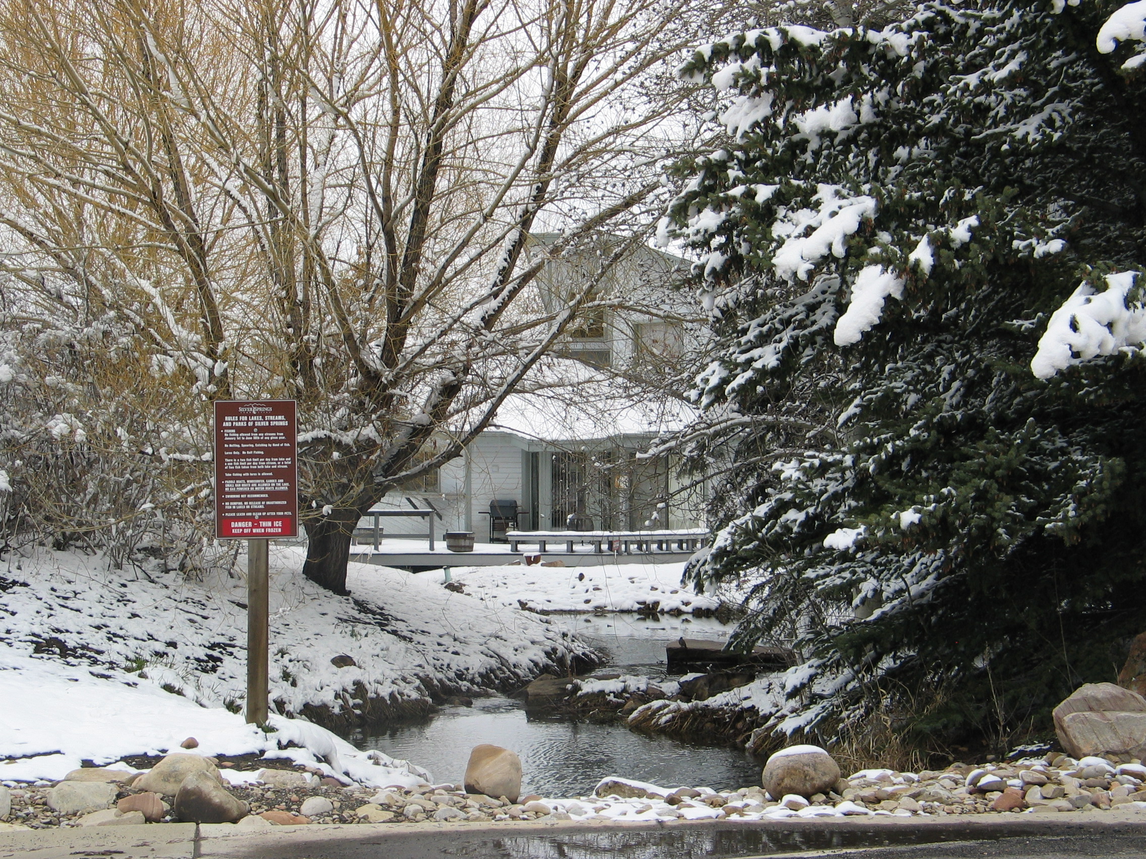
Willow Creek drainage channel behind a house on East Meadows Drive.
Parcel O – has several sections, this one is between SouthShore lots 23 and 24, off from Silver Springs Road
Parcel P – drainage channel emanates from under Silver Springs Road flows north into Silver Willow Lake.
Parcel N – Drainage Channel
Parcel S – Drainage Channel along the back of Silver Springs Lots 199, 200, 201, 202.
Parcel S – Drainage Channel along the back of Silver Springs Lots 154-164. November 1984 – SSSF Minutes: Bill Ligety was assigned to contact Summit County concerning dredging of canals on North side of subdivision parallel to North East Meadows Drive, on back end of Lots 154-164, which would connect to the canal (known as Parcel S) on the west and north end of Lot 202 (west drainage) and the undeveloped parcel on the northeast end of Lot 154 (northeast drainage).
Parcel T – Drainage Channel runs from Silver Springs Parcel S through NorthShore lots
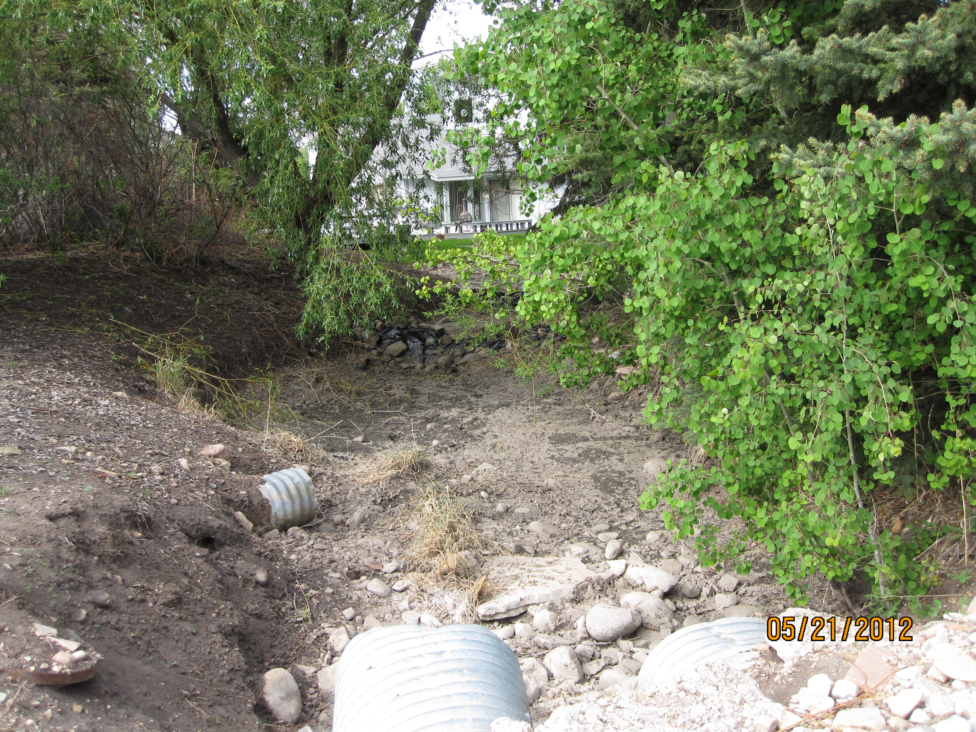
Photo 1– Parcel Q – drainage channel north of Silver Springs Road. The Park is
on the left. Lot 37 SSSF is on the right. See: 2010 Parcel Q stream in winter
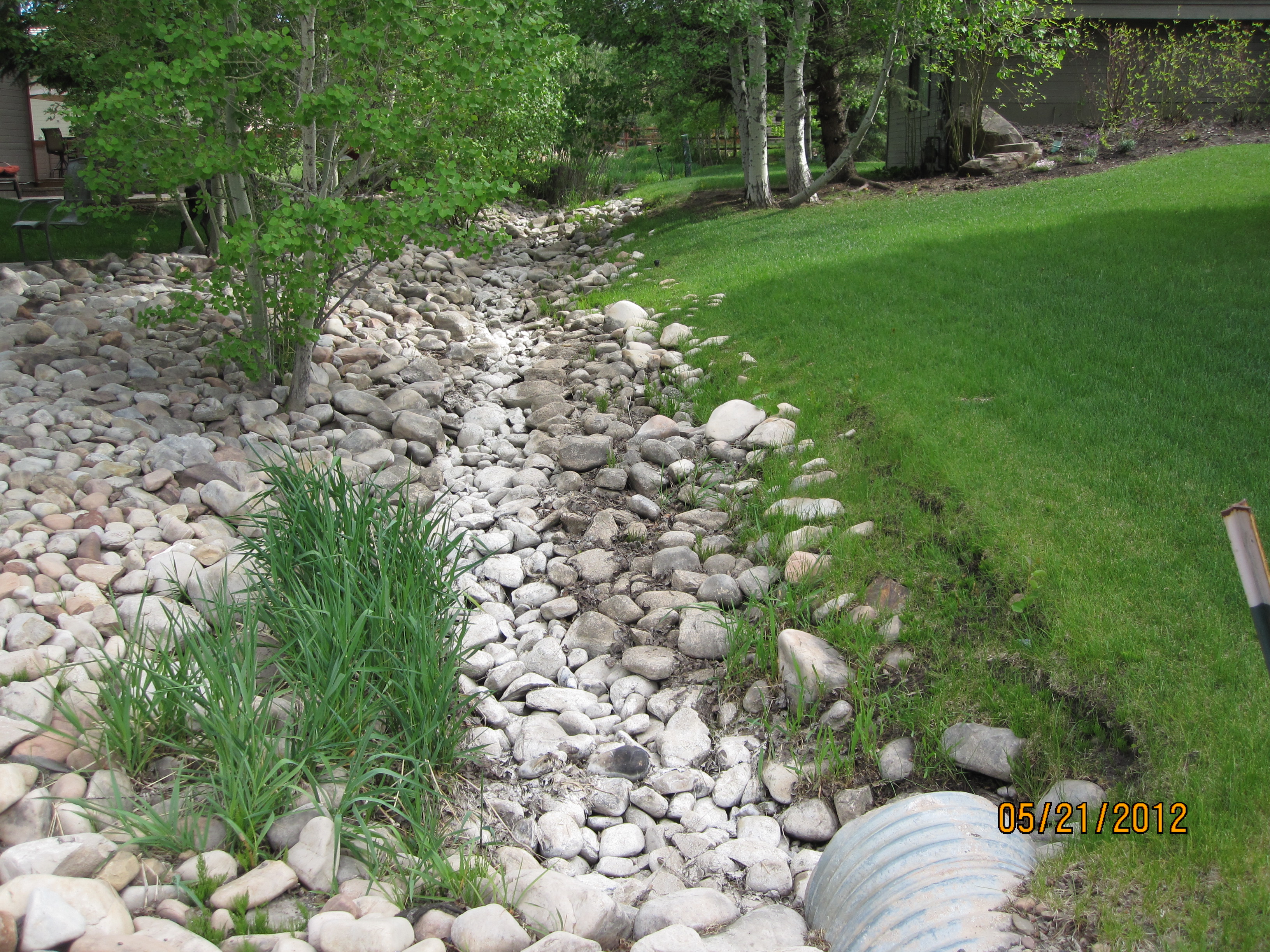
Photo 2 — Center section of Parcel Q drainage channel.
South of Silver Springs Road. Between lots 36 and 173, dried up in May.
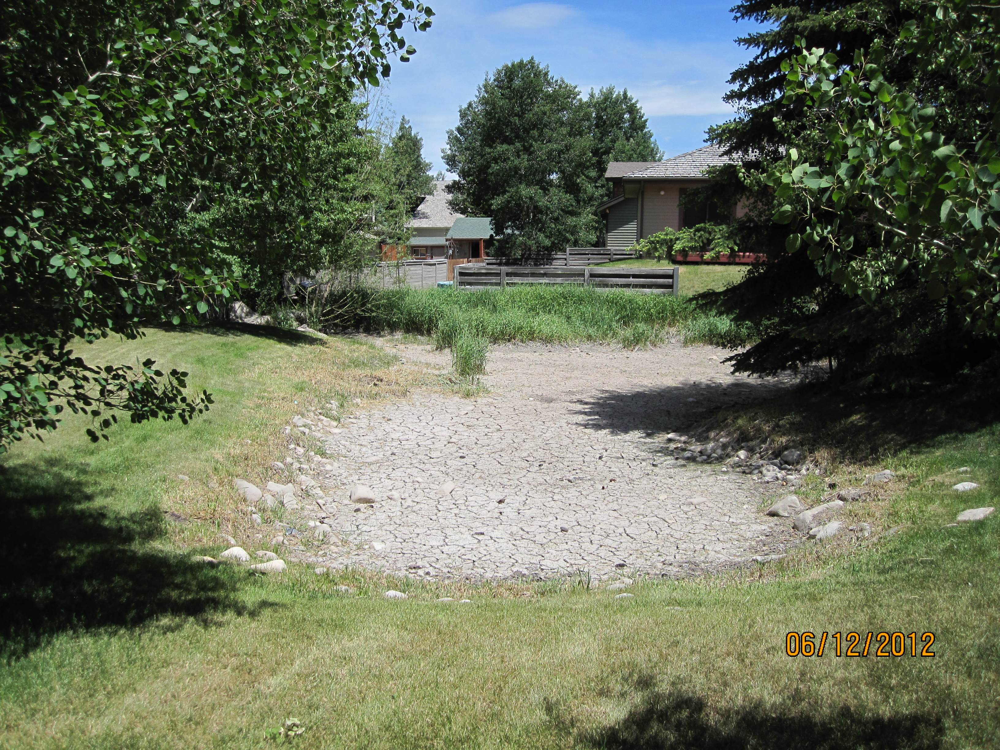
Photo 3 — May 2012 Parcel Q retention pond and drainage channel dried up.
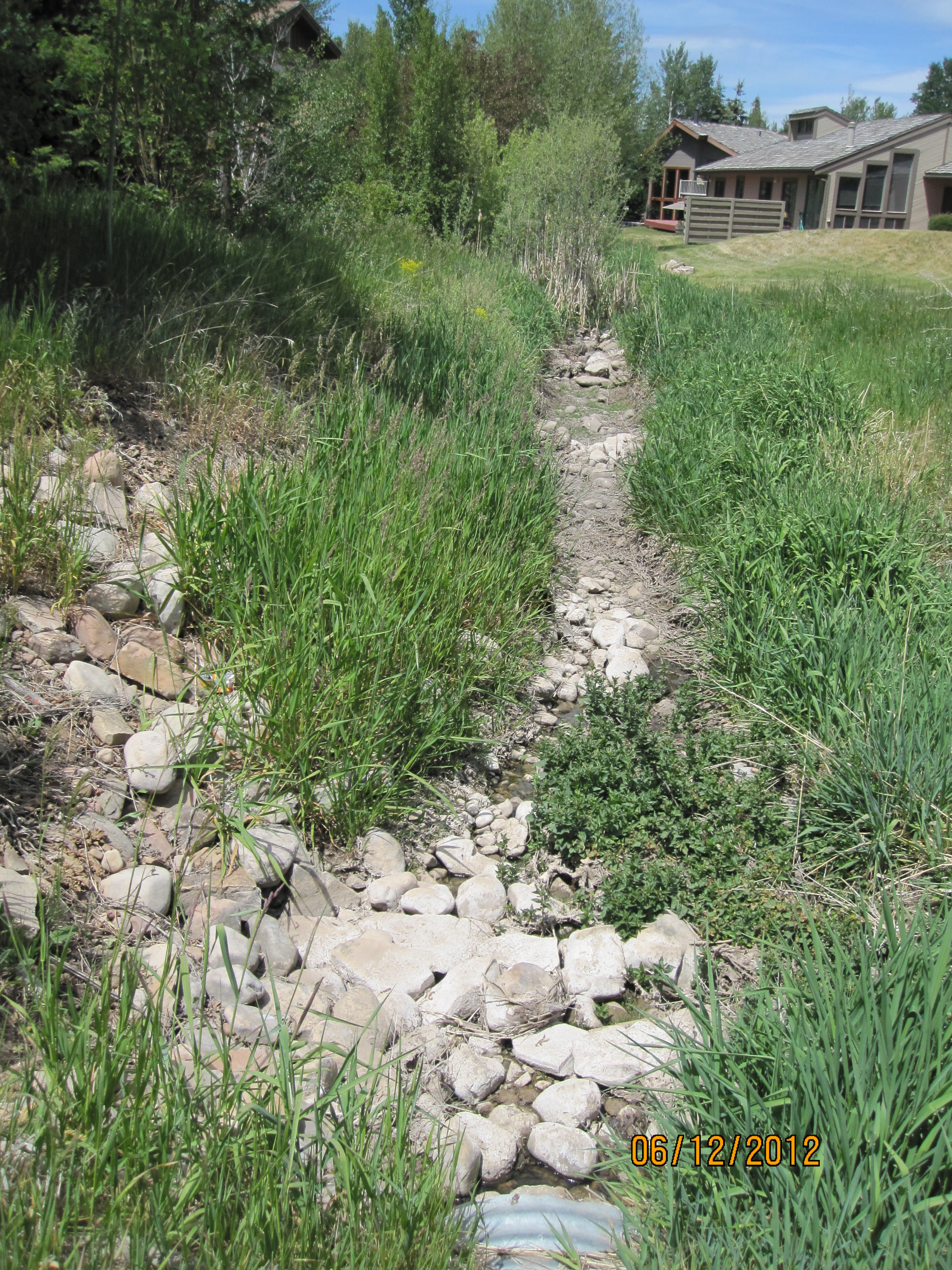
Photo 4 — Creekside Easement is center part of Parcel Q drainage channel, also dried up.
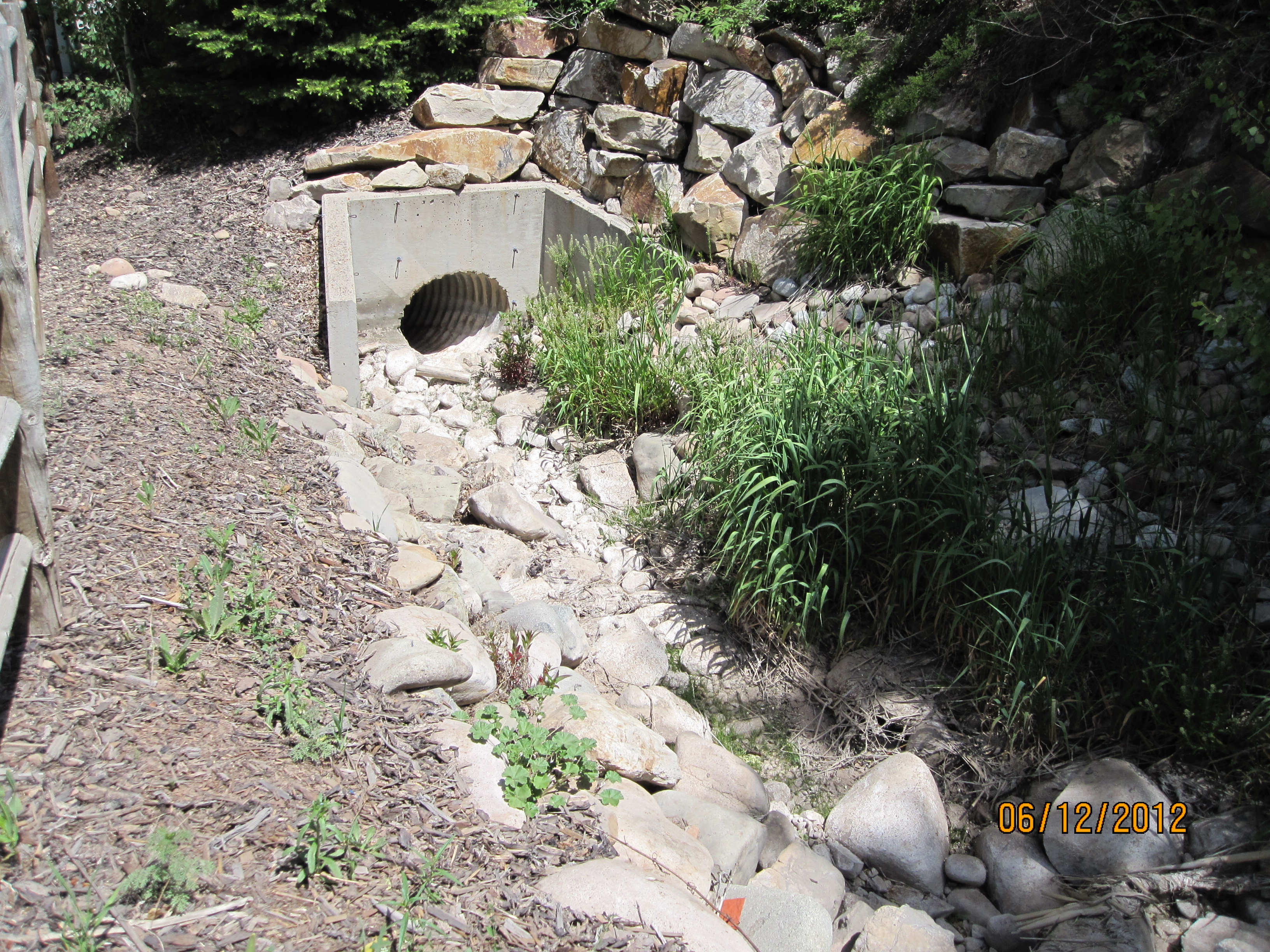
Photo 5 — The southwest end of Parcel Q from Silver Springs Drive to Silver Willow pond, was originally a fish ladder. New gate height built last summer hampers the flow of water from the pond to Parcel Q.
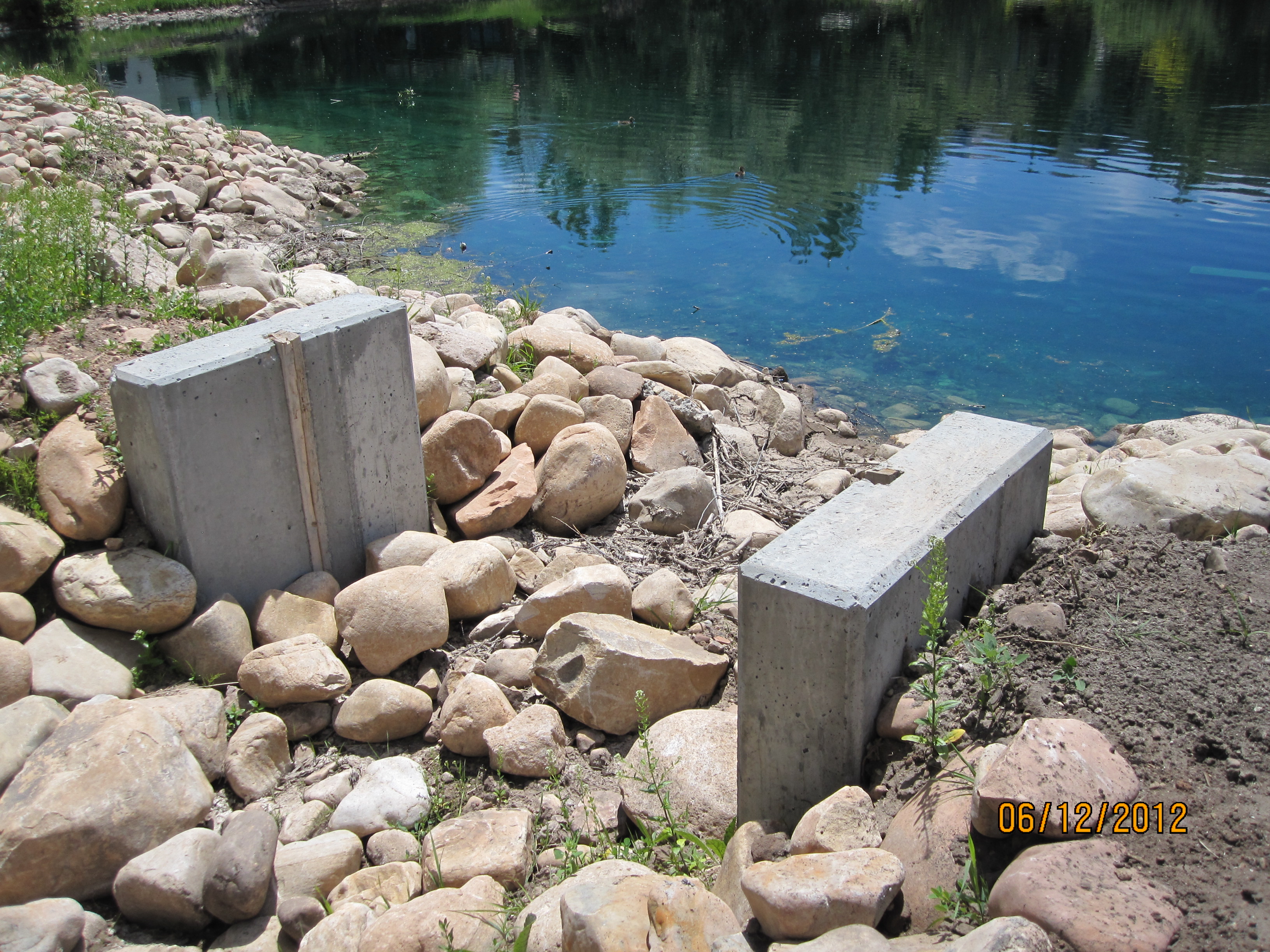
Photo 6 — Small lake/pond gate built too high to allow water to flow from little pond to Parcel Q fish ladder. Or is the pond water level becoming too low? 2011 gate.
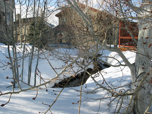
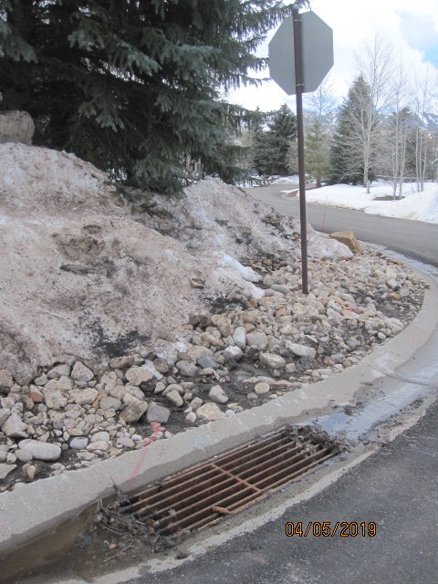
 Photo 7 — One of two underdrain outlets. This one on the east side of SSSF between Lots 104 and 105 spills into Willow Creek. In 2017 barely a trickle of the Silver Springs Single Family natural resource water remains to nourish our older trees and our properties. The underdrains are leaching away and discharging the water we pay for to sprinkle on our landscaping, as well as valuable natural ground water. When the water table is continually diminished the wells we depend on for culinary water run dry, according to the U.S.G.S Water Resources Division and Mountain Regional.
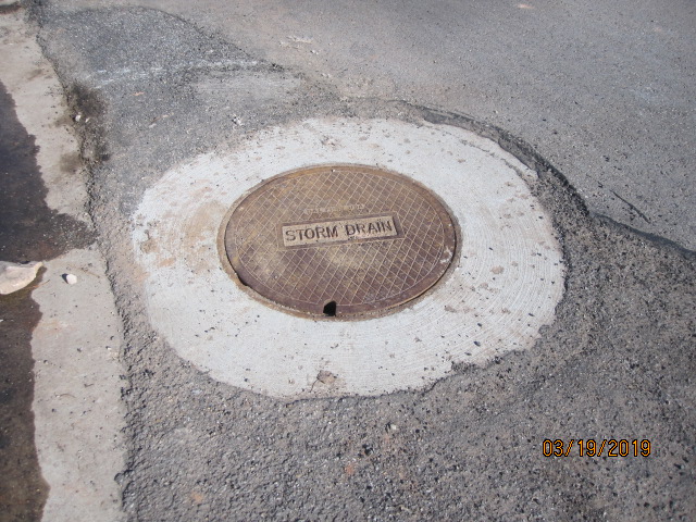
Sssf-storm-drains-2
Green lines on this map show location of storm drains and which lake or channel they flow to.
![]()
![]()
OUR STORM DRAINS, DRAINAGE CHANNELS, INLET STREAMS, AND RETENTION PONDS COLLECT RAIN AND SNOW MELT/RUNOFF. THEY QUICKLY DRAIN. SUBSURFACE GROUND WATER IS DIMINISHING EACH YEAR. ROCKPORT RESERVOIR, OUR SOURCE FOR POTABLE WATER HAS A CONTINUALLY DIMINISHING WATER SUPPLY. IN 2017 IT WAS AT 29%.
IT IS FOOLISH TO UNEARTH THE TEMPORARY UNDERDRAIN SYSTEM 5′ TO 10′ BELOW THE SURFACE TO FURTHER DRY OUT THE MOISTURE IN OUR GROUND THAT NOURISHES OUR TREES, YARDS & GARDENS.
Water runs into Rockport Reservoir on Monday, Sept. 10, 2018. This year’s long, hot summer has reduced water levels at many reservoirs across the state. As of Sept. 9, 2018, Rockport was at 29 percent capacity.

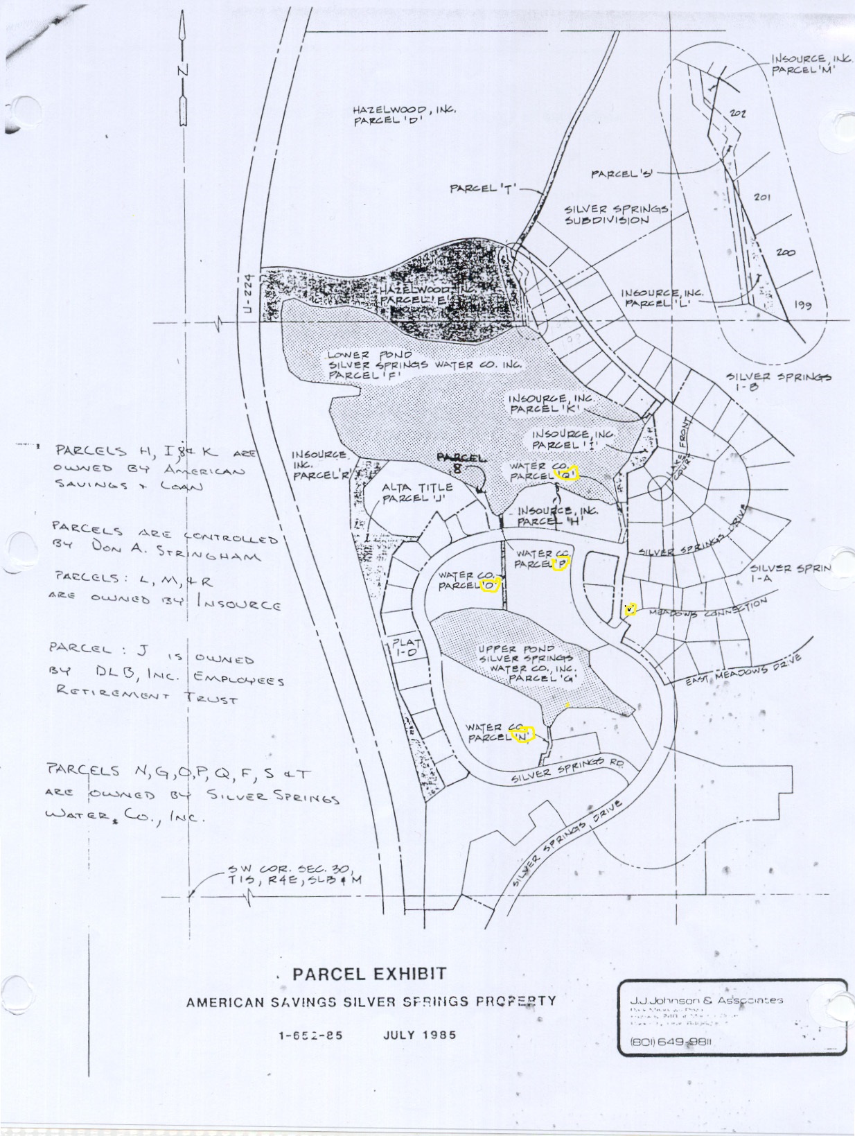
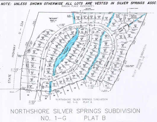
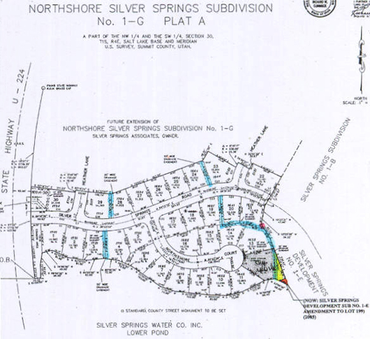
PARCEL LOCATION MAP:
2005 Aerial map was provided by Basin Recreation during the time the Willow Creek Trail was being planned and developed. 1987 American Savings/ Master Association 1989 parcels are shown.
Open Drainage Water Channels continue North from Silver Springs to and through the NorthShore subdivision:
Not all waterways easements belong to the SSMA, some are drainage channel easements belonging to individual property owners and some are controlled by the SSMA.
Mid-2010 the Community Developers 1990 water attorney, Craig J. Smith, who was involved with the 2004 Lake Conveyance Agreement, stated his opinion that the drainages the SSMA is responsible for are for the ones used by Spring Creek Spring past the Blue Roof, down through the west side of SouthShore (American Savings Bank Parcels “N”, “O” and “P”). The drainage that comes into the little lake from the Willow Creek diversion on the east side of SouthShore (American Savings Parcel “Q”), as far as he has determined, is not the MA Association’s responsibility.
*** 2014 – Sept-16 – MA Minutes– The MA board approved $15,000, spent $12,000 this month, to re-line with plastic sheath and cover with river rocks the quasi-inactive Parcel Q creek bed, though the MA does not formally hold title to it, Parcel Q is a part of the 1987 American Savings Bank Silver Springs parcels inventory at the time of the many builder bankruptcies. The larger of these parcels became the titled property of the MA.
“The 2004 Lakes Conveyance and Water Supply Agreement with the Summit County Mountain Regional Water District and the SS Master Association include these Recitals: “C. WHEREAS the Association desires both legal title and beneficial use of the property that encompasses the two Lakes and property with subsequent minor holding ponds, together with the dams more particularly described in Exhibit A, formerly owned by the Silver Springs Water Company, (such property and/or the Lakes with such property is collectively referred herein as “Lakes” as the context may require); and “H. WHEREAS the [Master]Association and the District both desire to provide for the proper and effective operation of the Lakes [that includes the inlet and outlet creeks and channels including Parcel Q]“…; and “K. WHEREAS the District and the Association desire to formalize an agreement whereby the Association will take legal title and beneficial usage of the Lakes [sustained by the inlet and outlet creeks and channels including Parcel Q]”.
With the above Water Supply Agreement Recitals in mind the Master Association approved the re-lining work for the Parcel Q creek bed to be performed by Arlen, a St. George friend of Les Carriel, a Lake Committee member of the MA board.” ****
Willow Creek Channel Maintenance: c.2005, Summit County Engineer Instructions to residents along Willow Creek in the Silver Springs Master Association neighborhoods. “To reduce flood water overflow over embankments: Keep willows trimmed so they do not catch debris. Remove litter and other debris at willow clumps and structures. Lower center of drop structures to prevent erosion of banks. Have utility companies re-bury exposed cables. Anchor bridge planks to prevent floating.”
This work is assigned to the following Silver Springs Area Lot Owners:
[2005] Lot SLS-58 Steven & Cindy Marteney; SLS-59 Franklin & Nancy Carey; SLS-60 Bruce Booher; SLS-61 Ron & Kirsten Kobler; SLS-62 Kent & Marilyn Schlopy; SLS-63 Charles Wagner; SLS-64 Rex & Christine Keeler; SLS-100 Robert & Elisabeth Lentz, SLS-101 Joan Benson; SLS-102 Matthew Lindon; SLS-103 Terry & Kathryn Clark; SLS-104 Bonnie Park -SBRD; SLS-105 Heggie & Julie Wilson; Willow Bend manager Brenda Lake; Ptarmigan Townhouses John Buchhammer- Property Manager; Willow Creek Open Space – Bonnie Park – Director SBRD; Ranch Place – Mike Beeley- President HOA; SSHOA – Skip Domenick – President; PP-92-107- David & Gayle Evans.